
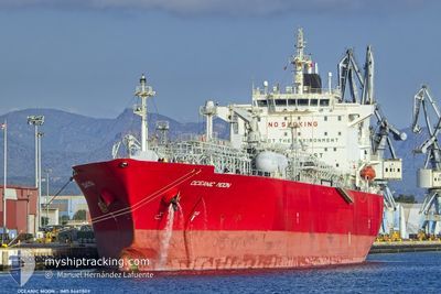
OCEANIC MOON
Lpg Tanker
Current Trip
| Time Travelled | 3 days |
|---|---|
| Remaining Time | --- |
| Distance Travelled | 712.70 nm |
| Remaining Distance | --- |
| AVG Speed | 13.2 Knots |
| MAX Speed | 14.1 Knots |
| AVG Wind | 10.5 knots |
| MAX Wind | 22.6 knots |
| MIN Temp | 25.3°C / 77.54°F |
| MAX Temp | 28°C / 82.4°F |
| Dybgang | 10.3 m |
| Position Modtaget | 1 d siden |
Current Position
| Longitude | --- |
|---|---|
| Latitude | --- |
| Status | Under way using engine |
| Fart | 12.9 Knots |
| Kurs | 137° |
| Område | Gulf of Oman |
| Station | T-AIS |
| Position Modtaget | 1 d siden |
Info
Information
The current position of OCEANIC MOON is in Gulf of Oman with coordinates 24.68633° / 57.09356° as reported on 2024-11-24 16:05 by AIS to our vessel tracker app. The vessel's current speed is 12.9 Knots and is heading at the port of LAS PALMAS. The estimated time of arrival as calculated by MyShipTracking vessel tracking app is 2024-12-24 12:00 LT
The vessel OCEANIC MOON (IMO: 9447809, MMSI: 636023107) is a Lpg Tanker that was built in 2011 ( 13 år gamle ). It's sailing under the flag of [LR] Liberia.
In this page you can find informations about the vessels current position, last detected port calls, and current voyage information. If the vessels is not in coverage by AIS you will find the latest position.
The current position of OCEANIC MOON is detected by our AIS receivers and we are not responsible for the reliability of the data. The last position was recorded while the vessel was in Coverage by the Ais receivers of our vessel tracking app.
The current draught of OCEANIC MOON as reported by AIS is 10.3 meters
Weather
| Temperature | 26.5°C / 79.7°F |
|---|---|
| Wind Speed | 11 knots |
| Direction | 69° ENE |
| Pressure | 1013.8 hPa |
| Humidity | 64.8 % |
| Cloud Coverage | 40 % |
Featured Company
Last Port Calls
| Port | Arrival | Departure | Time In Port |
|---|---|---|---|
| 2024-11-21 21:03 | 2024-11-22 23:13 | 1 d | |
| 2024-11-17 06:57 | 2024-11-18 10:29 | 1 d | |
| 2024-10-13 12:33 | 2024-10-15 06:27 | 1 d | |
| 2024-09-06 16:46 | 2024-09-08 03:42 | 1 d |
Most Visited Ports (Last year)
| Port | Arrivals | |
|---|---|---|
| 3 | ||
| 2 | ||
| 2 | ||
| 1 | ||
| 1 | ||
| 1 |
Last Trips
| Origin | Departure | Destination | Arrival | Distance | |
|---|---|---|---|---|---|
| 2024-11-18 14:29 | 2024-11-22 00:03 | 393.85 nm | |||
| 2024-10-15 07:27 | 2024-11-17 10:57 | 10113.45 nm | |||
| 2024-09-08 06:42 | 2024-10-13 13:33 | 10216.26 nm | |||
| 2024-08-17 20:28 | 2024-09-06 19:46 | 5333.10 nm |
Events
| Tid | Hændelsen | Detaljer | Position / Dest | Info |
|---|---|---|---|---|
| 2024-11-24 16:10 | Status er ændret | Default Under way using engine |
24.67274 / 57.10750
LAS PALMAS
|
Fart: 12.9 kn Kurs: 137° |
| 2024-11-24 16:05 | Udenfor Dækning |
24.68633 / 57.09356
Gulf of Oman
LAS PALMAS
|
Fart: 12.9 kn Kurs: 137° |
|
| 2024-11-24 15:59 | Status er ændret | Under way using engine Default |
24.70158 / 57.07760
LAS PALMAS
|
Fart: 13 kn Kurs: 137° |
| 2024-11-24 15:49 | Status er ændret | Default Under way using engine |
24.72872 / 57.04922
LAS PALMAS
|
Fart: 13.1 kn Kurs: 135.6° |
| 2024-11-24 15:47 | Status er ændret | Under way using engine Default |
24.73283 / 57.04504
LAS PALMAS
|
Fart: 13.1 kn Kurs: 137° |
| 2024-11-24 15:27 | Status er ændret | Default Under way using engine |
24.78673 / 56.98918
LAS PALMAS
|
Fart: 13.1 kn Kurs: 139.4° |
| 2024-11-24 14:43 | Ændre havområde | Omani part of the Gulf of Oman United Arab Emirates part of the Gulf of Oman |
24.90935 / 56.87662
Gulf of Oman
LAS PALMAS
|
Fart: 12.9 kn Kurs: 141° |
| 2024-11-24 14:41 | Status er ændret | Under way using engine Default |
24.91499 / 56.87164
LAS PALMAS
|
Fart: 12.9 kn Kurs: 141° |
| 2024-11-24 14:00 | Status er ændret | Default Under way using engine |
25.04746 / 56.79568
LAS PALMAS
|
Fart: 13.4 kn Kurs: 158.1° |
| 2024-11-24 13:48 | Status er ændret | Under way using engine Default |
25.09132 / 56.77526
LAS PALMAS
|
Fart: 13.6 kn Kurs: 167° |