
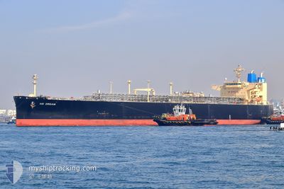
NS DREAM
Tanker
Current Trip
FOR ORDERS
| Time Travelled | 8 days |
|---|---|
| Remaining Time | --- |
| Distance Travelled | 1186.68 nm |
| Remaining Distance | --- |
| AVG Speed | 10.7 Noeuds |
| MAX Speed | 17.6 Noeuds |
| AVG Wind | 10.4 knots |
| MAX Wind | 28.8 knots |
| MIN Temp | 14.6°C / 58.28°F |
| MAX Temp | 27.1°C / 80.78°F |
| Tirant d eau | 7.8 m |
| Position reçue | 2 d depuis |
Current Position
| Longitude | 141.47929° |
|---|---|
| Latitude | 35.50784° |
| Etat | Under way using engine |
| Vitesse | 11.3 Noeuds |
| Parcours | 151.6° |
| Zone | North Pacific Ocean |
| Station | T-AIS |
| Position reçue | 2 d depuis |
Info
Information
The current position of NS DREAM is in North Pacific Ocean with coordinates 35.50784° / 141.47929° as reported on 2024-04-30 07:42 by AIS to our vessel tracker app. The vessel's current speed is 11.3 Noeuds
The vessel NS DREAM (IMO: 9800506, MMSI: 351236000) is a Tanker It's sailing under the flag of [PA] Panama.
In this page you can find informations about the vessels current position, last detected port calls, and current voyage information. If the vessels is not in coverage by AIS you will find the latest position.
The current position of NS DREAM is detected by our AIS receivers and we are not responsible for the reliability of the data. The last position was recorded while the vessel was in Coverage by the Ais receivers of our vessel tracking app.
The current draught of NS DREAM as reported by AIS is 7.8 meters
Weather
| Temperature | 27.3°C / 81.14°F |
|---|---|
| Wind Speed | 4 knots |
| Direction | 118° ESE |
| Pressure | 1014.4 hPa |
| Humidity | 65.1 % |
| Cloud Coverage | 93 % |
Featured Company
Last Port Calls
| Port | Arrival | Departure | Time In Port |
|---|---|---|---|
| 2024-04-23 02:09 | 2024-04-24 06:14 | 1 d | |
| 2024-04-21 05:59 | 2024-04-22 07:56 | 1 d | |
| 2024-03-31 16:55 | 2024-04-01 20:28 | 1 d | |
| 2024-03-04 02:22 |
Events
| Heure | Evenement | Détails | Position/ Destination | Info |
|---|---|---|---|---|
| 2024-04-30 07:53 | Etat Changé | Default Under way using engine |
35.47779 / 141.49963
FOR ORDERS
|
Vitesse: 11.3 kn Parcours: 151.6° |
| 2024-04-30 07:42 | Hors de la zone couverte |
35.50784 / 141.47929
North Pacific Ocean
|
Vitesse: 11.3 kn Parcours: 151.6° |
|
| 2024-04-30 07:40 | Dans la zone couverte |
35.51331 / 141.47557
North Pacific Ocean
|
Vitesse: 11.3 kn Parcours: 150.3° |
|
| 2024-04-30 07:38 | Etat Changé | Under way using engine Default |
35.51877 / 141.47183
FOR ORDERS
|
Vitesse: 11.3 kn Parcours: 151° |
| 2024-04-30 06:33 | Etat Changé | Default Under way using engine |
35.69327 / 141.33437
FOR ORDERS
|
Vitesse: 12.6 kn Parcours: 128.4° |
| 2024-04-30 06:26 | Hors de la zone couverte |
35.70932 / 141.31639
North Pacific Ocean
|
Vitesse: 12.6 kn Parcours: 128.4° |
|
| 2024-04-30 06:25 | Etat Changé | Under way using engine Default |
35.71078 / 141.31425
FOR ORDERS
|
Vitesse: 12.5 kn Parcours: 133° |
| 2024-04-30 06:20 | Etat Changé | Default Under way using engine |
35.72232 / 141.29903
FOR ORDERS
|
Vitesse: 12.8 kn Parcours: 138.5° |
| 2024-04-30 06:13 | Etat Changé | Under way using engine Default |
35.74162 / 141.27432
FOR ORDERS
|
Vitesse: 12.6 kn Parcours: 140° |
| 2024-04-30 06:13 | Dans la zone couverte |
35.74162 / 141.27432
North Pacific Ocean
|
Vitesse: 12.8 kn Parcours: 139.6° |