
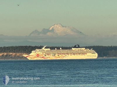
NORWEGIAN SUN
Passengers Ship
Current Trip
| Time Travelled | 14 h, 15 mins |
|---|---|
| Remaining Time | --- |
| Distance Travelled | 286.52 nm |
| Remaining Distance | --- |
| AVG Speed | 19.6 Noeuds |
| MAX Speed | 22.4 Noeuds |
| AVG Wind | 6.9 knots |
| MAX Wind | 8 knots |
| MIN Temp | 27.7°C / 81.86°F |
| MAX Temp | 30.3°C / 86.54°F |
| Tirant d eau | 8.2 m |
| Position reçue | Maintenant |
Current Position
| Longitude | --- |
|---|---|
| Latitude | --- |
| Etat | Under way using engine |
| Vitesse | 20 Noeuds |
| Parcours | 124.4° |
| Zone | Coral Sea |
| Station | T-AIS |
| Position reçue | Maintenant |
Info
Information
The current position of NORWEGIAN SUN is in Coral Sea with coordinates -19.81602° / 148.61434° as reported on 2025-03-07 20:37 by AIS to our vessel tracker app. The vessel's current speed is 20 Noeuds and is heading at the port of AIRLIE. The estimated time of arrival as calculated by MyShipTracking vessel tracking app is 2025-03-07 22:00 LT
The vessel NORWEGIAN SUN (IMO: 9218131, MMSI: 311109000) is a Passengers Ship that was built in 2001 ( 24 Age ). It's sailing under the flag of [BS] Bahamas.
In this page you can find informations about the vessels current position, last detected port calls, and current voyage information. If the vessels is not in coverage by AIS you will find the latest position.
The current position of NORWEGIAN SUN is detected by our AIS receivers and we are not responsible for the reliability of the data. The last position was recorded while the vessel was in Coverage by the Ais receivers of our vessel tracking app.
The current draught of NORWEGIAN SUN as reported by AIS is 8.2 meters
Weather
| Temperature | 27.7°C / 81.86°F |
|---|---|
| Wind Speed | 7 knots |
| Direction | 324° NW |
| Pressure | 1009.5 hPa |
| Humidity | 80.5 % |
| Cloud Coverage | 1 % |
Featured Company
Last Port Calls
| Port | Arrival | Departure | Time In Port |
|---|---|---|---|
| 2025-03-06 04:31 | 2025-03-07 06:22 | 1 d | |
| 2025-02-28 17:53 | 2025-03-01 06:10 | 12 h | |
| 2025-02-27 19:33 | 2025-02-28 07:21 | 11 h | |
| 2025-02-26 20:24 | 2025-02-27 03:45 | 7 h | |
| 2025-02-25 22:26 | 2025-02-26 07:59 | 9 h | |
| 2025-02-24 19:44 | 2025-02-25 04:07 | 8 h | |
| 2025-02-20 22:29 | 2025-02-21 08:01 | 9 h | |
| 2025-02-19 18:32 | 2025-02-20 05:19 | 10 h | |
| 2025-02-16 23:07 | 2025-02-17 10:49 | 11 h | |
| 2025-02-15 19:52 | 2025-02-16 05:24 | 9 h |
Last Trips
| Origin | Departure | Destination | Arrival | Distance | |
|---|---|---|---|---|---|
| 2025-03-01 19:10 | 2025-03-06 14:31 | 2284.61 nm | |||
| 2025-02-28 20:21 | 2025-03-01 06:53 | 155.11 nm | |||
| 2025-02-27 16:45 | 2025-02-28 08:33 | 299.74 nm | |||
| 2025-02-26 20:59 | 2025-02-27 09:24 | 232.86 nm | |||
| 2025-02-25 17:07 | 2025-02-26 11:26 | 347.63 nm | |||
| 2025-02-21 19:01 | 2025-02-25 08:44 | 1300.31 nm | |||
| 2025-02-20 16:19 | 2025-02-21 09:29 | 332.33 nm | |||
| 2025-02-17 21:19 | 2025-02-20 05:32 | 591.53 nm | |||
| 2025-02-16 16:24 | 2025-02-17 09:37 | 328.87 nm | |||
| 2025-02-15 18:22 | 2025-02-16 06:52 | 217.99 nm |
Events
| Heure | Evenement | Détails | Position/ Destination | Info |
|---|---|---|---|---|
| 2025-03-07 19:58 | Etat Changé | Under way using engine Default |
-19.69371 / 148.42352
AIRLIE BEACH
|
Vitesse: 20.3 kn Parcours: 134° |
| 2025-03-07 19:53 | Etat Changé | Default Under way using engine |
-19.67396 / 148.40129
AIRLIE BEACH
|
Vitesse: 20.3 kn Parcours: 125.9° |
| 2025-03-07 19:34 | Etat Changé | Under way using engine Default |
-19.61070 / 148.31118
AIRLIE BEACH
|
Vitesse: 20.6 kn Parcours: 124° |
| 2025-03-07 19:33 | Dans la zone couverte |
-19.61131 / 148.31209
Coral Sea
AIRLIE BEACH
|
Vitesse: 20.5 kn Parcours: 125.4° |
|
| 2025-03-07 11:09 | Etat Changé | Default Under way using engine |
-17.22435 / 146.76433
AIRLIE BEACH
|
Vitesse: 21.4 kn Parcours: 160.8° |
| 2025-03-07 11:01 | Hors de la zone couverte |
-17.18287 / 146.74780
Coral Sea
AIRLIE BEACH
|
Vitesse: 21.4 kn Parcours: 160.8° |
|
| 2025-03-07 10:22 | Etat Changé | Under way using engine Default |
-16.96992 / 146.65811
AIRLIE BEACH
|
Vitesse: 21.2 kn Parcours: 158° |
| 2025-03-07 10:13 | Etat Changé | Default Under way using engine |
-16.91737 / 146.63644
AIRLIE BEACH
|
Vitesse: 21.3 kn Parcours: 159.7° |
| 2025-03-07 10:06 | Etat Changé | Under way using engine Default |
-16.88303 / 146.62290
AIRLIE BEACH
|
Vitesse: 21.2 kn Parcours: 152° |
| 2025-03-07 10:05 | Etat Changé | Default Under way using engine |
-16.87435 / 146.61897
AIRLIE BEACH
|
Vitesse: 21.1 kn Parcours: 135.5° |