
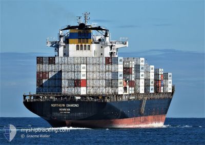
NORTHERN DIAMOND
Container Ship
Current Trip
| Time Travelled | 37 days |
|---|---|
| Remaining Time | --- |
| Distance Travelled | 14278.59 nm |
| Remaining Distance | --- |
| AVG Speed | 16 Noeuds |
| MAX Speed | 16 Noeuds |
| AVG Wind | 13 knots |
| MAX Wind | 30 knots |
| MIN Temp | 12.4°C / 54.32°F |
| MAX Temp | 29°C / 84.2°F |
| Tirant d eau | 12.7 m |
| Position reçue | 6 d depuis |
Current Position
| Longitude | 32.08379° |
|---|---|
| Latitude | -29.37208° |
| Etat | Under way using engine |
| Vitesse | 14.4 Noeuds |
| Parcours | 38.5° |
| Zone | Indian Ocean |
| Station | T-AIS |
| Position reçue | 6 d depuis |
Info
Information
The current position of NORTHERN DIAMOND is in Indian Ocean with coordinates -29.37208° / 32.08379° as reported on 2024-06-11 13:43 by AIS to our vessel tracker app. The vessel's current speed is 14.4 Noeuds and is heading at the port of JEBEL ALI. The estimated time of arrival as calculated by MyShipTracking vessel tracking app is 2024-06-22 01:30 LT
The vessel NORTHERN DIAMOND (IMO: 9405033, MMSI: 636091527) is a Container Ship that was built in 2008 ( 16 Age ). It's sailing under the flag of [LR] Liberia.
In this page you can find informations about the vessels current position, last detected port calls, and current voyage information. If the vessels is not in coverage by AIS you will find the latest position.
The current position of NORTHERN DIAMOND is detected by our AIS receivers and we are not responsible for the reliability of the data. The last position was recorded while the vessel was in Coverage by the Ais receivers of our vessel tracking app.
The current draught of NORTHERN DIAMOND as reported by AIS is 12.7 meters
Weather
| Temperature | 28.9°C / 84.02°F |
|---|---|
| Wind Speed | 17 knots |
| Direction | 251° WSW |
| Pressure | 1008.7 hPa |
| Humidity | 75.2 % |
| Cloud Coverage | 100 % |
Featured Company
Last Port Calls
| Port | Arrival | Departure | Time In Port |
|---|---|---|---|
| 2024-05-21 21:09 | 2024-05-22 16:27 | 19 h | |
| 2024-05-11 02:42 | 2024-05-12 02:32 | 23 h | |
| 2024-04-01 09:37 |
Most Visited Ports (Last year)
| Port | Arrivals | |
|---|---|---|
| 3 | ||
| 3 | ||
| 3 | ||
| 2 | ||
| 2 | ||
| 2 |
Last Trips
| Origin | Departure | Destination | Arrival | Distance | |
|---|---|---|---|---|---|
| 2024-05-12 04:32 | 2024-05-21 23:09 | 3377.52 nm | |||
| 2024-04-01 17:37 | 2024-05-11 04:42 | 14080.44 nm |
Events
| Heure | Evenement | Détails | Position/ Destination | Info |
|---|---|---|---|---|
| 2024-06-11 13:48 | Etat Changé | Default Under way using engine |
-29.35694 / 32.09715
EGPSD>AEJEA
|
Vitesse: 14.4 kn Parcours: 38.5° |
| 2024-06-11 13:43 | Etat Changé | Under way using engine Default |
-29.37208 / 32.08379
EGPSD>AEJEA
|
Vitesse: 13.9 kn Parcours: 38° |
| 2024-06-11 13:43 | Hors de la zone couverte |
-29.37208 / 32.08379
Indian Ocean
EGPSD>AEJEA
|
Vitesse: 14.4 kn Parcours: 38.5° |
|
| 2024-06-11 13:40 | Etat Changé | Default Under way using engine |
-29.38147 / 32.07539
EGPSD>AEJEA
|
Vitesse: 14.4 kn Parcours: 38.8° |
| 2024-06-11 13:19 | Etat Changé | Under way using engine Default |
-29.44758 / 32.01607
EGPSD>AEJEA
|
Vitesse: 14.8 kn Parcours: 36° |
| 2024-06-11 13:16 | Etat Changé | Default Under way using engine |
-29.45711 / 32.00787
EGPSD>AEJEA
|
Vitesse: 14.7 kn Parcours: 35.2° |
| 2024-06-11 09:53 | Etat Changé | Under way using engine Default |
-30.11217 / 31.43914
EGPSD>AEJEA
|
Vitesse: 13.9 kn Parcours: 38° |
| 2024-06-11 09:50 | Etat Changé | Default Under way using engine |
-30.12223 / 31.43021
EGPSD>AEJEA
|
Vitesse: 13.8 kn Parcours: 36.7° |
| 2024-06-11 06:57 | Detecté en mer | South African part of the Indian Ocean |
-30.60703 / 31.00420
Indian Ocean
EGPSD>AEJEA
|
Vitesse: 13.3 kn Parcours: 35.8° |
| 2024-06-11 06:57 | Etat Changé | Under way using engine Default |
-30.60758 / 31.00375
EGPSD>AEJEA
|
Vitesse: 13.2 kn Parcours: 36° |