
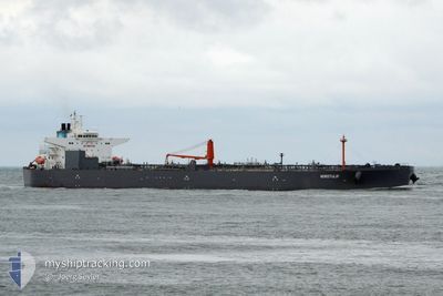
NORDTULIP
Crude Oil Tanker
Current Trip
| Time Travelled | 1 day |
|---|---|
| Remaining Time | --- |
| Distance Travelled | 49.49 nm |
| Remaining Distance | --- |
| AVG Speed | 9.8 Noeuds |
| MAX Speed | 14.3 Noeuds |
| AVG Wind | 15.1 knots |
| MAX Wind | 19.2 knots |
| MIN Temp | 21.7°C / 71.06°F |
| MAX Temp | 24.3°C / 75.74°F |
| Tirant d eau | 8 m |
| Position reçue | 1 h, 12 m depuis |
Current Position
| Longitude | -93.71716° |
|---|---|
| Latitude | 29.23381° |
| Etat | At anchor |
| Vitesse | 0.3 Noeuds |
| Parcours | 99° |
| Zone | Gulf of Mexico |
| Station | T-AIS |
| Position reçue | 1 h, 12 m depuis |
Info
Information
The current position of NORDTULIP is in Gulf of Mexico with coordinates 29.23381° / -93.71716° as reported on 2024-05-03 15:41 by AIS to our vessel tracker app. The vessel's current speed is 0.3 Noeuds
The vessel NORDTULIP (IMO: 9521447, MMSI: 255806154) is a Crude Oil Tanker that was built in 2013 ( 11 Age ). It's sailing under the flag of [PT] Portugal.
In this page you can find informations about the vessels current position, last detected port calls, and current voyage information. If the vessels is not in coverage by AIS you will find the latest position.
The current position of NORDTULIP is detected by our AIS receivers and we are not responsible for the reliability of the data. The last position was recorded while the vessel was in Coverage by the Ais receivers of our vessel tracking app.
The current draught of NORDTULIP as reported by AIS is 8 meters
Weather
| Temperature | 22.9°C / 73.22°F |
|---|---|
| Wind Speed | 18 knots |
| Direction | 95° E |
| Pressure | 1013.3 hPa |
| Humidity | 88.3 % |
| Cloud Coverage | 100 % |
Featured Company
Last Port Calls
| Port | Arrival | Departure | Time In Port |
|---|---|---|---|
| 2024-04-30 20:05 | 2024-05-02 07:03 | 1 d | |
| 2024-04-03 22:59 | 2024-04-03 23:35 | 36 m | |
| 2024-04-02 00:29 | 2024-04-03 22:39 | 1 d | |
| 2024-03-07 19:24 | 2024-03-11 10:13 | 3 d | |
| 2024-03-01 01:03 |
Most Visited Ports (Last year)
| Port | Arrivals | |
|---|---|---|
| 8 | ||
| 7 | ||
| 6 | ||
| 3 | ||
| 3 | ||
| 3 |
Last Trips
| Origin | Departure | Destination | Arrival | Distance | |
|---|---|---|---|---|---|
| 2024-04-03 18:35 | 2024-04-30 15:05 | 1348.84 nm | |||
| 2024-04-03 17:39 | 2024-04-03 17:59 | 0.90 nm | |||
| 2024-03-11 05:13 | 2024-04-01 19:29 | 1364.61 nm | |||
| 2024-02-14 08:25 | 2024-02-29 19:03 | 668.15 nm |
Events
| Heure | Evenement | Détails | Position/ Destination | Info |
|---|---|---|---|---|
| 2024-05-03 15:44 | Etat Changé | Default At anchor |
29.23379 / -93.71701
USPOA-MXPAJ
|
Vitesse: 0.3 kn Parcours: 99° |
| 2024-05-03 15:41 | Etat Changé | At anchor Default |
29.23381 / -93.71716
USPOA-MXPAJ
|
Vitesse: 1 kn Parcours: 82° |
| 2024-05-03 15:41 | Hors de la zone couverte |
29.23381 / -93.71716
Gulf of Mexico
USPOA-MXPAJ
|
Vitesse: 0.3 kn Parcours: 54° |
|
| 2024-05-03 15:26 | Dans la zone couverte |
29.23381 / -93.71716
Gulf of Mexico
USPOA-MXPAJ
|
Vitesse: 0.3 kn Parcours: 54° |
|
| 2024-05-03 14:38 | Etat Changé | Default At anchor |
29.23305 / -93.71712
USPOA-MXPAJ
|
Vitesse: 0.6 kn Parcours: 86° |
| 2024-05-03 14:23 | Etat Changé | At anchor Default |
29.23340 / -93.71715
USPOA-MXPAJ
|
Vitesse: 0.3 kn Parcours: 74° |
| 2024-05-03 14:23 | Hors de la zone couverte |
29.23340 / -93.71715
Gulf of Mexico
USPOA-MXPAJ
|
Vitesse: 0.6 kn Parcours: 19.4° |
|
| 2024-05-03 14:17 | Etat Changé | Default At anchor |
29.23284 / -93.71658
USPOA-MXPAJ
|
Vitesse: 0.8 kn Parcours: 97° |
| 2024-05-03 14:11 | Etat Changé | At anchor Default |
29.23336 / -93.71675
USPOA-MXPAJ
|
Vitesse: 0.2 kn Parcours: 74° |
| 2024-05-03 14:11 | Dans la zone couverte |
29.23336 / -93.71675
Gulf of Mexico
USPOA-MXPAJ
|
Vitesse: 0.8 kn Parcours: 152° |