
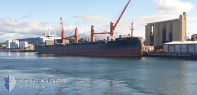
NORDRHONE
Cargo
Current Trip
TANIYAMA
| Time Travelled | 13 days |
|---|---|
| Remaining Time | --- |
| Distance Travelled | 3431.14 nm |
| Remaining Distance | --- |
| AVG Speed | 10.3 Noeuds |
| MAX Speed | 10.3 Noeuds |
| AVG Wind | 9.5 knots |
| MAX Wind | 23 knots |
| MIN Temp | 15.9°C / 60.62°F |
| MAX Temp | 29.9°C / 85.82°F |
| Tirant d eau | 10.2 m |
| Position reçue | 8 d depuis |
Current Position
| Longitude | 131.59244° |
|---|---|
| Latitude | 20.67408° |
| Etat | Under way using engine |
| Vitesse | 10.2 Noeuds |
| Parcours | 157.7° |
| Zone | Philippine Sea |
| Station | T-AIS |
| Position reçue | 8 d depuis |
Info
Information
The current position of NORDRHONE is in Philippine Sea with coordinates 20.67408° / 131.59244° as reported on 2024-06-03 07:17 by AIS to our vessel tracker app. The vessel's current speed is 10.2 Noeuds
The vessel NORDRHONE (IMO: 9596040, MMSI: 255806296) is a Cargo It's sailing under the flag of [PT] Portugal.
In this page you can find informations about the vessels current position, last detected port calls, and current voyage information. If the vessels is not in coverage by AIS you will find the latest position.
The current position of NORDRHONE is detected by our AIS receivers and we are not responsible for the reliability of the data. The last position was recorded while the vessel was in Coverage by the Ais receivers of our vessel tracking app.
The current draught of NORDRHONE as reported by AIS is 10.2 meters
Weather
| Temperature | 28.4°C / 83.12°F |
|---|---|
| Wind Speed | 13 knots |
| Direction | 135° SE |
| Pressure | 1010.6 hPa |
| Humidity | 82 % |
| Cloud Coverage | 100 % |
Featured Company
Last Trips
| Origin | Departure | Destination | Arrival | Distance | |
|---|---|---|---|---|---|
| 2024-05-25 12:12 | 2024-05-26 08:28 | 199.69 nm | |||
| 2024-05-17 18:20 | 2024-05-21 11:04 | 702.75 nm | |||
| 2024-05-09 07:52 | 2024-05-15 07:00 | 622.58 nm | |||
| 2024-04-08 14:24 | 2024-05-07 08:28 | 6130.49 nm | |||
| 2024-03-25 15:17 | 2024-04-04 22:44 | 1323.14 nm |
Events
| Heure | Evenement | Détails | Position/ Destination | Info |
|---|---|---|---|---|
| 2024-06-03 07:23 | Etat Changé | Default Under way using engine |
20.65667 / 131.59833
TANIYAMA
|
Vitesse: 10.2 kn Parcours: 157.7° |
| 2024-06-03 07:17 | Etat Changé | Under way using engine Default |
20.67408 / 131.59244
TANIYAMA
|
Vitesse: 10 kn Parcours: 156° |
| 2024-06-03 07:17 | Hors de la zone couverte |
20.67408 / 131.59244
Philippine Sea
|
Vitesse: 10.2 kn Parcours: 157.7° |
|
| 2024-06-03 06:45 | Etat Changé | Default Under way using engine |
20.75833 / 131.54834
TANIYAMA
|
Vitesse: 10.4 kn Parcours: 149.2° |
| 2024-06-03 06:35 | Detecté en mer | High seas of the Philippine Sea |
20.78301 / 131.53357
Philippine Sea
|
Vitesse: 10.4 kn Parcours: 149.2° |
| 2024-06-03 06:35 | Etat Changé | Under way using engine Default |
20.78301 / 131.53357
TANIYAMA
|
Vitesse: 10 kn Parcours: 148° |
| 2024-06-03 06:35 | Dans la zone couverte |
20.78301 / 131.53357
Philippine Sea
|
Vitesse: 10.4 kn Parcours: 149.2° |