
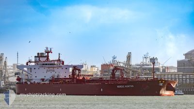
NORDIC HUNTER
Tanker
Current Trip
| Time Travelled | 26 days |
|---|---|
| Remaining Time | 17 h, 35 mins |
| Distance Travelled | 6184.22 nm |
| Remaining Distance | 374.94 nm |
| AVG Speed | 10 Noeuds |
| MAX Speed | 16.5 Noeuds |
| AVG Wind | 15.6 knots |
| MAX Wind | 31 knots |
| MIN Temp | 7.2°C / 44.96°F |
| MAX Temp | 26°C / 78.8°F |
| Tirant d eau | 9.6 m |
| Position reçue | 2 d depuis |
Current Position
| Longitude | --- |
|---|---|
| Latitude | --- |
| Etat | Under way using engine |
| Vitesse | 10.4 Noeuds |
| Parcours | 264° |
| Zone | North Atlantic Ocean |
| Station | T-AIS |
| Position reçue | 2 d depuis |
Info
Information
The current position of NORDIC HUNTER is in North Atlantic Ocean with coordinates 23.56421° / -82.21210° as reported on 2025-02-13 21:46 by AIS to our vessel tracker app. The vessel's current speed is 10.4 Noeuds and is heading at the port of CORPUS CHRISTI. The estimated time of arrival as calculated by MyShipTracking vessel tracking app is 2025-02-17 01:21 LT
The vessel NORDIC HUNTER (IMO: 9921075, MMSI: 636021028) is a Tanker It's sailing under the flag of [LR] Liberia.
In this page you can find informations about the vessels current position, last detected port calls, and current voyage information. If the vessels is not in coverage by AIS you will find the latest position.
The current position of NORDIC HUNTER is detected by our AIS receivers and we are not responsible for the reliability of the data. The last position was recorded while the vessel was in Coverage by the Ais receivers of our vessel tracking app.
The current draught of NORDIC HUNTER as reported by AIS is 9.6 meters
Weather
| Temperature | 21.3°C / 70.34°F |
|---|---|
| Wind Speed | 26 knots |
| Direction | 5° N |
| Pressure | 1015.6 hPa |
| Humidity | 77 % |
| Cloud Coverage | 9 % |
Featured Company
Most Visited Ports (Last year)
| Port | Arrivals | |
|---|---|---|
| 1 | ||
| 1 | ||
| 1 | ||
| 1 | ||
| 1 | ||
| 1 |
Events
| Heure | Evenement | Détails | Position/ Destination | Info |
|---|---|---|---|---|
| 2025-02-13 21:48 | Etat Changé | Default Under way using engine |
23.56375 / -82.21725
USCRP
|
Vitesse: 10.4 kn Parcours: 264° |
| 2025-02-13 21:46 | Hors de la zone couverte |
23.56421 / -82.21210
North Atlantic Ocean
USCRP
|
Vitesse: 10.4 kn Parcours: 264° |
|
| 2025-02-13 21:44 | Etat Changé | Under way using engine Default |
23.56486 / -82.20480
USCRP
|
Vitesse: 10.2 kn Parcours: 269° |
| 2025-02-13 21:07 | Etat Changé | Default Under way using engine |
23.57055 / -82.09038
USCRP
|
Vitesse: 10 kn Parcours: 264.2° |
| 2025-02-13 20:54 | Detecté en mer | Cuban part of the North Atlantic Ocean |
23.57354 / -82.05092
North Atlantic Ocean
USCRP
|
Vitesse: 10.1 kn Parcours: 267.2° |
| 2025-02-13 20:54 | Etat Changé | Under way using engine Default |
23.57354 / -82.05092
USCRP
|
Vitesse: 10.2 kn Parcours: 268° |
| 2025-02-13 20:54 | Dans la zone couverte |
23.57354 / -82.05092
North Atlantic Ocean
USCRP
|
Vitesse: 10.1 kn Parcours: 267.2° |
|
| 2025-02-13 00:50 | Etat Changé | Default Under way using engine |
25.50689 / -79.50797
USCRP
|
Vitesse: 9.7 kn Parcours: 189.1° |
| 2025-02-13 00:43 | Etat Changé | Under way using engine Default |
25.52520 / -79.50476
USCRP
|
Vitesse: 9.7 kn Parcours: 189° |
| 2025-02-13 00:43 | Hors de la zone couverte |
25.52520 / -79.50476
North Atlantic Ocean
USCRP
|
Vitesse: 9.7 kn Parcours: 189.1° |