

NIMERTIS
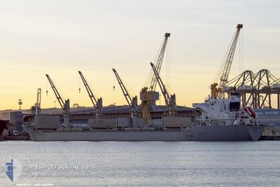
Bulk Carrier

Current Trip
| Time Travelled | 15 days |
|---|---|
| Remaining Time | --- |
| Distance Travelled | 3647.20 nm |
| Remaining Distance | --- |
| AVG Speed | 12.5 Noeuds |
| MAX Speed | 14.4 Noeuds |
| AVG Wind | 9.6 knots |
| MAX Wind | 17 knots |
| MIN Temp | 23.3°C / 73.94°F |
| MAX Temp | 28.1°C / 82.58°F |
| Tirant d eau | 5.5 m |
| Position reçue | 1 d depuis |
Current Position
| Longitude | --- |
|---|---|
| Latitude | --- |
| Etat | At anchor |
| Vitesse | 0.1 Noeuds |
| Parcours | 175° |
| Zone | South Atlantic Ocean |
| Station | T-AIS |
| Position reçue | 1 d depuis |
Information
The current position of NIMERTIS is in South Atlantic Ocean with coordinates -25.69274° / -48.22210° as reported on 2025-03-26 18:14 by AIS to our vessel tracker app. The vessel's current speed is 0.1 Noeuds
The vessel NIMERTIS (IMO: 9650999, MMSI: 636015990) is a Bulk Carrier that was built in 2013 ( 12 Age ). It's sailing under the flag of [LR] Liberia.
In this page you can find informations about the vessels current position, last detected port calls, and current voyage information. If the vessels is not in coverage by AIS you will find the latest position.
The current position of NIMERTIS is detected by our AIS receivers and we are not responsible for the reliability of the data. The last position was recorded while the vessel was in Coverage by the Ais receivers of our vessel tracking app.
The current draught of NIMERTIS as reported by AIS is 5.5 meters
Weather
| Temperature | 25.4°C / 77.72°F |
|---|---|
| Wind Speed | 7 knots |
| Direction | 110° ESE |
| Pressure | 1013.7 hPa |
| Humidity | 78 % |
| Cloud Coverage | 6 % |


Featured Company
Most Visited Ports (Last year)
| Port | Arrivals | |
|---|---|---|
| 2 | ||
| 2 | ||
| 2 | ||
| 1 | ||
| 1 | ||
| 1 |
Last Trips
Events
| Heure | Evenement | Détails | Position/ Destination | Info |
|---|---|---|---|---|
| 2025-03-26 18:17 | Etat Changé | Default At anchor |
-25.69277 / -48.22208
BR PNG
|
Vitesse: 0.1 kn Parcours: 175° |
| 2025-03-26 18:14 | Etat Changé | At anchor Default |
-25.69274 / -48.22210
BR PNG
|
Vitesse: 0.1 kn Parcours: 171° |
| 2025-03-26 18:14 | Dans la zone couverte |
-25.69274 / -48.22210
South Atlantic Ocean
|
Vitesse: 0.1 kn Parcours: 170.4° |
|
| 2025-03-26 18:14 | Hors de la zone couverte |
-25.69274 / -48.22210
South Atlantic Ocean
|
Vitesse: 0.1 kn Parcours: 170.4° |
|
| 2025-03-25 21:32 | Etat Changé | Default At anchor |
-25.69305 / -48.22291
BR PNG
|
Vitesse: 0.2 kn Parcours: 139° |
| 2025-03-25 21:29 | Etat Changé | At anchor Default |
-25.69297 / -48.22285
BR PNG
|
Vitesse: 0.2 kn Parcours: 140° |
| 2025-03-25 21:29 | Hors de la zone couverte |
-25.69297 / -48.22285
South Atlantic Ocean
|
Vitesse: 0.2 kn Parcours: 223.7° |
|
| 2025-03-25 21:05 | Etat Changé | Default At anchor |
-25.69296 / -48.22279
BR PNG
|
Vitesse: Parcours: 144° |
| 2025-03-25 21:02 | Etat Changé | At anchor Default |
-25.69291 / -48.22274
BR PNG
|
Vitesse: 0.3 kn Parcours: 142° |
| 2025-03-25 20:50 | Etat Changé | Default At anchor |
-25.69295 / -48.22283
BR PNG
|
Vitesse: 0.3 kn Parcours: 142° |