
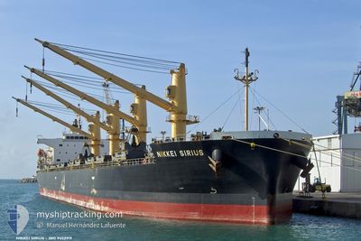
NIKKEI SIRIUS
Bulk Carrier
Current Trip
| Time Travelled | 28 days |
|---|---|
| Remaining Time | --- |
| Distance Travelled | 6187.40 nm |
| Remaining Distance | --- |
| AVG Speed | 11.2 Noeuds |
| MAX Speed | 15 Noeuds |
| AVG Wind | 10.4 knots |
| MAX Wind | 22.4 knots |
| MIN Temp | 13.5°C / 56.3°F |
| MAX Temp | 30.1°C / 86.18°F |
| Tirant d eau | 11.7 m |
| Position reçue | 6 d depuis |
Current Position
| Longitude | -123.40427° |
|---|---|
| Latitude | 27.92159° |
| Etat | Under way using engine |
| Vitesse | 11.3 Noeuds |
| Parcours | 298.4° |
| Zone | North Pacific Ocean |
| Station | T-AIS |
| Position reçue | 6 d depuis |
Info
Information
The current position of NIKKEI SIRIUS is in North Pacific Ocean with coordinates 27.92159° / -123.40427° as reported on 2024-04-22 16:51 by AIS to our vessel tracker app. The vessel's current speed is 11.3 Noeuds and is heading at the port of KASHIMA. The estimated time of arrival as calculated by MyShipTracking vessel tracking app is 2024-05-10 07:00 LT
The vessel NIKKEI SIRIUS (IMO: 9452919, MMSI: 353804000) is a Bulk Carrier that was built in 2013 ( 11 Age ). It's sailing under the flag of [PA] Panama.
In this page you can find informations about the vessels current position, last detected port calls, and current voyage information. If the vessels is not in coverage by AIS you will find the latest position.
The current position of NIKKEI SIRIUS is detected by our AIS receivers and we are not responsible for the reliability of the data. The last position was recorded while the vessel was in Coverage by the Ais receivers of our vessel tracking app.
The current draught of NIKKEI SIRIUS as reported by AIS is 11.7 meters
Weather
| Temperature | 14.3°C / 57.74°F |
|---|---|
| Wind Speed | 10 knots |
| Direction | 166° SSE |
| Pressure | 1025.6 hPa |
| Humidity | 86.5 % |
| Cloud Coverage | 99 % |
Featured Company
Last Port Calls
| Port | Arrival | Departure | Time In Port |
|---|---|---|---|
| 2024-03-31 13:09 | 2024-03-31 23:27 | 10 h | |
| 2024-03-21 16:34 | 2024-03-29 11:36 | 7 d |
Most Visited Ports (Last year)
| Port | Arrivals | |
|---|---|---|
| 2 | ||
| 2 | ||
| 2 | ||
| 2 | ||
| 2 | ||
| 1 |
Last Trips
| Origin | Departure | Destination | Arrival | Distance | |
|---|---|---|---|---|---|
| 2024-03-29 06:36 | 2024-03-31 08:09 | 465.32 nm | |||
| 2024-01-15 14:43 | 2024-03-21 11:34 | 10204.29 nm |
Events
| Heure | Evenement | Détails | Position/ Destination | Info |
|---|---|---|---|---|
| 2024-04-22 16:57 | Etat Changé | Default Under way using engine |
27.92947 / -123.42105
JP KSM
|
Vitesse: 11.3 kn Parcours: 298.4° |
| 2024-04-22 16:51 | Hors de la zone couverte |
27.92160 / -123.40427
North Pacific Ocean
JP KSM
|
Vitesse: 11.3 kn Parcours: 298.4° |
|
| 2024-04-22 16:47 | Etat Changé | Under way using engine Default |
27.91494 / -123.38998
JP KSM
|
Vitesse: 11.4 kn Parcours: 297° |
| 2024-04-22 16:08 | Etat Changé | Default Under way using engine |
27.85651 / -123.26881
JP KSM
|
Vitesse: 11.5 kn Parcours: 298° |
| 2024-04-22 15:52 | Tirant d'eau modifié | 11.7 11.8 |
27.83059 / -123.21667
JP KSM
|
Vitesse: 11.4 kn Parcours: 299.1° |
| 2024-04-22 15:45 | Etat Changé | Under way using engine Default |
27.82006 / -123.19544
JP KSM
|
Vitesse: 11.5 kn Parcours: 299° |
| 2024-04-22 15:37 | Etat Changé | Default Under way using engine |
27.80877 / -123.17241
JP KSM
|
Vitesse: 11.6 kn Parcours: 297.6° |
| 2024-04-22 15:27 | Etat Changé | Under way using engine Default |
27.79259 / -123.13915
JP KSM
|
Vitesse: 11.6 kn Parcours: 298° |
| 2024-04-22 15:25 | Dans la zone couverte |
27.79308 / -123.14015
North Pacific Ocean
JP KSM
|
Vitesse: 11.5 kn Parcours: 297.9° |
|
| 2024-04-22 13:36 | Hors de la zone couverte |
27.62365 / -122.79374
North Pacific Ocean
JP KSM
|
Vitesse: 11.4 kn Parcours: 298.1° |