
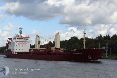
NAVIN EAGLE
Bulk Carrier
Current Trip
| Time Travelled | 4 days |
|---|---|
| Remaining Time | 4 days |
| Distance Travelled | 1007.94 nm |
| Remaining Distance | 922.55 nm |
| AVG Speed | 9.2 Noeuds |
| MAX Speed | 10.4 Noeuds |
| AVG Wind | 12.4 knots |
| MAX Wind | 27 knots |
| MIN Temp | 14.4°C / 57.92°F |
| MAX Temp | 20.1°C / 68.18°F |
| Tirant d eau | 6.7 m |
| Position reçue | 1 h, 18 m depuis |
Current Position
| Longitude | 13.73921° |
|---|---|
| Latitude | 36.95519° |
| Etat | Under way using engine |
| Vitesse | 9.6 Noeuds |
| Parcours | 297.9° |
| Zone | Mediterranean Sea - Eastern Basin |
| Station | T-AIS |
| Position reçue | 1 h, 18 m depuis |
Info
Information
The current position of NAVIN EAGLE is in Mediterranean Sea - Eastern Basin with coordinates 36.95519° / 13.73921° as reported on 2024-05-02 03:21 by AIS to our vessel tracker app. The vessel's current speed is 9.6 Noeuds and is heading at the port of CEUTA. The estimated time of arrival as calculated by MyShipTracking vessel tracking app is 2024-05-06 09:37 LT
The vessel NAVIN EAGLE (IMO: 9485186, MMSI: 538007990) is a Bulk Carrier that was built in 2008 ( 16 Age ). It's sailing under the flag of [MH] Marshall Is.
In this page you can find informations about the vessels current position, last detected port calls, and current voyage information. If the vessels is not in coverage by AIS you will find the latest position.
The current position of NAVIN EAGLE is detected by our AIS receivers and we are not responsible for the reliability of the data. The last position was recorded while the vessel was in Coverage by the Ais receivers of our vessel tracking app.
The current draught of NAVIN EAGLE as reported by AIS is 6.7 meters
Weather
| Temperature | 16.2°C / 61.16°F |
|---|---|
| Wind Speed | 10 knots |
| Direction | 285° WNW |
| Pressure | 1014.8 hPa |
| Humidity | 81.1 % |
| Cloud Coverage | --- |
Featured Company
Last Trips
| Origin | Departure | Destination | Arrival | Distance | |
|---|---|---|---|---|---|
| 2024-04-05 17:10 | 2024-04-26 07:09 | 1576.69 nm | |||
| 2024-03-28 14:12 | 2024-04-03 11:02 | 1354.63 nm | |||
| 2024-03-11 16:06 | 2024-03-26 17:41 | 1403.79 nm | |||
| 2024-03-05 17:28 | 2024-03-06 06:40 | 18.72 nm | |||
| 2024-02-12 01:22 | 2024-03-01 07:21 | 1454.41 nm |
Events
| Heure | Evenement | Détails | Position/ Destination | Info |
|---|---|---|---|---|
| 2024-05-02 03:26 | Etat Changé | Default Under way using engine |
36.96195 / 13.72351
ESCEU
|
Vitesse: 9.6 kn Parcours: 297.9° |
| 2024-05-02 03:21 | Hors de la zone couverte |
36.95519 / 13.73921
Mediterranean Sea - Eastern Basin
|
Vitesse: 9.6 kn Parcours: 297.9° |
|
| 2024-05-02 02:32 | Etat Changé | Under way using engine Default |
36.89489 / 13.88510
ESCEU
|
Vitesse: 9 kn Parcours: 295° |
| 2024-05-02 02:22 | Etat Changé | Default Under way using engine |
36.88334 / 13.91167
ESCEU
|
Vitesse: 9.3 kn Parcours: 295.4° |
| 2024-05-02 00:33 | Changement d'ETA | 2025/04/06 14:00 2024/04/06 14:00 |
36.76321 / 14.22903
ESCEU
|
Vitesse: 8.9 kn Parcours: 296.7° |
| 2024-05-01 23:45 | Etat Changé | Under way using engine Default |
36.71245 / 14.35984
ESCEU
|
Vitesse: 8.4 kn Parcours: 296° |
| 2024-05-01 23:28 | Dans la zone couverte |
36.71245 / 14.35984
Mediterranean Sea - Eastern Basin
|
Vitesse: 8.5 kn Parcours: 295° |
|
| 2024-05-01 19:01 | Etat Changé | Default Under way using engine |
36.50834 / 15.18833
ESCEU
|
Vitesse: 9 kn Parcours: 273° |
| 2024-05-01 18:50 | Changement de zone | Italian part of the Mediterranean Sea - Eastern Basin Greek part of the Mediterranean Sea - Eastern Basin |
36.50680 / 15.22305
Mediterranean Sea - Eastern Basin
|
Vitesse: 9 kn Parcours: 273° |
| 2024-05-01 18:50 | Hors de la zone couverte |
36.50680 / 15.22305
Mediterranean Sea - Eastern Basin
|
Vitesse: 9 kn Parcours: 273° |