
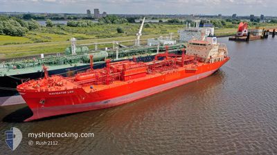
NAVIGATOR LEO
Lpg Tanker
Current Trip
BR ARB
| Time Travelled | 4 days |
|---|---|
| Remaining Time | --- |
| Distance Travelled | 1697.90 nm |
| Remaining Distance | --- |
| AVG Speed | 14 Noeuds |
| MAX Speed | 15.7 Noeuds |
| AVG Wind | 11.1 knots |
| MAX Wind | 19 knots |
| MIN Temp | 25.2°C / 77.36°F |
| MAX Temp | 27.9°C / 82.22°F |
| Tirant d eau | 6.5 m |
| Position reçue | 21 d depuis |
Current Position
| Longitude | --- |
|---|---|
| Latitude | --- |
| Etat | Under way using engine |
| Vitesse | 14.1 Noeuds |
| Parcours | 204.8° |
| Zone | North Atlantic Ocean |
| Station | T-AIS |
| Position reçue | 21 d depuis |
Info
Information
The current position of NAVIGATOR LEO is in North Atlantic Ocean with coordinates 28.04115° / -16.31533° as reported on 2025-01-02 23:13 by AIS to our vessel tracker app. The vessel's current speed is 14.1 Noeuds
The vessel NAVIGATOR LEO (IMO: 9482574, MMSI: 636015187) is a Lpg Tanker that was built in 2011 ( 14 Age ). It's sailing under the flag of [LR] Liberia.
In this page you can find informations about the vessels current position, last detected port calls, and current voyage information. If the vessels is not in coverage by AIS you will find the latest position.
The current position of NAVIGATOR LEO is detected by our AIS receivers and we are not responsible for the reliability of the data. The last position was recorded while the vessel was in Coverage by the Ais receivers of our vessel tracking app.
The current draught of NAVIGATOR LEO as reported by AIS is 6.5 meters
Weather
| Temperature | 27°C / 80.6°F |
|---|---|
| Wind Speed | 19 knots |
| Direction | 59° ENE |
| Pressure | 1012.6 hPa |
| Humidity | 81 % |
| Cloud Coverage | 92 % |
Featured Company
Last Port Calls
| Port | Arrival | Departure | Time In Port |
|---|---|---|---|
| 2025-01-17 11:33 | 2025-01-19 08:46 | 1 d | |
| 2025-01-11 08:26 | 2025-01-12 22:50 | 1 d | |
| 2024-12-16 10:44 | 2024-12-17 21:31 | 1 d | |
| 2024-12-06 08:40 | 2024-12-09 03:19 | 2 d | |
| 2024-11-21 09:27 | 2024-11-23 19:36 | 2 d | |
| 2024-11-10 12:43 | 2024-11-11 12:13 | 23 h | |
| 2024-11-03 08:58 | 2024-11-05 09:00 | 2 d | |
| 2024-11-01 05:55 |
Last Trips
| Origin | Departure | Destination | Arrival | Distance | |
|---|---|---|---|---|---|
| 2025-01-12 22:50 | 2025-01-17 11:33 | 98.96 nm | |||
| 2024-12-17 21:31 | 2025-01-11 08:26 | 4458.96 nm | |||
| 2024-12-09 03:19 | 2024-12-16 10:44 | 1306.78 nm | |||
| 2024-11-23 19:36 | 2024-12-06 08:40 | 1301.63 nm | |||
| 2024-11-11 12:13 | 2024-11-21 09:27 | 1541.36 nm | |||
| 2024-11-05 09:00 | 2024-11-10 12:43 | 745.38 nm | |||
| 2024-11-01 05:55 | 2024-11-03 08:58 | 101.17 nm |
Events
| Heure | Evenement | Détails | Position/ Destination | Info |
|---|---|---|---|---|
| 2025-01-19 11:46 | Démarrage | 1.77 nm, West of ARATU |
-12.78780 / -38.50250
BR ARB
|
Vitesse: 4.7 kn Parcours: 245° |
| 2025-01-19 11:46 | PORT DE DEPART |
|
-12.78780 / -38.50250
BR ARB
|
Vitesse: 1.8 kn Parcours: 233° |
| 2025-01-17 15:00 | Arret |
-12.78478 / -38.49839
[BR] ARATU
|
Vitesse: 0.1 kn Parcours: 117° |
|
| 2025-01-17 14:33 | Port d'arrivée |
|
-12.78478 / -38.49839
[BR] ARATU
|
Vitesse: 8.9 kn Parcours: 10° |
| 2025-01-17 12:30 | Démarrage | 8.37 nm, South West of SALVADOR |
-13.07470 / -38.60635
BR ARB
|
Vitesse: 4.2 kn Parcours: 59° |
| 2025-01-14 20:48 | Arret | 8.76 nm, South West of SALVADOR |
-13.07719 / -38.61377
BR ARB
|
Vitesse: 0.3 kn Parcours: 53° |
| 2025-01-14 20:02 | Démarrage | 11.86 nm, South West of SALVADOR |
-13.14115 / -38.61288
BR ARB
|
Vitesse: 4.8 kn Parcours: 354° |
| 2025-01-14 19:30 | Arret | 11.78 nm, South West of SALVADOR |
-13.14081 / -38.61047
BR ARB
|
Vitesse: 0.2 kn Parcours: 344° |
| 2025-01-14 17:58 | Démarrage | 8.89 nm, South West of SALVADOR |
-13.08140 / -38.61224
BR ARB
|
Vitesse: 6.1 kn Parcours: 182° |