
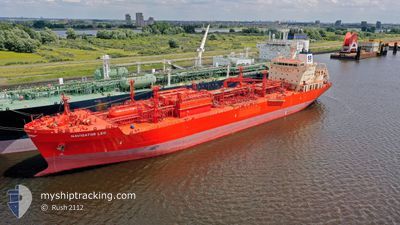
NAVIGATOR LEO
Lpg Tanker
Current Trip
| Trip Time | 13 days |
|---|---|
| Trip Distance | 1513.06 nm |
| AVG Speed | 9.5 Knopen |
| MAX Speed | 13.7 Knopen |
| Diepgang | 8.7 M |
| AVG Wind | 17.1 knots |
| MAX Wind | 36.8 knots |
| MIN Temp | 8.5°C / 47.3°F |
| MAX Temp | 21.8°C / 71.24°F |
| Positie ontvangen | 2 m geleden |
Current Position
| Lengtegraad | 29.74806° |
|---|---|
| Breedtegraat | 40.75418° |
| Status | Moored |
| Snelheid | |
| Koers | 246° |
| Gebied | Sea of Marmara |
| Station | T-AIS |
| Positie ontvangen | 2 m geleden |
Info
Information
The current position of NAVIGATOR LEO is in Sea of Marmara with coordinates 40.75418° / 29.74806° as reported on 2024-04-25 13:13 by AIS to our vessel tracker app. The vessel's current speed is 0 Knopen and is currently inside the port of KORFEZ.
The vessel NAVIGATOR LEO (IMO: 9482574, MMSI: 636015187) is a Lpg Tanker that was built in 2011 ( 13 Jaar oud ). It's sailing under the flag of [LR] Liberia.
In this page you can find informations about the vessels current position, last detected port calls, and current voyage information. If the vessels is not in coverage by AIS you will find the latest position.
The current position of NAVIGATOR LEO is detected by our AIS receivers and we are not responsible for the reliability of the data. The last position was recorded while the vessel was in Coverage by the Ais receivers of our vessel tracking app.
The current draught of NAVIGATOR LEO as reported by AIS is 8.7 meters
Weather
| Temperature | 19.4°C / 66.92°F |
|---|---|
| Wind Speed | 8 knots |
| Direction | 265° W |
| Pressure | 1003.2 hPa |
| Humidity | 71.5 % |
| Cloud Coverage | 100 % |
Featured Company
Last Port Calls
| Port | Arrival | Departure | Time In Port |
|---|---|---|---|
| 2024-04-23 15:05 | |||
| 2024-04-09 13:46 | 2024-04-09 21:23 | 7 h | |
| 2024-03-25 21:42 | |||
| 2024-03-20 16:41 | 2024-03-22 14:36 | 1 d | |
| 2024-03-03 05:06 | 2024-03-05 22:54 | 2 d | |
| 2024-02-18 20:40 | 2024-02-20 18:06 | 1 d | |
| 2024-02-13 08:31 | 2024-02-16 07:33 | 2 d | |
| 2024-02-10 09:49 | 2024-02-11 20:27 | 1 d |
Last Trips
| Origin | Departure | Destination | Arrival | Distance | |
|---|---|---|---|---|---|
| 2024-04-09 23:23 | 2024-04-23 18:05 | 1513.06 nm | |||
| 2024-03-25 23:42 | 2024-04-09 15:46 | 2737.26 nm | |||
| 2024-03-06 01:54 | 2024-03-20 17:41 | 2621.66 nm | |||
| 2024-02-20 20:06 | 2024-03-03 08:06 | 1844.50 nm | |||
| 2024-02-16 09:33 | 2024-02-18 22:40 | 264.32 nm | |||
| 2024-02-11 22:27 | 2024-02-13 10:31 | 400.97 nm | |||
| 2024-01-19 21:59 | 2024-02-10 11:49 | 3675.32 nm |
Events
| Tijd | Evenement | Details | Positie / Bestemming | Info |
|---|---|---|---|---|
| 2024-04-23 15:19 | Status Changed | Moored Under way using engine |
40.75419 / 29.74809
[TR] KORFEZ
|
Snelheid: Koers: 246° |
| 2024-04-23 15:07 | Stop beweging |
40.75409 / 29.74769
[TR] KORFEZ
|
Snelheid: 0.3 kn Koers: 246° |
|
| 2024-04-23 15:05 | Aankomsthaven |
|
40.75407 / 29.74751
[TR] KORFEZ
|
Snelheid: 0.6 kn Koers: 246° |
| 2024-04-23 14:20 | Start beweging | 1.87 nm, West of EVYAP |
40.76238 / 29.67276
TR YAR
|
Snelheid: 3.2 kn Koers: 85° |
| 2024-04-23 14:15 | Status Changed | Under way using engine At anchor |
40.76265 / 29.67058
TR YAR
|
Snelheid: 0.2 kn Koers: 96° |
| 2024-04-22 09:36 | Draught Changed | 8.7 8.5 |
40.76381 / 29.67406
TR YAR
|
Snelheid: Koers: 229° |
| 2024-04-21 05:10 | ETA Changed | 2024/04/21 02:00 2024/04/22 22:00 |
40.76003 / 29.66690
TR YAR
|
Snelheid: Koers: 169° |
| 2024-04-21 05:03 | ETA Changed | 2024/04/22 22:00 2024/04/19 22:00 |
40.76032 / 29.66700
TR YAR
|
Snelheid: 0.1 kn Koers: 175° |
| 2024-04-21 04:13 | Status Changed | At anchor Under way using engine |
40.75901 / 29.66811
TR YAR
|
Snelheid: 0.3 kn Koers: 246° |
| 2024-04-21 04:11 | Stop beweging | 2.15 nm, West of EVYAP |
40.75890 / 29.66791
TR YAR
|
Snelheid: Koers: 244° |