
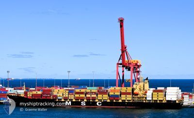
MSC SOTIRIA III
Container Ship
Current Trip
| Time Travelled | 10 h, 13 mins |
|---|---|
| Remaining Time | --- |
| Distance Travelled | 100.32 nm |
| Remaining Distance | 806.72 nm |
| AVG Speed | 10.1 Noeuds |
| MAX Speed | 10.6 Noeuds |
| AVG Wind | 14.7 knots |
| MAX Wind | 18.8 knots |
| MIN Temp | 24.9°C / 76.82°F |
| MAX Temp | 29.4°C / 84.92°F |
| Tirant d eau | 9.1 m |
| Position reçue | 2 d depuis |
Current Position
| Longitude | -92.77941° |
|---|---|
| Latitude | 13.74280° |
| Etat | Under way using engine |
| Vitesse | 17.3 Noeuds |
| Parcours | 270.9° |
| Zone | North Pacific Ocean |
| Station | T-AIS |
| Position reçue | 2 d depuis |
Info
Information
The current position of MSC SOTIRIA III is in North Pacific Ocean with coordinates 13.74280° / -92.77941° as reported on 2024-05-01 14:19 by AIS to our vessel tracker app. The vessel's current speed is 17.3 Noeuds and is heading at the port of PUERTO QUETZAL. The estimated time of arrival as calculated by MyShipTracking vessel tracking app is 2024-04-25 05:00 LT
The vessel MSC SOTIRIA III (IMO: 9259393, MMSI: 636021154) is a Container Ship that was built in 2002 ( 22 Age ). It's sailing under the flag of [LR] Liberia.
In this page you can find informations about the vessels current position, last detected port calls, and current voyage information. If the vessels is not in coverage by AIS you will find the latest position.
The current position of MSC SOTIRIA III is detected by our AIS receivers and we are not responsible for the reliability of the data. The last position was recorded while the vessel was in Coverage by the Ais receivers of our vessel tracking app.
The current draught of MSC SOTIRIA III as reported by AIS is 9.1 meters
Weather
| Temperature | 25.2°C / 77.36°F |
|---|---|
| Wind Speed | 12 knots |
| Direction | 311° NW |
| Pressure | 1007.7 hPa |
| Humidity | 74.3 % |
| Cloud Coverage | --- |
Featured Company
Last Port Calls
| Port | Arrival | Departure | Time In Port |
|---|---|---|---|
| 2024-05-03 04:50 | 2024-05-03 22:18 | 17 h | |
| 2024-04-30 19:49 | 2024-05-01 07:06 | 11 h | |
| 2024-04-29 08:18 | 2024-04-30 03:17 | 18 h | |
| 2024-04-23 00:01 | 2024-04-23 16:52 | 16 h | |
| 2024-04-21 00:26 | 2024-04-21 21:54 | 21 h | |
| 2024-04-18 01:09 | 2024-04-18 23:30 | 22 h | |
| 2024-04-15 08:39 | 2024-04-16 04:27 | 19 h | |
| 2024-04-09 05:32 | 2024-04-09 13:21 | 7 h | |
| 2024-04-06 06:11 | 2024-04-07 06:22 | 1 d | |
| 2024-03-09 18:27 | 2024-03-10 16:16 | 21 h |
Most Visited Ports (Last year)
| Port | Arrivals | |
|---|---|---|
| 13 | ||
| 10 | ||
| 6 | ||
| 4 | ||
| 3 | ||
| 3 |
Last Trips
| Origin | Departure | Destination | Arrival | Distance | |
|---|---|---|---|---|---|
| 2024-05-01 01:06 | 2024-05-02 23:50 | 731.20 nm | |||
| 2024-04-29 21:17 | 2024-04-30 13:49 | 8.27 nm | |||
| 2024-04-23 11:52 | 2024-04-29 02:18 | 916.77 nm | |||
| 2024-04-21 16:54 | 2024-04-22 19:01 | 48.98 nm | |||
| 2024-04-18 18:30 | 2024-04-20 19:26 | 15.82 nm | |||
| 2024-04-15 22:27 | 2024-04-17 20:09 | 780.20 nm | |||
| 2024-04-09 09:21 | 2024-04-15 02:39 | 1216.25 nm | |||
| 2024-04-07 01:22 | 2024-04-09 01:32 | 813.49 nm | |||
| 2024-03-11 01:16 | 2024-04-06 01:11 | 9165.97 nm | |||
| 2024-02-27 08:26 | 2024-03-04 14:53 | 1084.00 nm |
Events
| Heure | Evenement | Détails | Position/ Destination | Info |
|---|---|---|---|---|
| 2024-05-03 22:18 | PORT DE DEPART |
|
17.92148 / -102.15960
PAROD>GTPRQ
|
Vitesse: 7.4 kn Parcours: 123° |
| 2024-05-03 22:10 | Démarrage |
17.93028 / -102.17403
[MX] LAZARO CARDENAS
|
Vitesse: 6.5 kn Parcours: 121° |
|
| 2024-05-03 04:50 | Arret |
17.95180 / -102.17112
[MX] LAZARO CARDENAS
|
Vitesse: Parcours: 359° |
|
| 2024-05-03 04:50 | Port d'arrivée |
|
17.95180 / -102.17112
[MX] LAZARO CARDENAS
|
Vitesse: 5.1 kn Parcours: 26° |
| 2024-05-01 14:25 | Etat Changé | Default Under way using engine |
13.74363 / -92.81310
PAROD>GTPRQ
|
Vitesse: 17.3 kn Parcours: 270.9° |
| 2024-05-01 14:19 | Changement de zone | Guatemalan part of the North Pacific Ocean Panamanian part of the North Pacific Ocean |
13.74280 / -92.77941
North Pacific Ocean
|
Vitesse: 17.3 kn Parcours: 270.9° |
| 2024-05-01 14:19 | Etat Changé | Under way using engine Default |
13.74280 / -92.77941
PAROD>GTPRQ
|
Vitesse: 17.2 kn Parcours: 271° |
| 2024-05-01 14:19 | Hors de la zone couverte |
13.74280 / -92.77941
North Pacific Ocean
|
Vitesse: 17.3 kn Parcours: 270.9° |
|
| 2024-05-01 14:05 | Dans la zone couverte |
13.74280 / -92.77941
North Pacific Ocean
|
Vitesse: 17.3 kn Parcours: 270.9° |
|
| 2024-05-01 07:06 | Démarrage | 1.04 nm, South East of PUERTO QUETZAL |
13.90975 / -90.77420
PAROD>GTPRQ
|
Vitesse: 9.6 kn Parcours: 130° |