
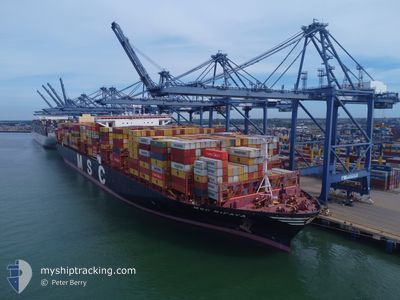
MSC RIFAYA
Cargo A
Current Trip
| Time Travelled | 1 day |
|---|---|
| Remaining Time | --- |
| Distance Travelled | 507.77 nm |
| Remaining Distance | --- |
| AVG Speed | 17.1 Noeuds |
| MAX Speed | 19.1 Noeuds |
| AVG Wind | 11.2 knots |
| MAX Wind | 16.8 knots |
| MIN Temp | 7.1°C / 44.78°F |
| MAX Temp | 14.1°C / 57.38°F |
| Tirant d eau | 11.3 m |
| Position reçue | 1 d depuis |
Current Position
| Longitude | --- |
|---|---|
| Latitude | --- |
| Etat | Under way using engine |
| Vitesse | 14.3 Noeuds |
| Parcours | 174.5° |
| Zone | Japan Sea |
| Station | T-AIS |
| Position reçue | 1 d depuis |
Info
Information
The current position of MSC RIFAYA is in Japan Sea with coordinates 34.75459° / 128.86046° as reported on 2025-01-01 12:01 by AIS to our vessel tracker app. The vessel's current speed is 14.3 Noeuds
The vessel MSC RIFAYA (IMO: 9767388, MMSI: 636017685) is a Cargo A It's sailing under the flag of [LR] Liberia.
In this page you can find informations about the vessels current position, last detected port calls, and current voyage information. If the vessels is not in coverage by AIS you will find the latest position.
The current position of MSC RIFAYA is detected by our AIS receivers and we are not responsible for the reliability of the data. The last position was recorded while the vessel was in Coverage by the Ais receivers of our vessel tracking app.
The current draught of MSC RIFAYA as reported by AIS is 11.3 meters
Weather
| Temperature | 14.3°C / 57.74°F |
|---|---|
| Wind Speed | 21 knots |
| Direction | 22° NNE |
| Pressure | 1022.8 hPa |
| Humidity | 64.7 % |
| Cloud Coverage | --- |
Featured Company
Last Port Calls
| Port | Arrival | Departure | Time In Port |
|---|---|---|---|
| 2024-12-30 15:35 | 2025-01-01 10:36 | 1 d | |
| 2024-12-04 13:29 | 2024-12-14 04:12 | 9 d | |
| 2024-11-03 12:48 | 2024-11-05 09:10 | 1 d |
Most Visited Ports (Last year)
| Port | Arrivals | |
|---|---|---|
| 4 | ||
| 3 | ||
| 3 | ||
| 2 | ||
| 1 | ||
| 1 |
Last Trips
| Origin | Departure | Destination | Arrival | Distance | |
|---|---|---|---|---|---|
| 2024-12-13 20:12 | 2024-12-31 00:35 | 7051.06 nm | |||
| 2024-11-05 17:10 | 2024-12-04 05:29 | 7765.81 nm | |||
| 2024-10-19 08:01 | 2024-11-03 20:48 | 6373.74 nm |
Events
| Heure | Evenement | Détails | Position/ Destination | Info |
|---|---|---|---|---|
| 2025-01-01 12:09 | Etat Changé | Default Under way using engine |
34.72451 / 128.86417
BUSAN
|
Vitesse: 14.3 kn Parcours: 174.5° |
| 2025-01-01 12:01 | Etat Changé | Under way using engine Default |
34.75459 / 128.86046
BUSAN
|
Vitesse: 14.4 kn Parcours: 175° |
| 2025-01-01 12:01 | Hors de la zone couverte |
34.75459 / 128.86046
Japan Sea
|
Vitesse: 14.3 kn Parcours: 174.5° |
|
| 2025-01-01 11:45 | Dans la zone couverte |
34.75459 / 128.86046
Japan Sea
|
Vitesse: 14.3 kn Parcours: 174.5° |
|
| 2025-01-01 10:36 | PORT DE DEPART |
|
35.04591 / 128.77945
BUSAN
|
Vitesse: 10.3 kn Parcours: 199° |
| 2025-01-01 10:26 | Démarrage |
35.07032 / 128.79542
[KR] BUSAN NEW PORT
|
Vitesse: 5.3 kn Parcours: 244° |
|
| 2024-12-30 15:49 | Arret |
35.07728 / 128.80040
[KR] BUSAN NEW PORT
|
Vitesse: 0.1 kn Parcours: 90° |
|
| 2024-12-30 15:35 | Port d'arrivée |
|
35.07583 / 128.80022
[KR] BUSAN NEW PORT
|
Vitesse: 2.1 kn Parcours: 63° |
| 2024-12-30 12:45 | Etat Changé | Default Under way using engine |
34.82942 / 128.99101
BUSAN
|
Vitesse: 11.1 kn Parcours: 299.1° |
| 2024-12-30 12:38 | Hors de la zone couverte |
34.82012 / 129.01202
Japan Sea
|
Vitesse: 11.1 kn Parcours: 299.1° |