
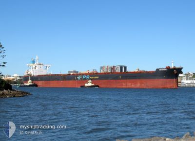
MOUNT K2
Bulk Carrier
Current Trip
| Time Travelled | 15 days |
|---|---|
| Remaining Time | --- |
| Distance Travelled | 3416.37 nm |
| Remaining Distance | --- |
| AVG Speed | 10.2 Noeuds |
| MAX Speed | 13.6 Noeuds |
| AVG Wind | 9.7 knots |
| MAX Wind | 22.3 knots |
| MIN Temp | 22.9°C / 73.22°F |
| MAX Temp | 29.9°C / 85.82°F |
| Tirant d eau | 8.1 m |
| Position reçue | 12 d depuis |
Current Position
| Longitude | --- |
|---|---|
| Latitude | --- |
| Etat | Under way using engine |
| Vitesse | 10.2 Noeuds |
| Parcours | 36.9° |
| Zone | Bali Sea |
| Station | T-AIS |
| Position reçue | 12 d depuis |
Info
Information
The current position of MOUNT K2 is in Bali Sea with coordinates -7.79928° / 116.28529° as reported on 2024-10-06 04:42 by AIS to our vessel tracker app. The vessel's current speed is 10.2 Noeuds
The vessel MOUNT K2 (IMO: 9546980, MMSI: 636020471) is a Bulk Carrier that was built in 2011 ( 13 Age ). It's sailing under the flag of [LR] Liberia.
In this page you can find informations about the vessels current position, last detected port calls, and current voyage information. If the vessels is not in coverage by AIS you will find the latest position.
The current position of MOUNT K2 is detected by our AIS receivers and we are not responsible for the reliability of the data. The last position was recorded while the vessel was in Coverage by the Ais receivers of our vessel tracking app.
The current draught of MOUNT K2 as reported by AIS is 8.1 meters
Weather
| Temperature | 27°C / 80.6°F |
|---|---|
| Wind Speed | 7 knots |
| Direction | 206° SSW |
| Pressure | 1011 hPa |
| Humidity | 65.8 % |
| Cloud Coverage | 79 % |
Featured Company
Last Port Calls
| Port | Arrival | Departure | Time In Port |
|---|---|---|---|
| 2024-10-02 00:35 | 2024-10-03 10:54 | 1 d | |
| 2024-09-04 04:17 | 2024-09-07 13:41 | 3 d | |
| 2024-08-15 07:11 | 2024-08-16 19:28 | 1 d |
Most Visited Ports (Last year)
| Port | Arrivals | |
|---|---|---|
| 9 | ||
| 2 | ||
| 2 | ||
| 1 | ||
| 1 | ||
| 1 |
Last Trips
| Origin | Departure | Destination | Arrival | Distance | |
|---|---|---|---|---|---|
| 2024-09-07 13:41 | 2024-10-02 00:35 | 3957.12 nm | |||
| 2024-08-16 19:28 | 2024-09-04 04:17 | 3881.11 nm | |||
| 2024-07-31 16:26 | 2024-08-15 07:11 | 3915.05 nm |
Events
| Heure | Evenement | Détails | Position/ Destination | Info |
|---|---|---|---|---|
| 2024-10-17 20:59 | Démarrage |
31.19617 / 122.61008
PORT HEDLAND
|
Vitesse: 3.5 kn Parcours: 290° |
|
| 2024-10-17 16:41 | Arret |
31.19749 / 122.61463
PORT HEDLAND
|
Vitesse: 0.2 kn Parcours: 48° |
|
| 2024-10-17 00:45 | Démarrage | 7.4 nm, South West of ZHOUSHAN |
29.90188 / 122.07925
PORT HEDLAND
|
Vitesse: 4.7 kn Parcours: 29° |
| 2024-10-16 01:29 | Arret | 7.74 nm, South West of ZHOUSHAN |
29.89353 / 122.07775
PORT HEDLAND
|
Vitesse: 0.2 kn Parcours: 257° |
| 2024-10-15 20:21 | Démarrage |
29.74178 / 122.75716
PORT HEDLAND
|
Vitesse: 4.4 kn Parcours: 205° |
|
| 2024-10-15 11:45 | Arret |
29.74893 / 122.76588
PORT HEDLAND
|
Vitesse: 0.2 kn Parcours: 120° |