
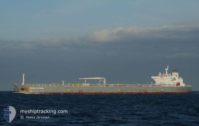
MINERVA KYTHNOS
Crude Oil Tanker
Current Trip
| Time Travelled | 11 days |
|---|---|
| Remaining Time | --- |
| Distance Travelled | 2987.58 nm |
| Remaining Distance | --- |
| AVG Speed | 11 Noeuds |
| MAX Speed | 15.3 Noeuds |
| AVG Wind | 14.3 knots |
| MAX Wind | 39.4 knots |
| MIN Temp | 10.2°C / 50.36°F |
| MAX Temp | 27.8°C / 82.04°F |
| Tirant d eau | 12.9 m |
| Position reçue | 8 d depuis |
Current Position
| Longitude | -79.42091° |
|---|---|
| Latitude | 26.35872° |
| Etat | Under way using engine |
| Vitesse | 13.3 Noeuds |
| Parcours | 11.4° |
| Zone | North Atlantic Ocean |
| Station | T-AIS |
| Position reçue | 8 d depuis |
Info
Information
The current position of MINERVA KYTHNOS is in North Atlantic Ocean with coordinates 26.35872° / -79.42091° as reported on 2024-04-23 12:47 by AIS to our vessel tracker app. The vessel's current speed is 13.3 Noeuds and is heading at the port of ROTTERDAM. The estimated time of arrival as calculated by MyShipTracking vessel tracking app is 2024-05-07 14:00 LT
The vessel MINERVA KYTHNOS (IMO: 9592252, MMSI: 241132000) is a Crude Oil Tanker that was built in 2011 ( 13 Age ). It's sailing under the flag of [GR] Greece.
In this page you can find informations about the vessels current position, last detected port calls, and current voyage information. If the vessels is not in coverage by AIS you will find the latest position.
The current position of MINERVA KYTHNOS is detected by our AIS receivers and we are not responsible for the reliability of the data. The last position was recorded while the vessel was in Coverage by the Ais receivers of our vessel tracking app.
The current draught of MINERVA KYTHNOS as reported by AIS is 12.9 meters
Weather
| Temperature | 14.8°C / 58.64°F |
|---|---|
| Wind Speed | 22 knots |
| Direction | 296° WNW |
| Pressure | 1002.9 hPa |
| Humidity | 73.3 % |
| Cloud Coverage | 100 % |
Featured Company
Last Port Calls
| Port | Arrival | Departure | Time In Port |
|---|---|---|---|
| 2024-04-18 00:43 | 2024-04-19 22:19 | 1 d | |
| 2024-04-05 02:51 | 2024-04-06 14:12 | 1 d |
Last Trips
| Origin | Departure | Destination | Arrival | Distance | |
|---|---|---|---|---|---|
| 2024-04-06 10:12 | 2024-04-17 19:43 | 2067.31 nm | |||
| 2024-02-05 15:10 | 2024-04-04 22:51 | 5428.79 nm |
Events
| Heure | Evenement | Détails | Position/ Destination | Info |
|---|---|---|---|---|
| 2024-05-01 03:02 | Démarrage |
40.57784 / -48.93026
NL RTM
|
Vitesse: 3.3 kn Parcours: 81° |
|
| 2024-05-01 02:05 | Arret |
40.57584 / -48.93750
NL RTM
|
Vitesse: 0.3 kn Parcours: 150° |
|
| 2024-04-23 12:54 | Etat Changé | Default Under way using engine |
26.38441 / -79.41560
NL RTM
|
Vitesse: 13.3 kn Parcours: 11.4° |
| 2024-04-23 12:47 | Hors de la zone couverte |
26.35872 / -79.42091
North Atlantic Ocean
NL RTM
|
Vitesse: 13.3 kn Parcours: 11.4° |
|
| 2024-04-23 08:59 | Changement d'ETA | 2024/05/07 14:00 2024/05/07 22:00 |
25.48647 / -79.55014
NL RTM
|
Vitesse: 13.6 kn Parcours: 7.3° |
| 2024-04-23 08:56 | Detecté en mer | Bahamas part of the North Atlantic Ocean |
25.47641 / -79.55150
North Atlantic Ocean
NL RTM
|
Vitesse: 13.6 kn Parcours: 6.3° |
| 2024-04-23 08:53 | Etat Changé | Under way using engine Default |
25.46500 / -79.55308
NL RTM
|
Vitesse: 13.7 kn Parcours: 8° |
| 2024-04-23 08:53 | Dans la zone couverte |
25.47641 / -79.55150
North Atlantic Ocean
NL RTM
|
Vitesse: 13.6 kn Parcours: 6.3° |