

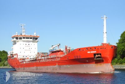
MED SERHAT
Tanker

Current Trip
| Trip Time | 3 days |
|---|---|
| Trip Distance | 984.23 nm |
| AVG Speed | 11.7 Noeuds |
| MAX Speed | 13.9 Noeuds |
| Tirant d eau | 6.6 m |
| AVG Wind | 14.7 knots |
| MAX Wind | 31.7 knots |
| MIN Temp | 9.7°C / 49.46°F |
| MAX Temp | 19°C / 66.2°F |
| Position reçue | 2 d depuis |
Current Position
| Longitude | --- |
|---|---|
| Latitude | --- |
| Etat | Under way using engine |
| Vitesse | 12.1 Noeuds |
| Parcours | 216.7° |
| Zone | North Atlantic Ocean |
| Station | T-AIS |
| Position reçue | 2 d depuis |
Information
The current position of MED SERHAT is in North Atlantic Ocean with coordinates 27.50907° / -13.92717° as reported on 2025-02-20 09:55 by AIS to our vessel tracker app. The vessel's current speed is 12.1 Noeuds and is currently inside the port of DAKHLA.
The vessel MED SERHAT (IMO: 9461922, MMSI: 215683000) is a Tanker It's sailing under the flag of [MT] Malta.
In this page you can find informations about the vessels current position, last detected port calls, and current voyage information. If the vessels is not in coverage by AIS you will find the latest position.
The current position of MED SERHAT is detected by our AIS receivers and we are not responsible for the reliability of the data. The last position was recorded while the vessel was in Coverage by the Ais receivers of our vessel tracking app.
The current draught of MED SERHAT as reported by AIS is 6.6 meters
Weather
| Temperature | 17.4°C / 63.32°F |
|---|---|
| Wind Speed | 15 knots |
| Direction | 23° NNE |
| Pressure | 1019.6 hPa |
| Humidity | 72.2 % |
| Cloud Coverage | --- |


Featured Company
Last Port Calls
| Port | Arrival | Departure | Time In Port |
|---|---|---|---|
| 2025-02-21 18:58 | |||
| 2025-02-16 15:21 | 2025-02-17 22:18 | 1 d | |
| 2025-02-15 17:09 | 2025-02-15 22:14 | 5 h | |
| 2025-02-11 11:56 | 2025-02-12 17:54 | 1 d | |
| 2025-02-03 15:31 | 2025-02-04 22:32 | 1 d | |
| 2025-02-01 22:51 | 2025-02-02 04:12 | 5 h | |
| 2025-01-31 14:06 | 2025-02-01 16:48 | 1 d | |
| 2025-01-29 15:14 | 2025-01-30 15:05 | 23 h | |
| 2025-01-22 10:35 | 2025-01-23 12:08 | 1 d | |
| 2025-01-17 21:16 | 2025-01-18 21:31 | 1 d |
Most Visited Ports (Last year)
| Port | Arrivals | |
|---|---|---|
| 7 | ||
| 6 | ||
| 4 | ||
| 4 | ||
| 3 | ||
| 3 |
Last Trips
| Origin | Departure | Destination | Arrival | Distance | |
|---|---|---|---|---|---|
| 2025-02-17 23:18 | 2025-02-21 19:58 | 984.23 nm | |||
| 2025-02-15 23:14 | 2025-02-16 16:21 | 92.58 nm | |||
| 2025-02-12 18:54 | 2025-02-15 18:09 | 894.32 nm | |||
| 2025-02-04 23:32 | 2025-02-11 12:56 | 901.62 nm | |||
| 2025-02-02 05:12 | 2025-02-03 16:31 | 196.15 nm | |||
| 2025-02-01 17:48 | 2025-02-01 23:51 | 23.58 nm | |||
| 2025-01-30 16:05 | 2025-01-31 15:06 | 197.49 nm | |||
| 2025-01-23 13:08 | 2025-01-29 16:14 | 841.40 nm | |||
| 2025-01-18 22:31 | 2025-01-22 11:35 | 204.16 nm | |||
| 2025-01-15 08:50 | 2025-01-17 22:16 | 489.24 nm |
Events
| Heure | Evenement | Détails | Position/ Destination | Info |
|---|---|---|---|---|
| 2025-02-21 19:11 | Arret |
23.65663 / -15.94561
[MA] DAKHLA
|
Vitesse: 0.3 kn Parcours: 44° |
|
| 2025-02-21 18:58 | Port d'arrivée |
|
23.65362 / -15.94657
[MA] DAKHLA
|
Vitesse: 1.7 kn Parcours: 31° |
| 2025-02-21 17:47 | Démarrage | 5.91 nm, West of DAKHLA |
23.62517 / -16.04279
MA VIL
|
Vitesse: 7.3 kn Parcours: 125° |
| 2025-02-21 09:25 | Arret | 5.79 nm, West of DAKHLA |
23.63059 / -16.04258
MA VIL
|
Vitesse: Parcours: 24° |
| 2025-02-20 09:55 | Etat Changé | Default Under way using engine |
27.50816 / -13.92800
MA VIL
|
Vitesse: 12.1 kn Parcours: 216.7° |
| 2025-02-20 09:55 | Etat Changé | Under way using engine Default |
27.50907 / -13.92717
MA VIL
|
Vitesse: 12.2 kn Parcours: 218° |
| 2025-02-20 09:55 | Hors de la zone couverte |
27.50907 / -13.92717
North Atlantic Ocean
MA VIL
|
Vitesse: 12.1 kn Parcours: 216.7° |
|
| 2025-02-20 09:14 | Etat Changé | Default Under way using engine |
27.61766 / -13.82718
MA VIL
|
Vitesse: 12.3 kn Parcours: 219.6° |
| 2025-02-20 09:11 | Etat Changé | Under way using engine Default |
27.62549 / -13.81984
MA VIL
|
Vitesse: 12.3 kn Parcours: 220° |
| 2025-02-20 09:11 | Detecté en mer | Western Saharan part of the North Atlantic Ocean |
27.62549 / -13.81984
North Atlantic Ocean
MA VIL
|
Vitesse: 12.3 kn Parcours: 219.6° |