
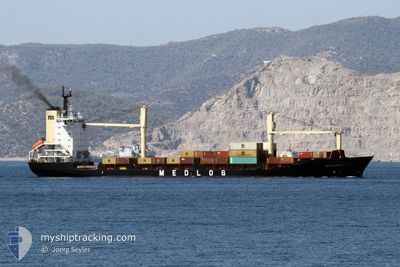
MED DENIZLI
Container Ship
Current Trip
| Time Travelled | 2 days |
|---|---|
| Remaining Time | -4 mins |
| Distance Travelled | 518.85 nm |
| Remaining Distance | 254.21 nm |
| AVG Speed | 10.4 Noeuds |
| MAX Speed | 11.7 Noeuds |
| AVG Wind | 11.5 knots |
| MAX Wind | 23.9 knots |
| MIN Temp | 24.5°C / 76.1°F |
| MAX Temp | 33.2°C / 91.76°F |
| Tirant d eau | 9.3 m |
| Position reçue | 14 m depuis |
Current Position
| Longitude | 29.79735° |
|---|---|
| Latitude | 31.19690° |
| Etat | Under way using engine |
| Vitesse | 4.1 Noeuds |
| Parcours | 196° |
| Zone | Mediterranean Sea - Eastern Basin |
| Station | T-AIS |
| Position reçue | 14 m depuis |
Info
Information
The current position of MED DENIZLI is in Mediterranean Sea - Eastern Basin with coordinates 31.19690° / 29.79735° as reported on 2024-06-26 12:06 by AIS to our vessel tracker app. The vessel's current speed is 4.1 Noeuds and is heading at the port of ALEXANDRIA. The estimated time of arrival as calculated by MyShipTracking vessel tracking app is 2024-06-26 12:16 LT
The vessel MED DENIZLI (IMO: 9106493, MMSI: 271044398) is a Container Ship that was built in 1996 ( 28 Age ). It's sailing under the flag of [TR] Turkey.
In this page you can find informations about the vessels current position, last detected port calls, and current voyage information. If the vessels is not in coverage by AIS you will find the latest position.
The current position of MED DENIZLI is detected by our AIS receivers and we are not responsible for the reliability of the data. The last position was recorded while the vessel was in Coverage by the Ais receivers of our vessel tracking app.
The current draught of MED DENIZLI as reported by AIS is 9.3 meters
Weather
| Temperature | 26.6°C / 79.88°F |
|---|---|
| Wind Speed | 13 knots |
| Direction | 331° NNW |
| Pressure | 1007.7 hPa |
| Humidity | 73.1 % |
| Cloud Coverage | --- |
Featured Company
Last Port Calls
| Port | Arrival | Departure | Time In Port |
|---|---|---|---|
| 2024-06-23 06:45 | 2024-06-24 10:59 | 1 d | |
| 2024-06-20 14:16 | 2024-06-22 04:07 | 1 d | |
| 2024-06-18 04:32 | 2024-06-18 17:17 | 12 h | |
| 2024-06-16 14:00 | 2024-06-17 18:58 | 1 d | |
| 2024-06-15 18:30 | 2024-06-16 02:42 | 8 h | |
| 2024-06-14 04:52 | 2024-06-15 08:10 | 1 d | |
| 2024-06-12 03:17 | 2024-06-12 21:33 | 18 h | |
| 2024-06-08 07:52 | 2024-06-09 15:39 | 1 d | |
| 2024-06-07 03:49 | 2024-06-07 17:02 | 13 h | |
| 2024-06-04 22:35 | 2024-06-05 13:12 | 14 h |
Last Trips
| Origin | Departure | Destination | Arrival | Distance | |
|---|---|---|---|---|---|
| 2024-06-22 07:07 | 2024-06-23 09:45 | 271.78 nm | |||
| 2024-06-18 20:17 | 2024-06-20 17:16 | 323.71 nm | |||
| 2024-06-17 21:58 | 2024-06-18 07:32 | 87.07 nm | |||
| 2024-06-16 05:42 | 2024-06-16 17:00 | 64.23 nm | |||
| 2024-06-15 11:10 | 2024-06-15 21:30 | 100.79 nm | |||
| 2024-06-13 00:33 | 2024-06-14 07:52 | 235.63 nm | |||
| 2024-06-09 18:39 | 2024-06-12 06:17 | 612.98 nm | |||
| 2024-06-07 20:02 | 2024-06-08 10:52 | 129.32 nm | |||
| 2024-06-05 15:12 | 2024-06-07 06:49 | 358.72 nm | |||
| 2024-06-01 19:14 | 2024-06-05 00:35 | 445.22 nm |
Events
| Heure | Evenement | Détails | Position/ Destination | Info |
|---|---|---|---|---|
| 2024-06-26 12:08 | Etat Changé | Default Under way using engine |
31.19407 / 29.79674
EGALY
|
Vitesse: 4.1 kn Parcours: 196° |
| 2024-06-26 12:06 | Etat Changé | Under way using engine Default |
31.19690 / 29.79735
EGALY
|
Vitesse: 1.7 kn Parcours: 202° |
| 2024-06-26 11:57 | Etat Changé | Default Under way using engine |
31.20300 / 29.79795
EGALY
|
Vitesse: 1.4 kn Parcours: 216° |
| 2024-06-26 11:52 | Changement de zone | Egyptian part of the Mediterranean Sea - Eastern Basin Greek part of the Mediterranean Sea - Eastern Basin |
31.20493 / 29.79777
Mediterranean Sea - Eastern Basin
EGALY
|
Vitesse: 1.4 kn Parcours: 159.6° |
| 2024-06-26 11:51 | Etat Changé | Under way using engine Default |
31.20518 / 29.79765
EGALY
|
Vitesse: 4.4 kn Parcours: 172° |
| 2024-06-26 11:42 | Dans la zone couverte |
31.20493 / 29.79777
Mediterranean Sea - Eastern Basin
EGALY
|
Vitesse: 1.4 kn Parcours: 159.6° |
|
| 2024-06-25 12:07 | Etat Changé | Default Under way using engine |
34.64864 / 26.98358
EGALY
|
Vitesse: 10.4 kn Parcours: 139.8° |
| 2024-06-25 12:04 | Hors de la zone couverte |
34.65541 / 26.97693
Mediterranean Sea - Eastern Basin
EGALY
|
Vitesse: 10.4 kn Parcours: 139.8° |
|
| 2024-06-25 11:18 | Etat Changé | Under way using engine Default |
34.75888 / 26.87506
EGALY
|
Vitesse: 10.1 kn Parcours: 144° |
| 2024-06-25 11:10 | Etat Changé | Default Under way using engine |
34.77637 / 26.85954
EGALY
|
Vitesse: 10.1 kn Parcours: 143.5° |