
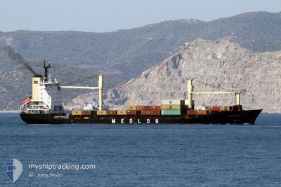
MED DENIZLI
Container Ship
Current Trip
| Time Travelled | 3 days |
|---|---|
| Remaining Time | --- |
| Distance Travelled | 437.70 nm |
| Remaining Distance | --- |
| AVG Speed | 9.8 Knots |
| MAX Speed | 11.4 Knots |
| AVG Wind | 12.7 knots |
| MAX Wind | 28.6 knots |
| MIN Temp | 14.3°C / 57.74°F |
| MAX Temp | 20.2°C / 68.36°F |
| Dybgang | 8.9 m |
| Position Modtaget | 2 d siden |
Current Position
| Longitude | 33.51016° |
|---|---|
| Latitude | 34.36593° |
| Status | Under way using engine |
| Fart | 10.5 Knots |
| Kurs | 46° |
| Område | Mediterranean Sea - Eastern Basin |
| Station | T-AIS |
| Position Modtaget | 2 d siden |
Info
Information
The current position of MED DENIZLI is in Mediterranean Sea - Eastern Basin with coordinates 34.36593° / 33.51016° as reported on 2024-05-04 11:32 by AIS to our vessel tracker app. The vessel's current speed is 10.5 Knots
The vessel MED DENIZLI (IMO: 9106493, MMSI: 271044398) is a Container Ship that was built in 1996 ( 28 år gamle ). It's sailing under the flag of [TR] Turkey.
In this page you can find informations about the vessels current position, last detected port calls, and current voyage information. If the vessels is not in coverage by AIS you will find the latest position.
The current position of MED DENIZLI is detected by our AIS receivers and we are not responsible for the reliability of the data. The last position was recorded while the vessel was in Coverage by the Ais receivers of our vessel tracking app.
The current draught of MED DENIZLI as reported by AIS is 8.9 meters
Weather
| Temperature | 15°C / 59°F |
|---|---|
| Wind Speed | 15 knots |
| Direction | 49° NE |
| Pressure | 1011.7 hPa |
| Humidity | 81.8 % |
| Cloud Coverage | 42 % |
Featured Company
Last Port Calls
| Port | Arrival | Departure | Time In Port |
|---|---|---|---|
| 2024-05-02 14:08 | 2024-05-03 08:16 | 18 h | |
| 2024-04-30 11:09 | 2024-05-01 08:03 | 20 h | |
| 2024-04-27 18:00 | 2024-04-28 03:45 | 9 h | |
| 2024-04-25 17:44 | 2024-04-26 15:45 | 22 h | |
| 2024-04-20 02:32 | 2024-04-20 13:45 | 11 h | |
| 2024-04-16 21:20 | 2024-04-17 02:02 | 4 h | |
| 2024-04-16 05:59 | 2024-04-16 15:19 | 9 h | |
| 2024-04-14 21:02 | 2024-04-15 21:27 | 1 d | |
| 2024-04-11 05:28 | 2024-04-12 07:43 | 1 d | |
| 2024-04-07 17:20 | 2024-04-08 14:36 | 21 h |
Last Trips
| Origin | Departure | Destination | Arrival | Distance | |
|---|---|---|---|---|---|
| 2024-05-01 10:03 | 2024-05-02 16:08 | 142.15 nm | |||
| 2024-04-28 06:45 | 2024-04-30 13:09 | 573.50 nm | |||
| 2024-04-26 18:45 | 2024-04-27 21:00 | 269.42 nm | |||
| 2024-04-20 16:45 | 2024-04-25 20:44 | 277.94 nm | |||
| 2024-04-17 05:02 | 2024-04-20 05:32 | 105.63 nm | |||
| 2024-04-16 18:19 | 2024-04-17 00:20 | 62.29 nm | |||
| 2024-04-16 00:27 | 2024-04-16 08:59 | 86.37 nm | |||
| 2024-04-12 10:43 | 2024-04-15 00:02 | 238.29 nm | |||
| 2024-04-08 17:36 | 2024-04-11 08:28 | 652.68 nm | |||
| 2024-04-07 06:45 | 2024-04-07 20:20 | 127.12 nm |
Events
| Tid | Hændelsen | Detaljer | Position / Dest | Info |
|---|---|---|---|---|
| 2024-05-05 05:32 | STOP Sejllads | 6.64 nm, South East of MERSIN |
36.71289 / 34.73596
TRMER
|
Fart: 0.3 kn Kurs: 163° |
| 2024-05-04 11:48 | Status er ændret | Default Under way using engine |
34.41040 / 33.56981
TRMER
|
Fart: 10.5 kn Kurs: 46° |
| 2024-05-04 11:32 | Status er ændret | Under way using engine Default |
34.36593 / 33.51016
TRMER
|
Fart: 10.3 kn Kurs: 48° |
| 2024-05-04 11:32 | Udenfor Dækning |
34.36593 / 33.51016
Mediterranean Sea - Eastern Basin
TRMER
|
Fart: 10.5 kn Kurs: 46° |
|
| 2024-05-04 11:24 | Indenfor Dækning |
34.36593 / 33.51016
Mediterranean Sea - Eastern Basin
TRMER
|
Fart: 10.5 kn Kurs: 46° |
|
| 2024-05-04 03:12 | Status er ændret | Default Under way using engine |
33.41893 / 32.29243
TRMER
|
Fart: 9.7 kn Kurs: 43.8° |
| 2024-05-04 03:07 | Udenfor Dækning |
33.40824 / 32.27975
Mediterranean Sea - Eastern Basin
TRMER
|
Fart: 9.7 kn Kurs: 43.8° |
|
| 2024-05-04 03:07 | Status er ændret | Under way using engine Default |
33.40761 / 32.27902
TRMER
|
Fart: 9.8 kn Kurs: 43° |
| 2024-05-04 02:56 | Status er ændret | Default Under way using engine |
33.38630 / 32.25386
TRMER
|
Fart: 9.5 kn Kurs: 44.1° |
| 2024-05-04 02:51 | Status er ændret | Under way using engine Default |
33.37741 / 32.24321
TRMER
|
Fart: 9.6 kn Kurs: 46° |