
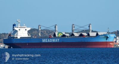
MAXIMOS
Cargo
Current Trip
| Time Travelled | 32 days |
|---|---|
| Remaining Time | --- |
| Distance Travelled | 7525.21 nm |
| Remaining Distance | --- |
| AVG Speed | 10.1 Noeuds |
| MAX Speed | 14.9 Noeuds |
| AVG Wind | 16.5 knots |
| MAX Wind | 36.3 knots |
| MIN Temp | -4.5°C / 23.9°F |
| MAX Temp | 28.6°C / 83.48°F |
| Tirant d eau | 10 m |
| Position reçue | 6 d depuis |
Current Position
| Longitude | --- |
|---|---|
| Latitude | --- |
| Etat | Under way using engine |
| Vitesse | 12.5 Noeuds |
| Parcours | 84.3° |
| Zone | North Pacific Ocean |
| Station | T-AIS |
| Position reçue | 6 d depuis |
Info
Information
The current position of MAXIMOS is in North Pacific Ocean with coordinates 41.67995° / 141.72315° as reported on 2025-02-12 00:29 by AIS to our vessel tracker app. The vessel's current speed is 12.5 Noeuds and is heading at the port of LAZARO CARDENAS. The estimated time of arrival as calculated by MyShipTracking vessel tracking app is 2025-03-05 06:00 LT
The vessel MAXIMOS (IMO: 9883027, MMSI: 636020010) is a Cargo It's sailing under the flag of [LR] Liberia.
In this page you can find informations about the vessels current position, last detected port calls, and current voyage information. If the vessels is not in coverage by AIS you will find the latest position.
The current position of MAXIMOS is detected by our AIS receivers and we are not responsible for the reliability of the data. The last position was recorded while the vessel was in Coverage by the Ais receivers of our vessel tracking app.
The current draught of MAXIMOS as reported by AIS is 10 meters
Weather
| Temperature | 2.2°C / 35.96°F |
|---|---|
| Wind Speed | 12 knots |
| Direction | 63° ENE |
| Pressure | 994.9 hPa |
| Humidity | 74.8 % |
| Cloud Coverage | 57 % |
Featured Company
Last Port Calls
| Port | Arrival | Departure | Time In Port |
|---|---|---|---|
| 2025-01-12 12:36 | 2025-01-16 12:16 | 3 d | |
| 2024-12-22 18:56 | 2024-12-28 13:28 | 5 d | |
| 2024-12-05 01:51 |
Last Trips
| Origin | Departure | Destination | Arrival | Distance | |
|---|---|---|---|---|---|
| 2024-12-28 16:28 | 2025-01-12 16:36 | 1960.94 nm | |||
| 2024-12-05 04:51 | 2024-12-22 21:56 | 2380.36 nm |
Events
| Heure | Evenement | Détails | Position/ Destination | Info |
|---|---|---|---|---|
| 2025-02-12 00:34 | Etat Changé | Default Under way using engine |
41.68148 / 141.74539
MXLZC
|
Vitesse: 12.5 kn Parcours: 84.3° |
| 2025-02-12 00:29 | Hors de la zone couverte |
41.67995 / 141.72315
North Pacific Ocean
MXLZC
|
Vitesse: 12.5 kn Parcours: 84.3° |
|
| 2025-02-12 00:24 | Etat Changé | Under way using engine Default |
41.67809 / 141.69915
MXLZC
|
Vitesse: 12.5 kn Parcours: 88° |
| 2025-02-11 23:41 | Etat Changé | Default Under way using engine |
41.66661 / 141.49477
MXLZC
|
Vitesse: 12.1 kn Parcours: 79.2° |
| 2025-02-11 22:52 | Changement de zone | Japanese part of the North Pacific Ocean Japanese part of the Japan Sea |
41.64993 / 141.27949
North Pacific Ocean
MXLZC
|
Vitesse: 11.7 kn Parcours: 88° |
| 2025-02-11 22:09 | Etat Changé | Under way using engine Default |
41.63858 / 141.10227
MXLZC
|
Vitesse: 13.4 kn Parcours: 89° |
| 2025-02-11 21:55 | Etat Changé | Default Under way using engine |
41.63633 / 141.03790
MXLZC
|
Vitesse: 13.6 kn Parcours: 88.8° |
| 2025-02-11 18:47 | Etat Changé | Under way using engine Default |
41.30078 / 140.25579
MXLZC
|
Vitesse: 12.7 kn Parcours: 55° |
| 2025-02-11 18:45 | Etat Changé | Default Under way using engine |
41.29559 / 140.24622
MXLZC
|
Vitesse: 12.7 kn Parcours: 55.7° |
| 2025-02-11 18:23 | Etat Changé | Under way using engine Default |
41.25281 / 140.16506
MXLZC
|
Vitesse: 11.9 kn Parcours: 54° |