

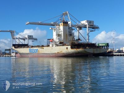
MAUNAWILI
Container Ship

Current Trip
| Time Travelled | 1 day |
|---|---|
| Remaining Time | 2 days |
| Distance Travelled | 799.43 nm |
| Remaining Distance | 1351.33 nm |
| AVG Speed | 19.4 Noeuds |
| MAX Speed | 22.6 Noeuds |
| AVG Wind | 9.7 knots |
| MAX Wind | 22 knots |
| MIN Temp | 12.7°C / 54.86°F |
| MAX Temp | 17.5°C / 63.5°F |
| Tirant d eau | 9.1 m |
| Position reçue | 1 d depuis |
Current Position
| Longitude | --- |
|---|---|
| Latitude | --- |
| Etat | Under way using engine |
| Vitesse | 21.2 Noeuds |
| Parcours | 231.4° |
| Zone | North Pacific Ocean |
| Station | T-AIS |
| Position reçue | 1 d depuis |
Information
The current position of MAUNAWILI is in North Pacific Ocean with coordinates 36.65698° / -124.71841° as reported on 2025-03-25 17:08 by AIS to our vessel tracker app. The vessel's current speed is 21.2 Noeuds and is heading at the port of HONOLULU . The estimated time of arrival as calculated by MyShipTracking vessel tracking app is 2025-03-29 04:21 LT
The vessel MAUNAWILI (IMO: 9268538, MMSI: 367438000) is a Container Ship that was built in 2004 ( 21 Age ). It's sailing under the flag of [US] USA.
In this page you can find informations about the vessels current position, last detected port calls, and current voyage information. If the vessels is not in coverage by AIS you will find the latest position.
The current position of MAUNAWILI is detected by our AIS receivers and we are not responsible for the reliability of the data. The last position was recorded while the vessel was in Coverage by the Ais receivers of our vessel tracking app.
The current draught of MAUNAWILI as reported by AIS is 9.1 meters
Weather
| Temperature | 17°C / 62.6°F |
|---|---|
| Wind Speed | 12 knots |
| Direction | 298° WNW |
| Pressure | 1020.5 hPa |
| Humidity | 65.9 % |
| Cloud Coverage | 100 % |


Featured Company
Last Port Calls
| Port | Arrival | Departure | Time In Port |
|---|---|---|---|
| 2025-03-23 22:49 | 2025-03-25 02:39 | 1 d | |
| 2025-03-21 06:06 | 2025-03-22 03:29 | 21 h | |
| 2025-03-15 05:58 | 2025-03-16 14:26 | 1 d | |
| 2025-03-10 03:01 | 2025-03-11 02:58 | 23 h | |
| 2025-03-07 07:24 | 2025-03-08 05:58 | 22 h | |
| 2025-03-01 05:48 | 2025-03-02 16:03 | 1 d | |
| 2025-02-24 01:21 | 2025-02-25 04:36 | 1 d | |
| 2025-02-21 06:23 | 2025-02-22 03:27 | 21 h | |
| 2025-02-15 05:08 | 2025-02-16 15:27 | 1 d | |
| 2025-02-10 01:49 | 2025-02-11 03:01 | 1 d |
Most Visited Ports (Last year)
| Port | Arrivals | |
|---|---|---|
| 11 | ||
| 7 | ||
| 7 | ||
| 7 | ||
| 7 | ||
| 1 |
Last Trips
| Origin | Departure | Destination | Arrival | Distance | |
|---|---|---|---|---|---|
| 2025-03-22 03:29 | 2025-03-23 22:49 | 872.65 nm | |||
| 2025-03-16 14:26 | 2025-03-21 06:06 | 2441.78 nm | |||
| 2025-03-11 02:58 | 2025-03-15 05:58 | 2137.49 nm | |||
| 2025-03-08 05:58 | 2025-03-10 03:01 | 870.97 nm | |||
| 2025-03-02 16:03 | 2025-03-07 07:24 | 2442.27 nm | |||
| 2025-02-25 04:36 | 2025-03-01 05:48 | 2140.82 nm | |||
| 2025-02-22 03:27 | 2025-02-24 01:21 | 873.36 nm | |||
| 2025-02-16 15:27 | 2025-02-21 06:23 | 2440.45 nm | |||
| 2025-02-11 03:01 | 2025-02-15 05:08 | 2121.76 nm | |||
| 2025-02-08 08:31 | 2025-02-10 01:49 | 868.51 nm |
Events
| Heure | Evenement | Détails | Position/ Destination | Info |
|---|---|---|---|---|
| 2025-03-25 17:15 | Etat Changé | Default Under way using engine |
36.63169 / -124.75818
US HNL
|
Vitesse: 21.2 kn Parcours: 231.4° |
| 2025-03-25 17:08 | Hors de la zone couverte |
36.65698 / -124.71841
North Pacific Ocean
US HNL
|
Vitesse: 21.2 kn Parcours: 231.4° |
|
| 2025-03-25 16:43 | Etat Changé | Under way using engine Default |
36.74825 / -124.57644
US HNL
|
Vitesse: 21.2 kn Parcours: 232° |
| 2025-03-25 16:22 | Etat Changé | Default Under way using engine |
36.82251 / -124.45820
US HNL
|
Vitesse: 21 kn Parcours: 231.8° |
| 2025-03-25 15:10 | Etat Changé | Under way using engine Default |
37.08411 / -124.04915
US HNL
|
Vitesse: 18.6 kn Parcours: 233° |
| 2025-03-25 14:52 | Etat Changé | Default Under way using engine |
37.14357 / -123.95268
US HNL
|
Vitesse: 18.3 kn Parcours: 232.9° |
| 2025-03-25 13:35 | Etat Changé | Under way using engine Default |
37.38023 / -123.56639
US HNL
|
Vitesse: 18.6 kn Parcours: 233° |
| 2025-03-25 13:31 | Etat Changé | Default Under way using engine |
37.39321 / -123.54469
US HNL
|
Vitesse: 18.6 kn Parcours: 234.4° |
| 2025-03-25 09:39 | PORT DE DEPART |
|
37.80186 / -122.34350
US HNL
|
Vitesse: 8.1 kn Parcours: 286° |
| 2025-03-25 09:15 | Démarrage |
37.79249 / -122.30155
[US] OAKLAND
|
Vitesse: 3.5 kn Parcours: 267° |