

JOZUA ___ ___
Cargo

Current Trip
| Time Travelled | 1 h, 28 mins |
|---|---|
| Remaining Time | 36 mins |
| Distance Travelled | 8.99 nm |
| Remaining Distance | 5.23 nm |
| AVG Speed | 6.1 Noeuds |
| MAX Speed | 7.1 Noeuds |
| AVG Wind | 3.9 knots |
| MAX Wind | 4 knots |
| MIN Temp | 7.9°C / 46.22°F |
| MAX Temp | 9.2°C / 48.56°F |
| Tirant d eau | 0 m |
| Position reçue | 1 m depuis |
Current Position
| Longitude | --- |
|---|---|
| Latitude | --- |
| Etat | Moored |
| Vitesse | 6.8 Noeuds |
| Parcours | 8.7° |
| Zone | North Sea |
| Station | T-AIS |
| Position reçue | 1 m depuis |
Information
The current position of JOZUA ___ ___ is in North Sea with coordinates 51.94739° / 4.63839° as reported on 2025-03-27 20:42 by AIS to our vessel tracker app. The vessel's current speed is 6.8 Noeuds and is heading at the port of GOUDA. The estimated time of arrival as calculated by MyShipTracking vessel tracking app is 2025-03-27 22:19 LT
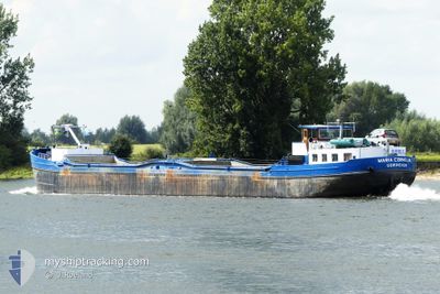
The vessel JOZUA ___ ___ (MMSI: 244730883) is a Cargo It's sailing under the flag of [NL] Netherlands.
In this page you can find informations about the vessels current position, last detected port calls, and current voyage information. If the vessels is not in coverage by AIS you will find the latest position.
The current position of JOZUA ___ ___ is detected by our AIS receivers and we are not responsible for the reliability of the data. The last position was recorded while the vessel was in Coverage by the Ais receivers of our vessel tracking app.
Weather
| Temperature | 8°C / 46.4°F |
|---|---|
| Wind Speed | 3 knots |
| Direction | 247° WSW |
| Pressure | 1017.8 hPa |
| Humidity | 70.3 % |
| Cloud Coverage | 5 % |


Featured Company
Last Port Calls
| Port | Arrival | Departure | Time In Port |
|---|---|---|---|
| 2025-03-27 19:09 | 2025-03-27 20:15 | 1 h | |
| 2025-03-27 16:37 | 2025-03-27 17:08 | 30 m | |
| 2025-03-27 07:44 | 2025-03-27 07:56 | 12 m | |
| 2025-03-26 21:29 | 2025-03-27 06:42 | 9 h | |
| 2025-03-26 18:49 | 2025-03-26 19:28 | 38 m | |
| 2025-03-26 13:41 | 2025-03-26 16:36 | 2 h | |
| 2025-03-25 20:37 | 2025-03-26 11:04 | 14 h | |
| 2025-03-25 15:21 | 2025-03-25 18:09 | 2 h | |
| 2025-03-25 13:16 | 2025-03-25 13:26 | 9 m | |
| 2025-03-24 10:28 | 2025-03-24 12:52 | 2 h |
Most Visited Ports (Last year)
| Port | Arrivals | |
|---|---|---|
| 54 | ||
| 40 | ||
| 30 | ||
| 16 | ||
| 9 | ||
| 9 |
Last Trips
| Origin | Departure | Destination | Arrival | Distance | |
|---|---|---|---|---|---|
| 2025-03-27 17:08 | 2025-03-27 19:09 | 16.06 nm | |||
| 2025-03-27 07:56 | 2025-03-27 16:37 | 26.24 nm | |||
| 2025-03-27 06:42 | 2025-03-27 07:44 | 4.42 nm | |||
| 2025-03-26 19:28 | 2025-03-26 21:29 | 7.29 nm | |||
| 2025-03-26 16:36 | 2025-03-26 18:49 | 13.33 nm | |||
| 2025-03-26 11:04 | 2025-03-26 13:41 | 16.15 nm | |||
| 2025-03-25 18:09 | 2025-03-25 20:37 | 13.55 nm | |||
| 2025-03-25 13:26 | 2025-03-25 15:21 | 16.17 nm | |||
| 2025-03-24 12:52 | 2025-03-25 13:16 | 56.89 nm | |||
| 2025-03-24 07:09 | 2025-03-24 10:28 | 24.83 nm |
Events
| Heure | Evenement | Détails | Position/ Destination | Info |
|---|---|---|---|---|
| 2025-03-27 19:15 | PORT DE DEPART |
|
51.89918 / 4.46649
ROTT
|
Vitesse: 5.8 kn Parcours: 76.4° |
| 2025-03-27 18:42 | Démarrage |
51.88836 / 4.40447
[NL] ROTTERDAM WAALHAVEN
|
Vitesse: 4.3 kn Parcours: 330.8° |
|
| 2025-03-27 18:09 | Arret |
51.88654 / 4.40641
[NL] ROTTERDAM WAALHAVEN
|
Vitesse: Parcours: 511° |
|
| 2025-03-27 18:09 | Port d'arrivée |
|
51.88654 / 4.40641
[NL] ROTTERDAM WAALHAVEN
|
Vitesse: 1.4 kn Parcours: 511° |
| 2025-03-27 16:08 | PORT DE DEPART |
|
51.98896 / 4.67783
ROTT
|
Vitesse: 8.5 kn Parcours: 211.6° |
| 2025-03-27 16:03 | Démarrage |
51.99740 / 4.69112
[NL] GOUDA
|
Vitesse: 8.8 kn Parcours: 227.2° |
|
| 2025-03-27 15:58 | Arret |
52.00178 / 4.69415
[NL] GOUDA
|
Vitesse: 0.1 kn Parcours: 511° |
|
| 2025-03-27 15:37 | Port d'arrivée |
|
52.02286 / 4.67093
[NL] GOUDA
|
Vitesse: 7.3 kn Parcours: 143.9° |
| 2025-03-27 12:43 | Démarrage | 0.35 nm, North East of JONKMAN |
52.22301 / 4.55362
ROTT
|
Vitesse: 4.7 kn Parcours: 149.5° |
| 2025-03-27 12:18 | Arret | 0.4 nm, North East of JONKMAN |
52.22544 / 4.55131
ROTT
|
Vitesse: 0.1 kn Parcours: 511° |