
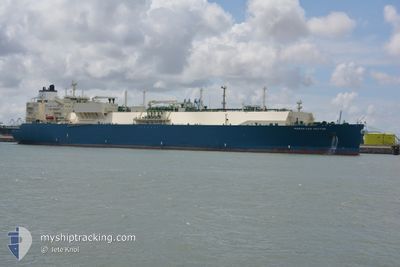
MARAN GAS HECTOR
Tanker
Current Trip
FOR ORDERS
| Time Travelled | 18 days |
|---|---|
| Remaining Time | --- |
| Distance Travelled | 7881.11 nm |
| Remaining Distance | --- |
| AVG Speed | 18.1 Noeuds |
| MAX Speed | 22.1 Noeuds |
| AVG Wind | 14.1 knots |
| MAX Wind | 25.8 knots |
| MIN Temp | 16.1°C / 60.98°F |
| MAX Temp | 30.6°C / 87.08°F |
| Tirant d eau | 9.3 m |
| Position reçue | 6 d depuis |
Current Position
| Longitude | 17.70461° |
|---|---|
| Latitude | -34.51319° |
| Etat | Under way using engine |
| Vitesse | 16.6 Noeuds |
| Parcours | 299.8° |
| Zone | South Atlantic Ocean |
| Station | T-AIS |
| Position reçue | 6 d depuis |
Info
Information
The current position of MARAN GAS HECTOR is in South Atlantic Ocean with coordinates -34.51319° / 17.70461° as reported on 2024-05-06 21:14 by AIS to our vessel tracker app. The vessel's current speed is 16.6 Noeuds
The vessel MARAN GAS HECTOR (IMO: 9682605, MMSI: 241425000) is a Tanker It's sailing under the flag of [GR] Greece.
In this page you can find informations about the vessels current position, last detected port calls, and current voyage information. If the vessels is not in coverage by AIS you will find the latest position.
The current position of MARAN GAS HECTOR is detected by our AIS receivers and we are not responsible for the reliability of the data. The last position was recorded while the vessel was in Coverage by the Ais receivers of our vessel tracking app.
The current draught of MARAN GAS HECTOR as reported by AIS is 9.3 meters
Weather
| Temperature | 27.6°C / 81.68°F |
|---|---|
| Wind Speed | 12 knots |
| Direction | 100° E |
| Pressure | 1013 hPa |
| Humidity | 77 % |
| Cloud Coverage | 100 % |
Featured Company
Last Port Calls
| Port | Arrival | Departure | Time In Port |
|---|---|---|---|
| 2024-04-24 04:41 | 2024-04-25 12:44 | 1 d | |
| 2024-03-27 03:10 | 2024-03-29 18:27 | 2 d | |
| 2024-03-19 15:57 | 2024-03-20 17:44 | 1 d | |
| 2024-03-02 10:45 | 2024-03-06 00:37 | 3 d |
Last Trips
| Origin | Departure | Destination | Arrival | Distance | |
|---|---|---|---|---|---|
| 2024-03-29 19:27 | 2024-04-24 10:11 | 10724.98 nm | |||
| 2024-03-20 18:44 | 2024-03-27 04:10 | 598.97 nm | |||
| 2024-03-05 18:37 | 2024-03-19 16:57 | 5065.97 nm | |||
| 2024-02-15 11:20 | 2024-03-02 04:45 | 5125.87 nm |
Events
| Heure | Evenement | Détails | Position/ Destination | Info |
|---|---|---|---|---|
| 2024-05-06 21:18 | Etat Changé | Default Under way using engine |
-34.50583 / 17.69008
FOR ORDERS
|
Vitesse: 16.6 kn Parcours: 299.8° |
| 2024-05-06 21:14 | Hors de la zone couverte |
-34.51319 / 17.70461
South Atlantic Ocean
FOR ORDERS
|
Vitesse: 16.6 kn Parcours: 299.8° |
|
| 2024-05-06 21:13 | Etat Changé | Under way using engine Default |
-34.51555 / 17.70938
FOR ORDERS
|
Vitesse: 16.6 kn Parcours: 299° |
| 2024-05-06 21:11 | Etat Changé | Default Under way using engine |
-34.52222 / 17.72314
FOR ORDERS
|
Vitesse: 15.5 kn Parcours: 305.5° |
| 2024-05-06 21:04 | Etat Changé | Under way using engine Default |
-34.53804 / 17.75594
FOR ORDERS
|
Vitesse: 16.5 kn Parcours: 297° |
| 2024-05-06 20:58 | Etat Changé | Default Under way using engine |
-34.55157 / 17.78243
FOR ORDERS
|
Vitesse: 16.1 kn Parcours: 304.2° |
| 2024-05-06 20:54 | Etat Changé | Under way using engine Default |
-34.56070 / 17.80047
FOR ORDERS
|
Vitesse: 16.2 kn Parcours: 295° |
| 2024-05-06 20:37 | Etat Changé | Default Under way using engine |
-34.59931 / 17.87674
FOR ORDERS
|
Vitesse: 16 kn Parcours: 305.1° |
| 2024-05-06 20:30 | Etat Changé | Under way using engine Default |
-34.61548 / 17.90807
FOR ORDERS
|
Vitesse: 16.3 kn Parcours: 304° |
| 2024-05-06 20:26 | Etat Changé | Default Under way using engine |
-34.62524 / 17.92742
FOR ORDERS
|
Vitesse: 16.2 kn Parcours: 292.6° |