
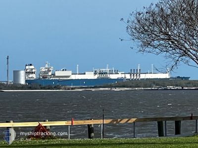
MARAN GAS AMPHIPOLIS
Tanker
Current Trip
| Time Travelled | 21 days |
|---|---|
| Remaining Time | --- |
| Distance Travelled | 8175.08 nm |
| Remaining Distance | --- |
| AVG Speed | 16.2 Noeuds |
| MAX Speed | 21 Noeuds |
| AVG Wind | 15.8 knots |
| MAX Wind | 32.8 knots |
| MIN Temp | 6.1°C / 42.98°F |
| MAX Temp | 29.4°C / 84.92°F |
| Tirant d eau | 9.2 m |
| Position reçue | 1 m depuis |
Current Position
| Longitude | -64.21862° |
|---|---|
| Latitude | 31.94451° |
| Etat | Under way using engine |
| Vitesse | 18.3 Noeuds |
| Parcours | 233.3° |
| Zone | North Atlantic Ocean |
| Station | T-AIS |
| Position reçue | 1 m depuis |
Info
Information
The current position of MARAN GAS AMPHIPOLIS is in North Atlantic Ocean with coordinates 31.94451° / -64.21862° as reported on 2024-05-02 09:47 by AIS to our vessel tracker app. The vessel's current speed is 18.3 Noeuds and is heading at the port of SABINE PASS. The estimated time of arrival as calculated by MyShipTracking vessel tracking app is 2024-05-07 00:01 LT
The vessel MARAN GAS AMPHIPOLIS (IMO: 9701217, MMSI: 241414000) is a Tanker It's sailing under the flag of [GR] Greece.
In this page you can find informations about the vessels current position, last detected port calls, and current voyage information. If the vessels is not in coverage by AIS you will find the latest position.
The current position of MARAN GAS AMPHIPOLIS is detected by our AIS receivers and we are not responsible for the reliability of the data. The last position was recorded while the vessel was in Coverage by the Ais receivers of our vessel tracking app.
The current draught of MARAN GAS AMPHIPOLIS as reported by AIS is 9.2 meters
Weather
| Temperature | 20.2°C / 68.36°F |
|---|---|
| Wind Speed | 6 knots |
| Direction | 269° W |
| Pressure | 1017.4 hPa |
| Humidity | 80.8 % |
| Cloud Coverage | 100 % |
Featured Company
Last Port Calls
| Port | Arrival | Departure | Time In Port |
|---|---|---|---|
| 2024-04-09 16:51 | 2024-04-10 21:28 | 1 d | |
| 2024-03-27 21:49 | 2024-03-29 06:56 | 1 d | |
| 2024-03-11 23:52 | 2024-03-13 19:18 | 1 d |
Most Visited Ports (Last year)
| Port | Arrivals | |
|---|---|---|
| 4 | ||
| 2 | ||
| 2 | ||
| 2 | ||
| 1 | ||
| 1 |
Last Trips
| Origin | Departure | Destination | Arrival | Distance | |
|---|---|---|---|---|---|
| 2024-03-29 07:56 | 2024-04-09 12:51 | 4175.59 nm | |||
| 2024-03-13 14:18 | 2024-03-27 22:49 | 5713.99 nm | |||
| 2024-02-26 17:59 | 2024-03-11 18:52 | 5195.08 nm |
Events
| Heure | Evenement | Détails | Position/ Destination | Info |
|---|---|---|---|---|
| 2024-05-02 08:44 | Etat Changé | Under way using engine Default |
32.13340 / -63.91119
USSAB
|
Vitesse: 18.7 kn Parcours: 236° |
| 2024-05-02 08:34 | Etat Changé | Default Under way using engine |
32.16312 / -63.86020
USSAB
|
Vitesse: 18.6 kn Parcours: 236.5° |
| 2024-05-02 07:44 | Etat Changé | Under way using engine Default |
32.27496 / -63.60195
USSAB
|
Vitesse: 18.5 kn Parcours: 172° |
| 2024-05-02 07:41 | Etat Changé | Default Under way using engine |
32.28857 / -63.60407
USSAB
|
Vitesse: 18.1 kn Parcours: 189.4° |
| 2024-05-02 07:21 | Etat Changé | Under way using engine Default |
32.36270 / -63.54748
USSAB
|
Vitesse: 18.1 kn Parcours: 298° |
| 2024-05-02 07:09 | Etat Changé | Default Under way using engine |
32.33167 / -63.49039
USSAB
|
Vitesse: 18.1 kn Parcours: 16.4° |
| 2024-05-02 07:05 | Etat Changé | Under way using engine Default |
32.31417 / -63.49065
USSAB
|
Vitesse: 17.9 kn Parcours: 48° |
| 2024-05-02 06:12 | Etat Changé | Default Under way using engine |
32.16611 / -63.76179
USSAB
|
Vitesse: 18.9 kn Parcours: 55.7° |
| 2024-05-02 06:08 | Etat Changé | Under way using engine Default |
32.15596 / -63.77905
USSAB
|
Vitesse: 18.9 kn Parcours: 57° |
| 2024-05-02 06:08 | Dans la zone couverte |
32.15596 / -63.77905
North Atlantic Ocean
USSAB
|
Vitesse: 18.9 kn Parcours: 55.7° |