
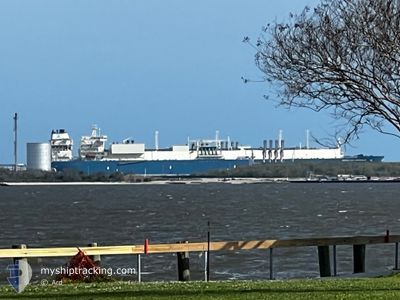
MARAN GAS AMPHIPOLIS
Tanker
Current Trip
| Time Travelled | 13 days |
|---|---|
| Remaining Time | --- |
| Distance Travelled | 5072.72 nm |
| Remaining Distance | --- |
| AVG Speed | 16.2 Knop |
| MAX Speed | 21 Knop |
| AVG Wind | 15.7 knots |
| MAX Wind | 25 knots |
| MIN Temp | 6.1°C / 42.98°F |
| MAX Temp | 29.4°C / 84.92°F |
| Djupgående | 9.2 m |
| Position mottagen | 5 h, 39 m sen |
Current Position
| Longitud | -5.92512° |
|---|---|
| Latitude | 48.74739° |
| Status | Under way using engine |
| Fart | 14.9 Knop |
| Kurs | 208.5° |
| Område | Celtic Sea |
| Station | T-AIS |
| Position mottagen | 5 h, 39 m sen |
Info
Information
The current position of MARAN GAS AMPHIPOLIS is in Celtic Sea with coordinates 48.74739° / -5.92512° as reported on 2024-04-24 03:42 by AIS to our vessel tracker app. The vessel's current speed is 14.9 Knop and is heading at the port of SABINE PASS. The estimated time of arrival as calculated by MyShipTracking vessel tracking app is 2024-05-07 00:01 LT
The vessel MARAN GAS AMPHIPOLIS (IMO: 9701217, MMSI: 241414000) is a Tanker It's sailing under the flag of [GR] Greece.
In this page you can find informations about the vessels current position, last detected port calls, and current voyage information. If the vessels is not in coverage by AIS you will find the latest position.
The current position of MARAN GAS AMPHIPOLIS is detected by our AIS receivers and we are not responsible for the reliability of the data. The last position was recorded while the vessel was in Coverage by the Ais receivers of our vessel tracking app.
The current draught of MARAN GAS AMPHIPOLIS as reported by AIS is 9.2 meters
Weather
| Temperature | 11°C / 51.8°F |
|---|---|
| Wind Speed | 12 knots |
| Direction | 302° WNW |
| Pressure | 1021.7 hPa |
| Humidity | 81.7 % |
| Cloud Coverage | 78 % |
Featured Company
Last Port Calls
| Port | Arrival | Departure | Time In Port |
|---|---|---|---|
| 2024-04-09 16:51 | 2024-04-10 21:28 | 1 d | |
| 2024-03-27 21:49 | 2024-03-29 06:56 | 1 d | |
| 2024-03-11 23:52 | 2024-03-13 19:18 | 1 d | |
| 2024-02-25 08:02 | 2024-02-26 16:59 | 1 d | |
| 2024-02-12 10:04 | 2024-02-13 15:37 | 1 d | |
| 2024-02-02 17:10 | 2024-02-03 18:54 | 1 d |
Most Visited Ports (Last year)
| Port | Arrivals | |
|---|---|---|
| 4 | ||
| 3 | ||
| 2 | ||
| 2 | ||
| 1 | ||
| 1 |
Last Trips
| Origin | Departure | Destination | Arrival | Distance | |
|---|---|---|---|---|---|
| 2024-03-29 07:56 | 2024-04-09 12:51 | 4175.59 nm | |||
| 2024-03-13 14:18 | 2024-03-27 22:49 | 5713.99 nm | |||
| 2024-02-26 17:59 | 2024-03-11 18:52 | 5195.08 nm | |||
| 2024-02-13 11:37 | 2024-02-25 09:02 | 4558.26 nm | |||
| 2024-02-03 14:54 | 2024-02-12 06:04 | 3027.85 nm | |||
| 2024-01-24 16:35 | 2024-02-02 13:10 | 3106.71 nm |
Events
| Tid | Event | Detaljer | Position / Dest | Information |
|---|---|---|---|---|
| 2024-04-24 03:47 | Status ändrad | Default Under way using engine |
48.73015 / -5.93928
USSAB
|
Fart: 14.9 kn Kurs: 208.5° |
| 2024-04-24 03:42 | Upptäckt i hav | French part of the Celtic Sea |
48.74739 / -5.92512
Celtic Sea
USSAB
|
Fart: 14.9 kn Kurs: 208.5° |
| 2024-04-24 03:42 | Status ändrad | Under way using engine Default |
48.74739 / -5.92512
USSAB
|
Fart: 14.8 kn Kurs: 210° |
| 2024-04-24 03:42 | I täckningsområde |
48.74739 / -5.92512
Celtic Sea
USSAB
|
Fart: 14.9 kn Kurs: 208.5° |
|
| 2024-04-24 03:42 | UTANFÖR täckningsområde |
48.74739 / -5.92512
Celtic Sea
USSAB
|
Fart: 14.9 kn Kurs: 208.5° |
|
| 2024-04-24 00:22 | Status ändrad | Default Under way using engine |
49.26140 / -4.90264
USSAB
|
Fart: 17.2 kn Kurs: 239.1° |
| 2024-04-24 00:15 | UTANFÖR täckningsområde |
49.28017 / -4.85405
English Channel
USSAB
|
Fart: 17.2 kn Kurs: 239.1° |
|
| 2024-04-23 23:56 | Status ändrad | Under way using engine Default |
49.32783 / -4.73994
USSAB
|
Fart: 17.3 kn Kurs: 234° |
| 2024-04-23 23:54 | Status ändrad | Default Under way using engine |
49.33261 / -4.72974
USSAB
|
Fart: 17.3 kn Kurs: 234.3° |
| 2024-04-23 23:54 | Byter havsområde | French part of the English Channel United Kingdom part of the English Channel |
49.33406 / -4.72665
English Channel
USSAB
|
Fart: 17.3 kn Kurs: 234.3° |