
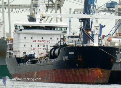
MANAS
Oil/Chemical Tanker
Current Trip
| Time Travelled | 6 days |
|---|---|
| Remaining Time | 7 days |
| Distance Travelled | 1850.00 nm |
| Remaining Distance | 1628.58 nm |
| AVG Speed | 10.2 Noeuds |
| MAX Speed | 13.8 Noeuds |
| AVG Wind | 15.7 knots |
| MAX Wind | 25 knots |
| MIN Temp | 13.4°C / 56.12°F |
| MAX Temp | 19.3°C / 66.74°F |
| Tirant d eau | 8 m |
| Position reçue | 21 m depuis |
Current Position
| Longitude | --- |
|---|---|
| Latitude | --- |
| Etat | Under way using engine |
| Vitesse | 9.7 Noeuds |
| Parcours | 267.9° |
| Zone | North Atlantic Ocean |
| Station | T-AIS |
| Position reçue | 21 m depuis |
Info
Information
The current position of MANAS is in North Atlantic Ocean with coordinates 35.97067° / -6.06400° as reported on 2025-03-16 18:51 by AIS to our vessel tracker app. The vessel's current speed is 9.7 Noeuds and is heading at the port of HAMBURG. The estimated time of arrival as calculated by MyShipTracking vessel tracking app is 2025-03-23 22:50 LT
The vessel MANAS (IMO: 9447055, MMSI: 249498000) is a Oil/Chemical Tanker that was built in 2008 ( 17 Age ). It's sailing under the flag of [MT] Malta.
In this page you can find informations about the vessels current position, last detected port calls, and current voyage information. If the vessels is not in coverage by AIS you will find the latest position.
The current position of MANAS is detected by our AIS receivers and we are not responsible for the reliability of the data. The last position was recorded while the vessel was in Coverage by the Ais receivers of our vessel tracking app.
The current draught of MANAS as reported by AIS is 8 meters
Weather
| Temperature | 16.2°C / 61.16°F |
|---|---|
| Wind Speed | 15 knots |
| Direction | 213° SSW |
| Pressure | 1018.1 hPa |
| Humidity | 75.3 % |
| Cloud Coverage | 100 % |
Featured Company
Last Port Calls
| Port | Arrival | Departure | Time In Port |
|---|---|---|---|
| 2025-03-03 16:06 | 2025-03-10 08:06 | 6 d | |
| 2025-02-18 03:55 | |||
| 2025-02-07 17:32 | 2025-02-09 08:36 | 1 d | |
| 2025-02-01 13:13 | 2025-02-04 12:53 | 2 d | |
| 2025-01-26 14:23 | 2025-01-29 23:18 | 3 d | |
| 2025-01-16 08:53 | 2025-01-17 20:20 | 1 d | |
| 2025-01-09 10:53 | 2025-01-11 07:37 | 1 d | |
| 2025-01-07 07:38 | 2025-01-08 16:49 | 1 d | |
| 2025-01-04 00:08 |
Most Visited Ports (Last year)
| Port | Arrivals | |
|---|---|---|
| 7 | ||
| 5 | ||
| 4 | ||
| 2 | ||
| 2 | ||
| 2 |
Last Trips
| Origin | Departure | Destination | Arrival | Distance | |
|---|---|---|---|---|---|
| 2025-02-18 03:55 | 2025-03-03 16:06 | 2145.28 nm | |||
| 2025-02-04 12:53 | 2025-02-07 17:32 | 860.21 nm | |||
| 2025-01-29 23:18 | 2025-02-01 13:13 | 548.16 nm | |||
| 2025-01-17 20:20 | 2025-01-26 14:23 | 2569.03 nm | |||
| 2025-01-11 07:37 | 2025-01-16 08:53 | 1347.40 nm | |||
| 2025-01-08 16:49 | 2025-01-09 10:53 | 15.63 nm | |||
| 2025-01-04 00:08 | 2025-01-07 07:38 | 24.55 nm |
Events
| Heure | Evenement | Détails | Position/ Destination | Info |
|---|---|---|---|---|
| 2025-03-16 18:53 | Etat Changé | Default Under way using engine |
35.97050 / -6.07050
EGALY>DEHAM
|
Vitesse: 9.7 kn Parcours: 267.9° |
| 2025-03-16 18:49 | Etat Changé | Under way using engine Default |
35.97083 / -6.05900
EGALY>DEHAM
|
Vitesse: 9.7 kn Parcours: 270° |
| 2025-03-16 18:36 | Etat Changé | Default Under way using engine |
35.97033 / -6.01317
EGALY>DEHAM
|
Vitesse: 9.9 kn Parcours: 272.2° |
| 2025-03-16 18:29 | Changement de zone | Spanish part of the North Atlantic Ocean Spanish part of the Strait of Gibraltar |
35.96966 / -5.99022
North Atlantic Ocean
EGALY>DEHAM
|
Vitesse: 9.9 kn Parcours: 272.2° |
| 2025-03-16 18:29 | Etat Changé | Under way using engine Default |
35.96966 / -5.99022
EGALY>DEHAM
|
Vitesse: 9.5 kn Parcours: 272° |
| 2025-03-16 18:28 | Etat Changé | Default Under way using engine |
35.96953 / -5.98623
EGALY>DEHAM
|
Vitesse: 10.2 kn Parcours: 272.7° |
| 2025-03-16 18:20 | Etat Changé | Under way using engine Default |
35.96883 / -5.95767
EGALY>DEHAM
|
Vitesse: 10.2 kn Parcours: 273° |
| 2025-03-16 18:16 | Etat Changé | Default Under way using engine |
35.96817 / -5.94383
EGALY>DEHAM
|
Vitesse: 9.8 kn Parcours: 273.8° |
| 2025-03-16 18:15 | Etat Changé | Under way using engine Default |
35.96812 / -5.94327
EGALY>DEHAM
|
Vitesse: 10.1 kn Parcours: 274° |
| 2025-03-16 18:00 | Etat Changé | Default Under way using engine |
35.96567 / -5.88900
EGALY>DEHAM
|
Vitesse: 9.4 kn Parcours: 272.7° |