
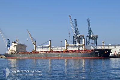
MAKRA
Bulk Carrier
Current Trip
BOHE
| Time Travelled | 1 day |
|---|---|
| Remaining Time | --- |
| Distance Travelled | 15.17 nm |
| Remaining Distance | --- |
| AVG Speed | 6 Noeuds |
| MAX Speed | 6 Noeuds |
| AVG Wind | 4.3 knots |
| MAX Wind | 7.8 knots |
| MIN Temp | 27.4°C / 81.32°F |
| MAX Temp | 29.5°C / 85.1°F |
| Tirant d eau | 12.1 m |
| Position reçue | 1 d depuis |
Current Position
| Longitude | 123.63608° |
|---|---|
| Latitude | 10.38814° |
| Etat | Moored |
| Vitesse | |
| Parcours | 196° |
| Zone | Philippine Sea |
| Station | T-AIS |
| Position reçue | 1 d depuis |
Info
Information
The current position of MAKRA is in Philippine Sea with coordinates 10.38814° / 123.63608° as reported on 2024-07-05 22:47 by AIS to our vessel tracker app. The vessel's current speed is 0 Noeuds
The vessel MAKRA (IMO: 9541813, MMSI: 311001036) is a Bulk Carrier that was built in 2012 ( 12 Age ). It's sailing under the flag of [BS] Bahamas.
In this page you can find informations about the vessels current position, last detected port calls, and current voyage information. If the vessels is not in coverage by AIS you will find the latest position.
The current position of MAKRA is detected by our AIS receivers and we are not responsible for the reliability of the data. The last position was recorded while the vessel was in Coverage by the Ais receivers of our vessel tracking app.
The current draught of MAKRA as reported by AIS is 12.1 meters
Weather
| Temperature | 28°C / 82.4°F |
|---|---|
| Wind Speed | 3 knots |
| Direction | 241° WSW |
| Pressure | 1009.6 hPa |
| Humidity | 76.3 % |
| Cloud Coverage | 100 % |
Featured Company
Most Visited Ports (Last year)
| Port | Arrivals | |
|---|---|---|
| 2 | ||
| 2 | ||
| 2 | ||
| 1 | ||
| 1 | ||
| 1 |
Events
| Heure | Evenement | Détails | Position/ Destination | Info |
|---|---|---|---|---|
| 2024-07-06 04:47 | PORT DE DEPART |
|
10.40512 / 123.50494
BOHE
|
Vitesse: Parcours: 196° |
| 2024-07-05 22:47 | Hors de la zone couverte |
10.38814 / 123.63608
Philippine Sea
[PH] TOLEDO
|
Vitesse: Parcours: 315° |
|
| 2024-07-05 22:47 | Detecté en mer | Philippines part of the Philippine Sea |
10.38814 / 123.63608
Philippine Sea
|
Vitesse: Parcours: 315° |
| 2024-07-05 22:47 | Dans la zone couverte |
10.38814 / 123.63608
Philippine Sea
[PH] TOLEDO
|
Vitesse: Parcours: 315° |
|
| 2024-07-01 06:51 | Port d'arrivée |
|
10.38761 / 123.63595
[PH] TOLEDO
|
Vitesse: 9.5 kn Parcours: 8° |
| 2024-06-28 01:24 | Démarrage |
-1.73819 / 116.66294
BOHE
|
Vitesse: 3.4 kn Parcours: 128° |
|
| 2024-06-27 19:44 | Arret |
-1.73112 / 116.66304
BOHE
|
Vitesse: 0.2 kn Parcours: 180° |
|
| 2024-06-27 18:52 | Démarrage |
-1.70530 / 116.63690
BOHE
|
Vitesse: 3.2 kn Parcours: 176° |