
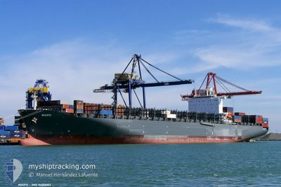
MAIPO
Container Ship
Current Trip
| Time Travelled | 7 days |
|---|---|
| Remaining Time | 2 days |
| Distance Travelled | 3281.24 nm |
| Remaining Distance | 976.92 nm |
| AVG Speed | 17.7 Noeuds |
| MAX Speed | 19.7 Noeuds |
| AVG Wind | 11.5 knots |
| MAX Wind | 19.9 knots |
| MIN Temp | 23.6°C / 74.48°F |
| MAX Temp | 30.3°C / 86.54°F |
| Tirant d eau | 13.9 m |
| Position reçue | 3 d depuis |
Current Position
| Longitude | -38.54917° |
|---|---|
| Latitude | -2.78069° |
| Etat | Under way using engine |
| Vitesse | 17.6 Noeuds |
| Parcours | 301.1° |
| Zone | South Atlantic Ocean |
| Station | T-AIS |
| Position reçue | 3 d depuis |
Info
Information
The current position of MAIPO is in South Atlantic Ocean with coordinates -2.78069° / -38.54917° as reported on 2024-05-11 20:18 by AIS to our vessel tracker app. The vessel's current speed is 17.6 Noeuds and is heading at the port of CARTAGENA. The estimated time of arrival as calculated by MyShipTracking vessel tracking app is 2024-05-17 08:16 LT
The vessel MAIPO (IMO: 9400083, MMSI: 636092848) is a Container Ship that was built in 2010 ( 14 Age ). It's sailing under the flag of [LR] Liberia.
In this page you can find informations about the vessels current position, last detected port calls, and current voyage information. If the vessels is not in coverage by AIS you will find the latest position.
The current position of MAIPO is detected by our AIS receivers and we are not responsible for the reliability of the data. The last position was recorded while the vessel was in Coverage by the Ais receivers of our vessel tracking app.
The current draught of MAIPO as reported by AIS is 13.9 meters
Weather
| Temperature | 28°C / 82.4°F |
|---|---|
| Wind Speed | 14 knots |
| Direction | 90° E |
| Pressure | 1011.7 hPa |
| Humidity | 74.4 % |
| Cloud Coverage | 87 % |
Featured Company
Last Port Calls
| Port | Arrival | Departure | Time In Port |
|---|---|---|---|
| 2024-05-06 05:31 | 2024-05-07 12:30 | 1 d | |
| 2024-05-03 11:07 | 2024-05-03 22:26 | 11 h | |
| 2024-04-26 17:17 | 2024-04-27 09:29 | 16 h | |
| 2024-04-24 23:51 | 2024-04-26 00:36 | 1 d | |
| 2024-04-17 06:45 | 2024-04-18 22:08 | 1 d | |
| 2024-04-05 06:08 | 2024-04-06 13:06 | 1 d | |
| 2024-03-28 08:08 | 2024-03-30 18:37 | 2 d | |
| 2024-03-19 05:56 | 2024-03-20 06:55 | 1 d | |
| 2024-03-08 21:40 | 2024-03-08 21:47 | 6 m | |
| 2024-03-08 00:47 |
Most Visited Ports (Last year)
| Port | Arrivals | |
|---|---|---|
| 11 | ||
| 11 | ||
| 5 | ||
| 5 | ||
| 5 | ||
| 5 |
Last Trips
| Origin | Departure | Destination | Arrival | Distance | |
|---|---|---|---|---|---|
| 2024-05-03 22:26 | 2024-05-06 05:31 | 252.64 nm | |||
| 2024-04-27 09:29 | 2024-05-03 11:07 | 762.34 nm | |||
| 2024-04-26 00:36 | 2024-04-26 17:17 | 149.09 nm | |||
| 2024-04-18 22:08 | 2024-04-24 23:51 | 2241.28 nm | |||
| 2024-04-06 13:06 | 2024-04-17 06:45 | 3083.12 nm | |||
| 2024-03-30 18:37 | 2024-04-05 06:08 | 1680.56 nm | |||
| 2024-03-20 06:55 | 2024-03-28 08:08 | 2207.65 nm | |||
| 2024-03-08 21:47 | 2024-03-19 05:56 | 4062.17 nm | |||
| 2024-03-08 00:47 | 2024-03-08 21:40 | 349.38 nm | |||
| 2024-02-26 02:16 | 2024-03-03 23:43 | 802.98 nm |
Events
| Heure | Evenement | Détails | Position/ Destination | Info |
|---|---|---|---|---|
| 2024-05-11 20:24 | Etat Changé | Default Under way using engine |
-2.76606 / -38.57324
COCTG
|
Vitesse: 17.6 kn Parcours: 301.1° |
| 2024-05-11 20:18 | Etat Changé | Under way using engine Default |
-2.78069 / -38.54917
COCTG
|
Vitesse: 17.7 kn Parcours: 301° |
| 2024-05-11 20:18 | Hors de la zone couverte |
-2.78069 / -38.54917
South Atlantic Ocean
COCTG
|
Vitesse: 17.6 kn Parcours: 301.1° |
|
| 2024-05-11 20:15 | Etat Changé | Default Under way using engine |
-2.78740 / -38.53813
COCTG
|
Vitesse: 17.8 kn Parcours: 300.5° |
| 2024-05-11 20:13 | Etat Changé | Under way using engine Default |
-2.79404 / -38.52724
COCTG
|
Vitesse: 17.7 kn Parcours: 301° |
| 2024-05-11 20:09 | Dans la zone couverte |
-2.79404 / -38.52724
South Atlantic Ocean
COCTG
|
Vitesse: 17.8 kn Parcours: 300.5° |
|
| 2024-05-08 06:28 | Etat Changé | Default Under way using engine |
-23.31388 / -42.34928
COCTG
|
Vitesse: 16.9 kn Parcours: 66.7° |
| 2024-05-08 06:22 | Hors de la zone couverte |
-23.32577 / -42.37896
South Atlantic Ocean
COCTG
|
Vitesse: 16.9 kn Parcours: 66.7° |
|
| 2024-05-08 05:13 | Etat Changé | Under way using engine Default |
-23.45277 / -42.70350
COCTG
|
Vitesse: 17.1 kn Parcours: 67° |
| 2024-05-08 05:13 | Dans la zone couverte |
-23.45133 / -42.69962
South Atlantic Ocean
COCTG
|
Vitesse: 16.9 kn Parcours: 67.2° |