
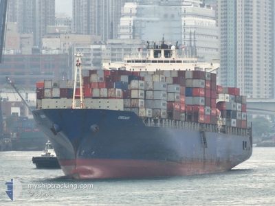
MV CHICAGO
Container Ship
Current Trip
| Time Travelled | 2 days |
|---|---|
| Remaining Time | 1 day |
| Distance Travelled | 965.23 nm |
| Remaining Distance | 782.53 nm |
| AVG Speed | 17 Noeuds |
| MAX Speed | 19.9 Noeuds |
| AVG Wind | 7.7 knots |
| MAX Wind | 15 knots |
| MIN Temp | 13.9°C / 57.02°F |
| MAX Temp | 18.9°C / 66.02°F |
| Tirant d eau | 8.2 m |
| Position reçue | 1 h, 33 m depuis |
Current Position
| Longitude | 10.68115° |
|---|---|
| Latitude | 37.60390° |
| Etat | Under way using engine |
| Vitesse | 19.5 Noeuds |
| Parcours | 300.8° |
| Zone | Mediterranean Sea - Western Basin |
| Station | T-AIS |
| Position reçue | 1 h, 33 m depuis |
Info
Information
The current position of MV CHICAGO is in Mediterranean Sea - Western Basin with coordinates 37.60390° / 10.68115° as reported on 2024-05-02 07:27 by AIS to our vessel tracker app. The vessel's current speed is 19.5 Noeuds and is heading at the port of GIBRALTAR. The estimated time of arrival as calculated by MyShipTracking vessel tracking app is 2024-05-04 00:44 LT
The vessel MV CHICAGO (IMO: 9248162, MMSI: 255805676) is a Container Ship that was built in 2003 ( 21 Age ). It's sailing under the flag of [PT] Portugal.
In this page you can find informations about the vessels current position, last detected port calls, and current voyage information. If the vessels is not in coverage by AIS you will find the latest position.
The current position of MV CHICAGO is detected by our AIS receivers and we are not responsible for the reliability of the data. The last position was recorded while the vessel was in Coverage by the Ais receivers of our vessel tracking app.
The current draught of MV CHICAGO as reported by AIS is 8.2 meters
Weather
| Temperature | 16.4°C / 61.52°F |
|---|---|
| Wind Speed | 14 knots |
| Direction | 283° WNW |
| Pressure | 1016.1 hPa |
| Humidity | 80.4 % |
| Cloud Coverage | 100 % |
Featured Company
Last Port Calls
| Port | Arrival | Departure | Time In Port |
|---|---|---|---|
| 2024-04-29 02:45 | 2024-04-30 00:40 | 21 h | |
| 2024-04-24 21:51 | 2024-04-25 19:29 | 21 h | |
| 2024-03-29 17:17 | 2024-03-30 10:43 | 17 h | |
| 2024-03-21 01:18 | 2024-03-21 17:54 | 16 h | |
| 2024-03-18 02:09 | 2024-03-19 02:34 | 1 d | |
| 2024-03-14 05:03 | 2024-03-15 03:34 | 22 h |
Last Trips
| Origin | Departure | Destination | Arrival | Distance | |
|---|---|---|---|---|---|
| 2024-04-25 21:29 | 2024-04-29 04:45 | 1404.02 nm | |||
| 2024-03-30 16:13 | 2024-04-24 23:51 | 10161.64 nm | |||
| 2024-03-22 01:54 | 2024-03-29 22:47 | 3061.41 nm | |||
| 2024-03-19 10:34 | 2024-03-21 09:18 | 805.65 nm | |||
| 2024-03-15 11:34 | 2024-03-18 10:09 | 422.65 nm | |||
| 2024-02-27 09:01 | 2024-03-14 13:03 | 4213.99 nm |
Events
| Heure | Evenement | Détails | Position/ Destination | Info |
|---|---|---|---|---|
| 2024-05-02 07:28 | Etat Changé | Default Under way using engine |
37.60707 / 10.67556
SIKOP>>GIGIB
|
Vitesse: 19.5 kn Parcours: 300.8° |
| 2024-05-02 07:27 | Hors de la zone couverte |
37.60390 / 10.68115
Mediterranean Sea - Western Basin
SIKOP>>GIGIB
|
Vitesse: 19.5 kn Parcours: 300.8° |
|
| 2024-05-02 05:11 | Changement de zone | Tunisian part of the Mediterranean Sea - Western Basin Tunisian part of the Mediterranean Sea - Eastern Basin |
37.32604 / 11.49657
Mediterranean Sea - Western Basin
SIKOP>>GIGIB
|
Vitesse: 18.7 kn Parcours: 298.7° |
| 2024-05-02 03:53 | Changement de zone | Tunisian part of the Mediterranean Sea - Eastern Basin Italian part of the Mediterranean Sea - Eastern Basin |
37.11582 / 11.90843
Mediterranean Sea - Eastern Basin
SIKOP>>GIGIB
|
Vitesse: 17.9 kn Parcours: 304.3° |
| 2024-05-02 03:51 | Etat Changé | Under way using engine Default |
37.10963 / 11.91970
SIKOP>>GIGIB
|
Vitesse: 17.9 kn Parcours: 303° |
| 2024-05-02 03:27 | Etat Changé | Default Under way using engine |
37.05420 / 12.05315
SIKOP>>GIGIB
|
Vitesse: 17.9 kn Parcours: 295° |
| 2024-05-02 02:55 | Etat Changé | Under way using engine Default |
37.00678 / 12.23477
SIKOP>>GIGIB
|
Vitesse: 18.2 kn Parcours: 292° |
| 2024-05-02 02:15 | Etat Changé | Default Under way using engine |
36.93716 / 12.47415
SIKOP>>GIGIB
|
Vitesse: 18.3 kn Parcours: 288.7° |
| 2024-05-02 02:02 | Etat Changé | Under way using engine Default |
36.91707 / 12.55196
SIKOP>>GIGIB
|
Vitesse: 18.5 kn Parcours: 286° |
| 2024-05-02 02:02 | Dans la zone couverte |
36.92073 / 12.53478
Mediterranean Sea - Eastern Basin
SIKOP>>GIGIB
|
Vitesse: 18.3 kn Parcours: 287.1° |