
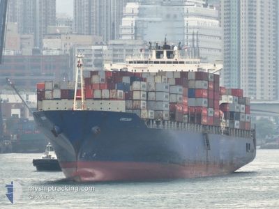
MV CHICAGO
Container Ship
Current Trip
| Time Travelled | 19 days |
|---|---|
| Remaining Time | --- |
| Distance Travelled | 8442.35 nm |
| Remaining Distance | --- |
| AVG Speed | 17.8 Knopen |
| MAX Speed | 23.3 Knopen |
| AVG Wind | 12.3 knots |
| MAX Wind | 28 knots |
| MIN Temp | 17.1°C / 62.78°F |
| MAX Temp | 29.9°C / 85.82°F |
| Diepgang | 10.8 M |
| Positie ontvangen | 16 m geleden |
Current Position
| Lengtegraad | -17.63430° |
|---|---|
| Breedtegraat | 21.34946° |
| Status | Under way using engine |
| Snelheid | 17.5 Knopen |
| Koers | 21° |
| Gebied | North Atlantic Ocean |
| Station | T-AIS |
| Positie ontvangen | 16 m geleden |
Info
Information
The current position of MV CHICAGO is in North Atlantic Ocean with coordinates 21.34946° / -17.63430° as reported on 2024-04-18 20:40 by AIS to our vessel tracker app. The vessel's current speed is 17.5 Knopen and is heading at the port of BARCELONA. The estimated time of arrival as calculated by MyShipTracking vessel tracking app is 2024-04-23 06:00 LT
The vessel MV CHICAGO (IMO: 9248162, MMSI: 255805676) is a Container Ship that was built in 2003 ( 21 Jaar oud ). It's sailing under the flag of [PT] Portugal.
In this page you can find informations about the vessels current position, last detected port calls, and current voyage information. If the vessels is not in coverage by AIS you will find the latest position.
The current position of MV CHICAGO is detected by our AIS receivers and we are not responsible for the reliability of the data. The last position was recorded while the vessel was in Coverage by the Ais receivers of our vessel tracking app.
The current draught of MV CHICAGO as reported by AIS is 10.8 meters
Weather
| Temperature | 20.4°C / 68.72°F |
|---|---|
| Wind Speed | 18 knots |
| Direction | 356° N |
| Pressure | 1014.2 hPa |
| Humidity | 83.1 % |
| Cloud Coverage | 64 % |
Featured Company
Last Port Calls
| Port | Arrival | Departure | Time In Port |
|---|---|---|---|
| 2024-03-29 17:17 | 2024-03-30 10:43 | 17 h | |
| 2024-03-21 01:18 | 2024-03-21 17:54 | 16 h | |
| 2024-03-18 02:09 | 2024-03-19 02:34 | 1 d | |
| 2024-03-14 05:03 | 2024-03-15 03:34 | 22 h | |
| 2024-02-26 15:39 | 2024-02-27 03:31 | 11 h | |
| 2024-02-04 10:21 | 2024-02-05 05:05 | 18 h | |
| 2024-02-01 05:28 |
Most Visited Ports (Last year)
| Port | Arrivals | |
|---|---|---|
| 6 | ||
| 4 | ||
| 4 | ||
| 4 | ||
| 4 | ||
| 4 |
Last Trips
| Origin | Departure | Destination | Arrival | Distance | |
|---|---|---|---|---|---|
| 2024-03-22 01:54 | 2024-03-29 22:47 | 3061.41 nm | |||
| 2024-03-19 10:34 | 2024-03-21 09:18 | 805.65 nm | |||
| 2024-03-15 11:34 | 2024-03-18 10:09 | 422.65 nm | |||
| 2024-02-27 09:01 | 2024-03-14 13:03 | 4213.99 nm | |||
| 2024-02-05 06:05 | 2024-02-26 21:09 | 10044.25 nm | |||
| 2024-02-01 06:28 | 2024-02-04 11:21 | 1414.43 nm |
Events
| Tijd | Evenement | Details | Positie / Bestemming | Info |
|---|---|---|---|---|
| 2024-04-18 20:44 | Status Changed | Default Under way using engine |
21.36797 / -17.62646
LKCMB>>>ESBCN
|
Snelheid: 17.5 kn Koers: 21° |
| 2024-04-18 19:59 | Draught Changed | 10.8 11 |
21.15582 / -17.71871
LKCMB>>>ESBCN
|
Snelheid: 17.9 kn Koers: 22° |
| 2024-04-18 19:59 | ETA Changed | 2024/04/23 06:00 2024/04/24 06:00 |
21.15582 / -17.71871
LKCMB>>>ESBCN
|
Snelheid: 17.9 kn Koers: 22° |
| 2024-04-18 19:56 | Wijzig zee gebeid | Western Saharan part of the North Atlantic Ocean Mauritanian part of the North Atlantic Ocean |
21.14425 / -17.72376
North Atlantic Ocean
LKCMB>>>ESBCN
|
Snelheid: 17.8 kn Koers: 20.7° |
| 2024-04-18 19:55 | Status Changed | Under way using engine Default |
21.13959 / -17.72562
LKCMB>>>ESBCN
|
Snelheid: 17.7 kn Koers: 2° |
| 2024-04-18 19:55 | Binnenbereik |
21.14425 / -17.72376
North Atlantic Ocean
LKCMB>>>ESBCN
|
Snelheid: 17.8 kn Koers: 20.7° |
|
| 2024-04-18 14:49 | Status Changed | Default Under way using engine |
19.63230 / -17.79351
LKCMB>>>ESBCN
|
Snelheid: 19.4 kn Koers: 359.8° |
| 2024-04-18 14:42 | Buitenbereik |
19.59105 / -17.79354
North Atlantic Ocean
LKCMB>>>ESBCN
|
Snelheid: 19.4 kn Koers: 359.8° |
|
| 2024-04-18 14:18 | Status Changed | Under way using engine Default |
19.47003 / -17.79274
LKCMB>>>ESBCN
|
Snelheid: 15.9 kn Koers: 1° |
| 2024-04-18 13:17 | Buitenbereik |
19.20850 / -17.79739
North Atlantic Ocean
LKCMB>>>ESBCN
|
Snelheid: 15.5 kn Koers: 1.4° |