
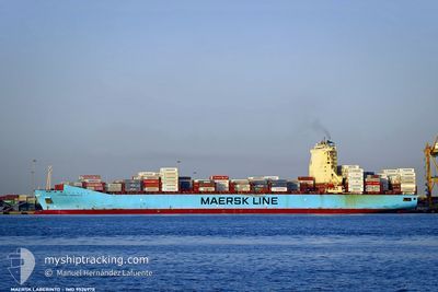
MAERSK LABERINTO
Container Ship
Current Trip
| Time Travelled | 1 day |
|---|---|
| Remaining Time | 18 days |
| Distance Travelled | 667.71 nm |
| Remaining Distance | 7522.62 nm |
| AVG Speed | 15.6 Noeuds |
| MAX Speed | 17.9 Noeuds |
| AVG Wind | 12.4 knots |
| MAX Wind | 19 knots |
| MIN Temp | 22.7°C / 72.86°F |
| MAX Temp | 28.9°C / 84.02°F |
| Tirant d eau | 13.9 m |
| Position reçue | 1 m depuis |
Current Position
| Longitude | 139.98505° |
|---|---|
| Latitude | 41.18777° |
| Etat | Under way using engine |
| Vitesse | 16.7 Noeuds |
| Parcours | 63.3° |
| Zone | Japan Sea |
| Station | T-AIS |
| Position reçue | 1 m depuis |
Info
Information
The current position of MAERSK LABERINTO is in Japan Sea with coordinates 41.18777° / 139.98505° as reported on 2024-09-17 16:48 by AIS to our vessel tracker app. The vessel's current speed is 16.7 Noeuds and is heading at the port of BALBOA. The estimated time of arrival as calculated by MyShipTracking vessel tracking app is 2024-10-06 02:32 LT
The vessel MAERSK LABERINTO (IMO: 9526978, MMSI: 219542000) is a Container Ship that was built in 2012 ( 12 Age ). It's sailing under the flag of [DK] Denmark.
In this page you can find informations about the vessels current position, last detected port calls, and current voyage information. If the vessels is not in coverage by AIS you will find the latest position.
The current position of MAERSK LABERINTO is detected by our AIS receivers and we are not responsible for the reliability of the data. The last position was recorded while the vessel was in Coverage by the Ais receivers of our vessel tracking app.
The current draught of MAERSK LABERINTO as reported by AIS is 13.9 meters
Weather
| Temperature | 22.7°C / 72.86°F |
|---|---|
| Wind Speed | 11 knots |
| Direction | 308° NW |
| Pressure | 1013.4 hPa |
| Humidity | 67.9 % |
| Cloud Coverage | 100 % |
Featured Company
Last Port Calls
| Port | Arrival | Departure | Time In Port |
|---|---|---|---|
| 2024-09-14 23:57 | 2024-09-15 23:49 | 23 h | |
| 2024-09-13 15:02 | 2024-09-14 01:21 | 10 h | |
| 2024-09-07 14:28 | 2024-09-08 16:29 | 1 d | |
| 2024-09-03 18:45 | 2024-09-04 21:33 | 1 d | |
| 2024-08-08 01:50 | 2024-08-10 09:00 | 2 d | |
| 2024-07-29 02:32 | 2024-07-30 10:55 | 1 d | |
| 2024-07-24 22:42 | 2024-07-26 12:14 | 1 d | |
| 2024-07-22 09:32 | 2024-07-24 03:28 | 1 d | |
| 2024-07-01 07:22 | 2024-07-02 14:54 | 1 d |
Most Visited Ports (Last year)
| Port | Arrivals | |
|---|---|---|
| 5 | ||
| 5 | ||
| 4 | ||
| 3 | ||
| 3 | ||
| 3 |
Last Trips
| Origin | Departure | Destination | Arrival | Distance | |
|---|---|---|---|---|---|
| 2024-09-14 10:21 | 2024-09-15 08:57 | 147.88 nm | |||
| 2024-09-09 00:29 | 2024-09-14 00:02 | 695.60 nm | |||
| 2024-09-05 05:33 | 2024-09-07 22:28 | 821.79 nm | |||
| 2024-08-10 05:00 | 2024-09-04 02:45 | 10648.35 nm | |||
| 2024-07-30 05:55 | 2024-08-07 21:50 | 1496.79 nm | |||
| 2024-07-26 07:14 | 2024-07-28 21:32 | 1144.90 nm | |||
| 2024-07-23 22:28 | 2024-07-24 17:42 | 361.18 nm | |||
| 2024-07-02 23:54 | 2024-07-22 04:32 | 8216.09 nm | |||
| 2024-06-29 11:25 | 2024-07-01 16:22 | 304.54 nm |
Events
| Heure | Evenement | Détails | Position/ Destination | Info |
|---|---|---|---|---|
| 2024-09-17 16:43 | Changement de zone | Japanese part of the Japan Sea South Korean part of the Japan Sea |
41.17650 / 139.95496
Japan Sea
KRPUS>PABLB
|
Vitesse: 16.9 kn Parcours: 63° |
| 2024-09-17 16:42 | Etat Changé | Under way using engine Default |
41.17611 / 139.95392
KRPUS>PABLB
|
Vitesse: 17 kn Parcours: 63° |
| 2024-09-17 16:41 | Dans la zone couverte |
41.17650 / 139.95496
Japan Sea
KRPUS>PABLB
|
Vitesse: 16.9 kn Parcours: 63° |
|
| 2024-09-16 03:47 | Etat Changé | Default Under way using engine |
35.21192 / 129.67097
KRPUS>PABLB
|
Vitesse: 16.6 kn Parcours: 41.1° |
| 2024-09-16 03:42 | Etat Changé | Under way using engine Default |
35.19199 / 129.64980
KRPUS>PABLB
|
Vitesse: 16.7 kn Parcours: 41° |
| 2024-09-16 03:42 | Hors de la zone couverte |
35.19199 / 129.64980
Japan Sea
KRPUS>PABLB
|
Vitesse: 16.6 kn Parcours: 41.1° |
|
| 2024-09-16 03:39 | Etat Changé | Default Under way using engine |
35.18428 / 129.64154
KRPUS>PABLB
|
Vitesse: 16.7 kn Parcours: 44° |
| 2024-09-16 00:18 | Tirant d'eau modifié | 13.9 13.1 |
34.97816 / 128.80181
KRPUS>PABLB
|
Vitesse: 11.9 kn Parcours: 162.5° |
| 2024-09-16 00:18 | Changement de destination | KRPUS>PABLB KRKAN>KRPUS |
34.97816 / 128.80181
KRPUS>PABLB
|
Vitesse: 11.9 kn Parcours: 162.5° |
| 2024-09-16 00:18 | Changement d'ETA | 2024/10/07 03:00 2024/09/14 23:00 |
34.97816 / 128.80181
KRPUS>PABLB
|
Vitesse: 11.9 kn Parcours: 162.5° |