
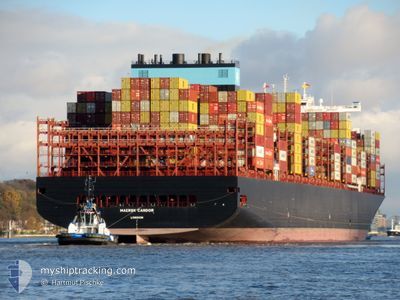
MAERSK CANDOR
Cargo A
Current Trip
| Time Travelled | 33 days |
|---|---|
| Remaining Time | --- |
| Distance Travelled | 12697.16 nm |
| Remaining Distance | --- |
| AVG Speed | 16.3 Noeuds |
| MAX Speed | 21 Noeuds |
| AVG Wind | 10.7 knots |
| MAX Wind | 22.7 knots |
| MIN Temp | 14.1°C / 57.38°F |
| MAX Temp | 28.5°C / 83.3°F |
| Tirant d eau | 14.4 m |
| Position reçue | 15 h, 8 m depuis |
Current Position
| Longitude | --- |
|---|---|
| Latitude | --- |
| Etat | Under way using engine |
| Vitesse | 15.9 Noeuds |
| Parcours | 314.5° |
| Zone | Mediterranean Sea - Eastern Basin |
| Station | T-AIS |
| Position reçue | 15 h, 8 m depuis |
Info
Information
The current position of MAERSK CANDOR is in Mediterranean Sea - Eastern Basin with coordinates 31.55515° / 32.21219° as reported on 2025-02-17 15:13 by AIS to our vessel tracker app. The vessel's current speed is 15.9 Noeuds
The vessel MAERSK CANDOR (IMO: 9924223, MMSI: 232043368) is a Cargo A It's sailing under the flag of [GB] United Kingdom.
In this page you can find informations about the vessels current position, last detected port calls, and current voyage information. If the vessels is not in coverage by AIS you will find the latest position.
The current position of MAERSK CANDOR is detected by our AIS receivers and we are not responsible for the reliability of the data. The last position was recorded while the vessel was in Coverage by the Ais receivers of our vessel tracking app.
The current draught of MAERSK CANDOR as reported by AIS is 14.4 meters
Weather
| Temperature | 17.2°C / 62.96°F |
|---|---|
| Wind Speed | 11 knots |
| Direction | 67° ENE |
| Pressure | 1016.5 hPa |
| Humidity | 65 % |
| Cloud Coverage | 43 % |
Featured Company
Last Port Calls
| Port | Arrival | Departure | Time In Port |
|---|---|---|---|
| 2025-02-15 22:25 | 2025-02-17 14:49 | 1 d | |
| 2025-01-15 04:18 | 2025-01-16 12:01 | 1 d | |
| 2025-01-07 07:11 | 2025-01-07 22:25 | 15 h | |
| 2024-12-28 18:49 | 2024-12-30 03:45 | 1 d | |
| 2024-12-22 15:04 | 2024-12-24 05:45 | 1 d | |
| 2024-12-12 20:23 | 2024-12-13 19:32 | 23 h |
Most Visited Ports (Last year)
| Port | Arrivals | |
|---|---|---|
| 4 | ||
| 3 | ||
| 3 | ||
| 3 | ||
| 2 | ||
| 2 |
Last Trips
| Origin | Departure | Destination | Arrival | Distance | |
|---|---|---|---|---|---|
| 2025-01-16 12:01 | 2025-02-15 22:25 | 12662.08 nm | |||
| 2025-01-07 22:25 | 2025-01-15 04:18 | 2383.87 nm | |||
| 2024-12-30 03:45 | 2025-01-07 07:11 | 708.10 nm | |||
| 2024-12-24 05:45 | 2024-12-28 18:49 | 807.44 nm | |||
| 2024-12-13 19:32 | 2024-12-22 15:04 | 2850.33 nm | |||
| 2024-11-01 16:34 | 2024-12-12 20:23 | 12660.65 nm |
Events
| Heure | Evenement | Détails | Position/ Destination | Info |
|---|---|---|---|---|
| 2025-02-17 15:19 | Etat Changé | Default Under way using engine |
31.57469 / 32.18899
EGPSD
|
Vitesse: 15.9 kn Parcours: 314.5° |
| 2025-02-17 15:13 | Hors de la zone couverte |
31.55515 / 32.21219
Mediterranean Sea - Eastern Basin
EGPSD
|
Vitesse: 15.9 kn Parcours: 314.5° |
|
| 2025-02-17 15:04 | Etat Changé | Under way using engine Default |
31.52839 / 32.24400
EGPSD
|
Vitesse: 14.8 kn Parcours: 299° |
| 2025-02-17 15:00 | Etat Changé | Default Under way using engine |
31.51672 / 32.26041
EGPSD
|
Vitesse: 15.1 kn Parcours: 311.3° |
| 2025-02-17 14:39 | Etat Changé | Under way using engine Default |
31.47769 / 32.34528
EGPSD
|
Vitesse: 13.8 kn Parcours: 299° |
| 2025-02-17 14:32 | Etat Changé | Default Under way using engine |
31.46567 / 32.37429
EGPSD
|
Vitesse: 12.4 kn Parcours: 301.8° |
| 2025-02-17 14:26 | Tirant d'eau modifié | 14.4 17 |
31.45094 / 32.40211
EGPSD
|
Vitesse: 10.8 kn Parcours: 302.3° |
| 2025-02-17 14:26 | Changement de destination | EGPSD ITTRS |
31.45094 / 32.40211
EGPSD
|
Vitesse: 10.8 kn Parcours: 302.3° |
| 2025-02-17 14:26 | Changement d'ETA | 2025/02/19 12:00 |
31.45094 / 32.40211
EGPSD
|
Vitesse: 10.8 kn Parcours: 302.3° |
| 2025-02-17 14:14 | Etat Changé | Under way using engine Default |
31.43214 / 32.41970
ITTRS
|
Vitesse: 9.4 kn Parcours: 0° |