
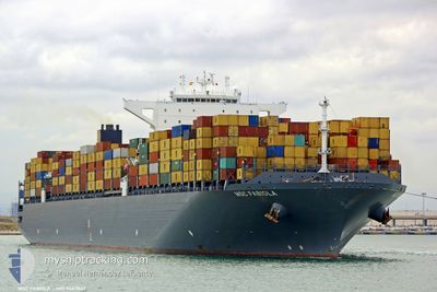
MADRID EXPRESS
Container Ship
Current Trip
| Time Travelled | 19 days |
|---|---|
| Remaining Time | --- |
| Distance Travelled | 8297.67 nm |
| Remaining Distance | 506.27 nm |
| AVG Speed | 18.1 Noeuds |
| MAX Speed | 20.3 Noeuds |
| AVG Wind | 10.6 knots |
| MAX Wind | 22.4 knots |
| MIN Temp | 18.2°C / 64.76°F |
| MAX Temp | 29.9°C / 85.82°F |
| Tirant d eau | 12 m |
| Position reçue | 1 d depuis |
Current Position
| Longitude | --- |
|---|---|
| Latitude | --- |
| Etat | Under way using engine |
| Vitesse | 18.3 Noeuds |
| Parcours | 229.1° |
| Zone | Japan Sea |
| Station | T-AIS |
| Position reçue | 1 d depuis |
Info
Information
The current position of MADRID EXPRESS is in Japan Sea with coordinates 41.05088° / 139.74050° as reported on 2024-09-26 21:20 by AIS to our vessel tracker app. The vessel's current speed is 18.3 Noeuds and is heading at the port of BUSAN. The estimated time of arrival as calculated by MyShipTracking vessel tracking app is 2024-09-28 01:00 LT
The vessel MADRID EXPRESS (IMO: 9447847, MMSI: 477624100) is a Container Ship that was built in 2010 ( 14 Age ). It's sailing under the flag of [HK] Hong Kong.
In this page you can find informations about the vessels current position, last detected port calls, and current voyage information. If the vessels is not in coverage by AIS you will find the latest position.
The current position of MADRID EXPRESS is detected by our AIS receivers and we are not responsible for the reliability of the data. The last position was recorded while the vessel was in Coverage by the Ais receivers of our vessel tracking app.
The current draught of MADRID EXPRESS as reported by AIS is 12 meters
Weather
| Temperature | 25°C / 77°F |
|---|---|
| Wind Speed | 25 knots |
| Direction | 52° NE |
| Pressure | 1017.4 hPa |
| Humidity | 72.3 % |
| Cloud Coverage | 11 % |
Featured Company
Last Port Calls
| Port | Arrival | Departure | Time In Port |
|---|---|---|---|
| 2024-09-08 08:26 | 2024-09-09 02:51 | 18 h | |
| 2024-08-31 00:39 | 2024-08-31 09:51 | 9 h | |
| 2024-08-25 13:59 | 2024-08-27 01:50 | 1 d | |
| 2024-08-22 20:32 | 2024-08-24 09:31 | 1 d | |
| 2024-08-19 13:23 | 2024-08-20 17:21 | 1 d | |
| 2024-08-14 08:08 | 2024-08-17 19:19 | 3 d | |
| 2024-08-02 04:43 | 2024-08-03 11:28 | 1 d | |
| 2024-07-09 09:58 | 2024-07-11 07:48 | 1 d | |
| 2024-07-07 05:14 | 2024-07-07 23:29 | 18 h | |
| 2024-07-01 09:16 | 2024-07-02 17:34 | 1 d |
Most Visited Ports (Last year)
| Port | Arrivals | |
|---|---|---|
| 4 | ||
| 4 | ||
| 4 | ||
| 3 | ||
| 3 | ||
| 3 |
Last Trips
| Origin | Departure | Destination | Arrival | Distance | |
|---|---|---|---|---|---|
| 2024-08-31 04:51 | 2024-09-08 03:26 | 88.85 nm | |||
| 2024-08-26 21:50 | 2024-08-30 19:39 | 1576.95 nm | |||
| 2024-08-24 05:31 | 2024-08-25 09:59 | 155.88 nm | |||
| 2024-08-20 13:21 | 2024-08-22 16:32 | 499.22 nm | |||
| 2024-08-17 15:19 | 2024-08-19 09:23 | 338.41 nm | |||
| 2024-08-03 06:28 | 2024-08-14 04:08 | 2049.40 nm | |||
| 2024-07-11 16:48 | 2024-08-01 23:43 | 8260.23 nm | |||
| 2024-07-08 07:29 | 2024-07-09 18:58 | 532.52 nm | |||
| 2024-07-03 01:34 | 2024-07-07 13:14 | 1016.93 nm | |||
| 2024-06-28 09:01 | 2024-07-01 17:16 | 554.91 nm |
Events
| Heure | Evenement | Détails | Position/ Destination | Info |
|---|---|---|---|---|
| 2024-09-26 21:25 | Etat Changé | Default Under way using engine |
41.03316 / 139.71460
KRPUS
|
Vitesse: 18.3 kn Parcours: 229.1° |
| 2024-09-26 21:20 | Hors de la zone couverte |
41.05088 / 139.74050
Japan Sea
KRPUS
|
Vitesse: 18.3 kn Parcours: 229.1° |
|
| 2024-09-26 16:37 | Changement de zone | Japanese part of the Japan Sea Japanese part of the North Pacific Ocean |
41.66498 / 141.25203
Japan Sea
KRPUS
|
Vitesse: 18.6 kn Parcours: 269.2° |
| 2024-09-26 15:13 | Tirant d'eau modifié | 12 11.9 |
41.66450 / 141.81288
KRPUS
|
Vitesse: 17.9 kn Parcours: 268.9° |
| 2024-09-26 15:13 | Changement de destination | KRPUS PAROD |
41.66450 / 141.81288
KRPUS
|
Vitesse: 17.9 kn Parcours: 268.9° |
| 2024-09-26 15:13 | Changement d'ETA | 2024/09/28 01:00 2024/09/08 07:00 |
41.66450 / 141.81288
KRPUS
|
Vitesse: 17.9 kn Parcours: 268.9° |
| 2024-09-26 14:25 | Etat Changé | Under way using engine Default |
41.67512 / 142.13577
PAROD
|
Vitesse: 18.8 kn Parcours: 268° |
| 2024-09-26 14:21 | Etat Changé | Default Under way using engine |
41.67602 / 142.16660
PAROD
|
Vitesse: 18.9 kn Parcours: 267.9° |
| 2024-09-26 14:14 | Changement de zone | Japanese part of the North Pacific Ocean Mexican part of the North Pacific Ocean |
41.67702 / 142.21248
North Pacific Ocean
|
Vitesse: 18.8 kn Parcours: 267.6° |
| 2024-09-26 14:14 | Etat Changé | Under way using engine Default |
41.67712 / 142.21598
PAROD
|
Vitesse: 18.9 kn Parcours: 269° |