
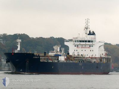
LOUIS P
Tanker
Current Trip
| Trip Time | 18 days |
|---|---|
| Trip Distance | 5211.70 nm |
| AVG Speed | 11.1 Noeuds |
| MAX Speed | 11.1 Noeuds |
| Tirant d eau | 9.7 m |
| AVG Wind | 13.7 knots |
| MAX Wind | 34.3 knots |
| MIN Temp | 0.5°C / 32.9°F |
| MAX Temp | 25.6°C / 78.08°F |
| Position reçue | 1 m depuis |
Current Position
| Longitude | --- |
|---|---|
| Latitude | --- |
| Etat | Moored |
| Vitesse | |
| Parcours | 72° |
| Zone | North Sea |
| Station | T-AIS |
| Position reçue | 1 m depuis |
Info
Information
The current position of LOUIS P is in North Sea with coordinates 51.87982° / 4.30095° as reported on 2025-01-05 06:38 by AIS to our vessel tracker app. The vessel's current speed is 0 Noeuds and is currently inside the port of BOTLEK - ROTTERDAM.
The vessel LOUIS P (IMO: 9749336, MMSI: 538006806) is a Tanker It's sailing under the flag of [MH] Marshall Is.
In this page you can find informations about the vessels current position, last detected port calls, and current voyage information. If the vessels is not in coverage by AIS you will find the latest position.
The current position of LOUIS P is detected by our AIS receivers and we are not responsible for the reliability of the data. The last position was recorded while the vessel was in Coverage by the Ais receivers of our vessel tracking app.
The current draught of LOUIS P as reported by AIS is 9.7 meters
Weather
| Temperature | 0.4°C / 32.72°F |
|---|---|
| Wind Speed | 11 knots |
| Direction | 103° ESE |
| Pressure | 1001 hPa |
| Humidity | 96.4 % |
| Cloud Coverage | 100 % |
Featured Company
Last Port Calls
| Port | Arrival | Departure | Time In Port |
|---|---|---|---|
| 2025-01-05 03:58 | |||
| 2024-12-14 05:13 | 2024-12-17 19:15 | 3 d | |
| 2024-12-05 13:47 | 2024-12-07 13:54 | 2 d | |
| 2024-11-27 08:57 | 2024-11-29 11:50 | 2 d | |
| 2024-11-19 00:00 | 2024-11-20 02:38 | 1 d | |
| 2024-11-11 19:06 | 2024-11-12 18:18 | 23 h | |
| 2024-11-08 13:48 | 2024-11-08 21:37 | 7 h | |
| 2024-11-07 03:46 | 2024-11-08 10:35 | 1 d |
Last Trips
| Origin | Departure | Destination | Arrival | Distance | |
|---|---|---|---|---|---|
| 2024-12-17 13:15 | 2025-01-05 04:58 | 5211.70 nm | |||
| 2024-12-07 08:54 | 2024-12-13 23:13 | 1331.77 nm | |||
| 2024-11-29 05:50 | 2024-12-05 08:47 | 1325.54 nm | |||
| 2024-11-19 20:38 | 2024-11-27 02:57 | 910.91 nm | |||
| 2024-11-12 13:18 | 2024-11-18 18:00 | 1509.18 nm | |||
| 2024-11-08 16:37 | 2024-11-11 14:06 | 727.30 nm | |||
| 2024-11-08 05:35 | 2024-11-08 08:48 | 30.64 nm | |||
| 2024-10-23 19:18 | 2024-11-06 22:46 | 3532.59 nm |
Events
| Heure | Evenement | Détails | Position/ Destination | Info |
|---|---|---|---|---|
| 2025-01-05 06:26 | Etat Changé | Moored Default |
51.87983 / 4.30096
[NL] BOTLEK - ROTTERDAM
|
Vitesse: Parcours: 72° |
| 2025-01-05 06:20 | Etat Changé | Default Moored |
51.87980 / 4.30096
[NL] BOTLEK - ROTTERDAM
|
Vitesse: Parcours: 72° |
| 2025-01-05 04:05 | Etat Changé | Moored Under way using engine |
51.87974 / 4.30171
[NL] BOTLEK - ROTTERDAM
|
Vitesse: 0.3 kn Parcours: 73° |
| 2025-01-05 04:02 | Arret |
51.87955 / 4.30217
[NL] BOTLEK - ROTTERDAM
|
Vitesse: 0.3 kn Parcours: 66° |
|
| 2025-01-05 03:58 | Port d'arrivée |
|
51.87946 / 4.30314
[NL] BOTLEK - ROTTERDAM
|
Vitesse: 0.6 kn Parcours: 68° |
| 2025-01-05 00:11 | Etat Changé | Under way using engine Default |
51.96168 / 3.61870
NL RTM
|
Vitesse: 8.6 kn Parcours: 53° |
| 2025-01-05 00:05 | Etat Changé | Default Under way using engine |
51.95320 / 3.60100
NL RTM
|
Vitesse: 9.2 kn Parcours: 62.1° |
| 2025-01-04 23:33 | Démarrage | 15.47 nm, North West of BROUWERSDAM |
51.91622 / 3.51288
NL RTM
|
Vitesse: 3.9 kn Parcours: 31° |
| 2025-01-04 23:15 | Etat Changé | Under way using engine At anchor |
51.91249 / 3.50981
NL RTM
|
Vitesse: 0.3 kn Parcours: 60° |
| 2025-01-04 23:10 | Etat Changé | At anchor Default |
51.91209 / 3.50937
NL RTM
|
Vitesse: Parcours: 65° |