
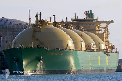
LNG SOKOTO
Lng Tanker
Current Trip
| Time Travelled | --- |
|---|---|
| Remaining Time | 1 day |
| Distance Travelled | 159.65 nm |
| Remaining Distance | 224.78 nm |
| AVG Speed | --- |
| MAX Speed | --- |
| AVG Wind | 9.7 knots |
| MAX Wind | 20 knots |
| MIN Temp | 18.2°C / 64.76°F |
| MAX Temp | 25.6°C / 78.08°F |
| Tirant d eau | 10 m |
| Position reçue | 1 m depuis |
Current Position
| Longitude | --- |
|---|---|
| Latitude | --- |
| Etat | Under way using engine |
| Vitesse | 8 Noeuds |
| Parcours | 146° |
| Zone | North Atlantic Ocean |
| Station | T-AIS |
| Position reçue | 1 m depuis |
Info
Information
The current position of LNG SOKOTO is in North Atlantic Ocean with coordinates 25.66350° / -18.54261° as reported on 2024-11-26 13:00 by AIS to our vessel tracker app. The vessel's current speed is 8 Noeuds and is heading at the port of TENERIFE. The estimated time of arrival as calculated by MyShipTracking vessel tracking app is 2024-11-27 14:47 LT
The vessel LNG SOKOTO (IMO: 9216303, MMSI: 310378000) is a Lng Tanker that was built in 2002 ( 22 Age ). It's sailing under the flag of [BM] Bermuda.
In this page you can find informations about the vessels current position, last detected port calls, and current voyage information. If the vessels is not in coverage by AIS you will find the latest position.
The current position of LNG SOKOTO is detected by our AIS receivers and we are not responsible for the reliability of the data. The last position was recorded while the vessel was in Coverage by the Ais receivers of our vessel tracking app.
The current draught of LNG SOKOTO as reported by AIS is 10 meters
Weather
| Temperature | 22.1°C / 71.78°F |
|---|---|
| Wind Speed | 10 knots |
| Direction | 70° ENE |
| Pressure | 1019.1 hPa |
| Humidity | 83.5 % |
| Cloud Coverage | 100 % |
Featured Company
Last Port Calls
Last Trips
| Origin | Departure | Destination | Arrival | Distance |
|---|
Events
| Heure | Evenement | Détails | Position/ Destination | Info |
|---|---|---|---|---|
| 2024-11-26 11:29 | Etat Changé | Under way using engine Default |
25.84456 / -18.67763
TENERIFE
|
Vitesse: 8.7 kn Parcours: 144° |
| 2024-11-26 11:16 | Dans la zone couverte |
25.84456 / -18.67763
North Atlantic Ocean
TENERIFE
|
Vitesse: 8.8 kn Parcours: 142° |
|
| 2024-11-26 01:00 | Etat Changé | Default Under way using engine |
26.47519 / -18.91108
TENERIFE
|
Vitesse: 7.6 kn Parcours: 350° |
| 2024-11-26 00:55 | Etat Changé | Under way using engine Default |
26.46425 / -18.90900
TENERIFE
|
Vitesse: 7.9 kn Parcours: 351° |
| 2024-11-26 00:55 | Hors de la zone couverte |
26.46425 / -18.90900
North Atlantic Ocean
TENERIFE
|
Vitesse: 7.6 kn Parcours: 350° |
|
| 2024-11-26 00:44 | Etat Changé | Default Under way using engine |
26.44060 / -18.90462
TENERIFE
|
Vitesse: 8.1 kn Parcours: 349.2° |
| 2024-11-26 00:28 | Etat Changé | Under way using engine Default |
26.40735 / -18.89879
TENERIFE
|
Vitesse: 8 kn Parcours: 349° |
| 2024-11-25 23:41 | Etat Changé | Default Under way using engine |
26.30460 / -18.88040
TENERIFE
|
Vitesse: 7.9 kn Parcours: 351.5° |
| 2024-11-25 23:32 | Etat Changé | Under way using engine Default |
26.28446 / -18.87689
TENERIFE
|
Vitesse: 8.1 kn Parcours: 353° |
| 2024-11-25 23:32 | Dans la zone couverte |
26.28446 / -18.87689
North Atlantic Ocean
TENERIFE
|
Vitesse: 7.9 kn Parcours: 351.5° |