

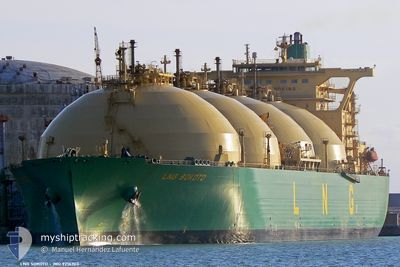
LNG SOKOTO
Lng Tanker

Current Trip
| Time Travelled | 7 days |
|---|---|
| Remaining Time | --- |
| Distance Travelled | 1788.62 nm |
| Remaining Distance | --- |
| AVG Speed | 9.6 Knots |
| MAX Speed | 14.1 Knots |
| AVG Wind | 15.7 knots |
| MAX Wind | 27 knots |
| MIN Temp | 12.8°C / 55.04°F |
| MAX Temp | 19.8°C / 67.64°F |
| Dybgang | 10 m |
| Position Modtaget | 8 h, 29 m siden |
Current Position
| Longitude | --- |
|---|---|
| Latitude | --- |
| Status | Under way using engine |
| Fart | 6.6 Knots |
| Kurs | 197.1° |
| Område | North Atlantic Ocean |
| Station | T-AIS |
| Position Modtaget | 8 h, 29 m siden |
Information
The current position of LNG SOKOTO is in North Atlantic Ocean with coordinates 31.94700° / -12.19399° as reported on 2025-03-28 21:01 by AIS to our vessel tracker app. The vessel's current speed is 6.6 Knots and is heading at the port of BONNY. The estimated time of arrival as calculated by MyShipTracking vessel tracking app is 2025-05-05 07:00 LT
The vessel LNG SOKOTO (IMO: 9216303, MMSI: 310378000) is a Lng Tanker that was built in 2002 ( 23 år gamle ). It's sailing under the flag of [BM] Bermuda.
In this page you can find informations about the vessels current position, last detected port calls, and current voyage information. If the vessels is not in coverage by AIS you will find the latest position.
The current position of LNG SOKOTO is detected by our AIS receivers and we are not responsible for the reliability of the data. The last position was recorded while the vessel was in Coverage by the Ais receivers of our vessel tracking app.
The current draught of LNG SOKOTO as reported by AIS is 10 meters
Weather
| Temperature | 19.2°C / 66.56°F |
|---|---|
| Wind Speed | 23 knots |
| Direction | 74° ENE |
| Pressure | 1011.1 hPa |
| Humidity | 74.2 % |
| Cloud Coverage | --- |


Featured Company
Events
| Tid | Hændelsen | Detaljer | Position / Dest | Info |
|---|---|---|---|---|
| 2025-03-28 21:08 | Status er ændret | Default Under way using engine |
31.93508 / -12.19748
NGBON
|
Fart: 6.6 kn Kurs: 197.1° |
| 2025-03-28 21:01 | Udenfor Dækning |
31.94700 / -12.19399
North Atlantic Ocean
|
Fart: 6.6 kn Kurs: 197.1° |
|
| 2025-03-28 20:51 | Status er ændret | Under way using engine Default |
31.96566 / -12.18829
NGBON
|
Fart: 6.5 kn Kurs: 189° |
| 2025-03-28 20:51 | Indenfor Dækning |
31.96377 / -12.18885
North Atlantic Ocean
|
Fart: 6.6 kn Kurs: 195.4° |
|
| 2025-03-28 18:59 | Status er ændret | Default Under way using engine |
32.15884 / -12.13480
NGBON
|
Fart: 6.5 kn Kurs: 194.9° |
| 2025-03-28 18:54 | Status er ændret | Under way using engine Default |
32.16737 / -12.13253
NGBON
|
Fart: 6.3 kn Kurs: 192° |
| 2025-03-28 18:54 | Indenfor Dækning |
32.16737 / -12.13253
North Atlantic Ocean
|
Fart: 6.5 kn Kurs: 194.9° |
|
| 2025-03-28 18:54 | Udenfor Dækning |
32.16737 / -12.13253
North Atlantic Ocean
|
Fart: 6.5 kn Kurs: 194.9° |
|
| 2025-03-28 17:50 | Status er ændret | Default Under way using engine |
32.27906 / -12.10162
NGBON
|
Fart: 6.5 kn Kurs: 190.4° |
| 2025-03-28 17:44 | Udenfor Dækning |
32.29039 / -12.09857
North Atlantic Ocean
|
Fart: 6.5 kn Kurs: 190.4° |