

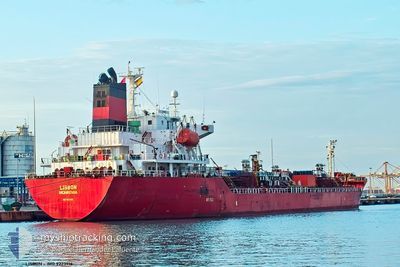
LISBON
Oil/Chemical Tanker

Current Trip
| Time Travelled | 10 days |
|---|---|
| Remaining Time | --- |
| Distance Travelled | 1589.40 nm |
| Remaining Distance | --- |
| AVG Speed | 11.6 Noeuds |
| MAX Speed | 15 Noeuds |
| AVG Wind | 8.3 knots |
| MAX Wind | 24 knots |
| MIN Temp | 17°C / 62.6°F |
| MAX Temp | 24.8°C / 76.64°F |
| Tirant d eau | 6.2 m |
| Position reçue | 10 h, 0 m depuis |
Current Position
| Longitude | --- |
|---|---|
| Latitude | --- |
| Etat | At anchor |
| Vitesse | 0.2 Noeuds |
| Parcours | 155° |
| Zone | Persian Gulf |
| Station | T-AIS |
| Position reçue | 10 h, 0 m depuis |
Information
The current position of LISBON is in Persian Gulf with coordinates 27.25640° / 49.92878° as reported on 2025-02-20 20:34 by AIS to our vessel tracker app. The vessel's current speed is 0.2 Noeuds
The vessel LISBON (IMO: 9223916, MMSI: 636021809) is a Oil/Chemical Tanker that was built in 2000 ( 25 Age ). It's sailing under the flag of [LR] Liberia.
In this page you can find informations about the vessels current position, last detected port calls, and current voyage information. If the vessels is not in coverage by AIS you will find the latest position.
The current position of LISBON is detected by our AIS receivers and we are not responsible for the reliability of the data. The last position was recorded while the vessel was in Coverage by the Ais receivers of our vessel tracking app.
The current draught of LISBON as reported by AIS is 6.2 meters
Weather
| Temperature | 18.8°C / 65.84°F |
|---|---|
| Wind Speed | 12 knots |
| Direction | 327° NNW |
| Pressure | 1017 hPa |
| Humidity | 79.8 % |
| Cloud Coverage | --- |


Featured Company
Last Port Calls
| Port | Arrival | Departure | Time In Port |
|---|---|---|---|
| 2025-02-08 17:05 | 2025-02-11 06:53 | 2 d | |
| 2025-02-05 20:16 | 2025-02-07 15:43 | 1 d | |
| 2025-01-30 20:13 | 2025-01-31 14:00 | 17 h | |
| 2025-01-17 04:08 | 2025-01-20 00:07 | 2 d | |
| 2025-01-14 13:21 | 2025-01-16 09:28 | 1 d | |
| 2025-01-09 06:03 | 2025-01-09 15:15 | 9 h | |
| 2025-01-06 01:58 | 2025-01-06 03:07 | 1 h | |
| 2025-01-02 22:00 | 2025-01-05 11:05 | 2 d | |
| 2025-01-02 16:24 | 2025-01-02 20:40 | 4 h | |
| 2024-12-29 08:09 | 2024-12-30 23:10 | 1 d |
Most Visited Ports (Last year)
| Port | Arrivals | |
|---|---|---|
| 4 | ||
| 4 | ||
| 4 | ||
| 2 | ||
| 2 | ||
| 2 |
Last Trips
| Origin | Departure | Destination | Arrival | Distance | |
|---|---|---|---|---|---|
| 2025-02-07 15:43 | 2025-02-08 17:05 | 87.63 nm | |||
| 2025-01-31 14:00 | 2025-02-05 20:16 | 230.97 nm | |||
| 2025-01-20 00:07 | 2025-01-30 20:13 | 2380.61 nm | |||
| 2025-01-16 09:28 | 2025-01-17 04:08 | 233.51 nm | |||
| 2025-01-06 03:07 | 2025-01-14 13:21 | 1708.97 nm | |||
| 2025-01-06 03:07 | 2025-01-09 06:03 | 854.23 nm | |||
| 2025-01-05 11:05 | 2025-01-06 01:58 | 176.50 nm | |||
| 2025-01-02 20:40 | 2025-01-02 22:00 | 6.93 nm | |||
| 2024-12-30 23:10 | 2025-01-02 16:24 | 339.12 nm | |||
| 2024-11-29 16:53 | 2024-12-29 08:09 | 8625.26 nm |
Events
| Heure | Evenement | Détails | Position/ Destination | Info |
|---|---|---|---|---|
| 2025-02-20 20:43 | Etat Changé | Default At anchor |
27.25613 / 49.92847
ALJUBAIL SA
|
Vitesse: 0.2 kn Parcours: 155° |
| 2025-02-20 20:34 | Etat Changé | At anchor Default |
27.25640 / 49.92878
ALJUBAIL SA
|
Vitesse: 0.2 kn Parcours: 111° |
| 2025-02-20 20:34 | Hors de la zone couverte |
27.25640 / 49.92878
Persian Gulf
|
Vitesse: 0.2 kn Parcours: 227° |
|
| 2025-02-20 20:22 | Dans la zone couverte |
27.25640 / 49.92878
Persian Gulf
|
Vitesse: 0.2 kn Parcours: 227° |
|
| 2025-02-20 19:25 | Etat Changé | Default At anchor |
27.25588 / 49.92827
ALJUBAIL SA
|
Vitesse: Parcours: 110° |
| 2025-02-20 19:16 | Etat Changé | At anchor Default |
27.25588 / 49.92828
ALJUBAIL SA
|
Vitesse: Parcours: 109° |
| 2025-02-20 19:16 | Hors de la zone couverte |
27.25588 / 49.92828
Persian Gulf
|
Vitesse: Parcours: 168° |
|
| 2025-02-20 19:01 | Dans la zone couverte |
27.25588 / 49.92828
Persian Gulf
|
Vitesse: Parcours: 168° |
|
| 2025-02-20 17:13 | Etat Changé | Default At anchor |
27.25575 / 49.92830
ALJUBAIL SA
|
Vitesse: Parcours: 95° |
| 2025-02-20 17:10 | Hors de la zone couverte |
27.25583 / 49.92825
Persian Gulf
|
Vitesse: Parcours: 213° |