
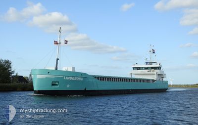
LINDEBORG
General Cargo
Current Trip
| Time Travelled | 4 days |
|---|---|
| Remaining Time | 1 h, 45 mins |
| Distance Travelled | 1001.69 nm |
| Remaining Distance | 27.87 nm |
| AVG Speed | 9.2 Noeuds |
| MAX Speed | 14.3 Noeuds |
| AVG Wind | 8.8 knots |
| MAX Wind | 23.7 knots |
| MIN Temp | 0.3°C / 32.54°F |
| MAX Temp | 10.8°C / 51.44°F |
| Tirant d eau | 5.3 m |
| Position reçue | 18 h, 10 m depuis |
Current Position
| Longitude | -10.34988° |
|---|---|
| Latitude | 51.54591° |
| Etat | Under way using engine |
| Vitesse | 6.3 Noeuds |
| Parcours | 315.7° |
| Zone | North Atlantic Ocean |
| Station | T-AIS |
| Position reçue | 18 h, 10 m depuis |
Info
Information
The current position of LINDEBORG is in North Atlantic Ocean with coordinates 51.54591° / -10.34988° as reported on 2024-04-29 01:09 by AIS to our vessel tracker app. The vessel's current speed is 6.3 Noeuds and is heading at the port of LIMERICK. The estimated time of arrival as calculated by MyShipTracking vessel tracking app is 2024-04-29 21:05 LT
The vessel LINDEBORG (IMO: 9279068, MMSI: 246499000) is a General Cargo that was built in 2005 ( 19 Age ). It's sailing under the flag of [NL] Netherlands.
In this page you can find informations about the vessels current position, last detected port calls, and current voyage information. If the vessels is not in coverage by AIS you will find the latest position.
The current position of LINDEBORG is detected by our AIS receivers and we are not responsible for the reliability of the data. The last position was recorded while the vessel was in Coverage by the Ais receivers of our vessel tracking app.
The current draught of LINDEBORG as reported by AIS is 5.3 meters
Weather
| Temperature | 8.2°C / 46.76°F |
|---|---|
| Wind Speed | 5 knots |
| Direction | 202° SSW |
| Pressure | 1002.6 hPa |
| Humidity | 89.6 % |
| Cloud Coverage | 100 % |
Featured Company
Last Port Calls
| Port | Arrival | Departure | Time In Port |
|---|---|---|---|
| 2024-04-23 11:37 | 2024-04-25 01:00 | 1 d | |
| 2024-04-22 23:20 | 2024-04-23 00:13 | 53 m | |
| 2024-04-20 06:40 | 2024-04-22 12:24 | 2 d | |
| 2024-04-17 11:57 | 2024-04-18 11:08 | 23 h | |
| 2024-04-12 15:45 | 2024-04-12 19:45 | 3 h | |
| 2024-04-11 01:40 | 2024-04-11 23:02 | 21 h | |
| 2024-04-01 19:32 | 2024-04-09 01:40 | 7 d | |
| 2024-03-22 12:15 | 2024-03-27 16:59 | 5 d | |
| 2024-03-13 08:16 | 2024-03-14 15:23 | 1 d | |
| 2024-03-10 13:12 | 2024-03-12 14:07 | 2 d |
Last Trips
| Origin | Departure | Destination | Arrival | Distance | |
|---|---|---|---|---|---|
| 2024-04-23 02:13 | 2024-04-23 13:37 | 88.33 nm | |||
| 2024-04-22 14:24 | 2024-04-23 01:20 | 105.48 nm | |||
| 2024-04-18 13:08 | 2024-04-20 08:40 | 288.66 nm | |||
| 2024-04-12 21:45 | 2024-04-17 13:57 | 504.63 nm | |||
| 2024-04-12 00:02 | 2024-04-12 17:45 | 185.77 nm | |||
| 2024-04-09 02:40 | 2024-04-11 02:40 | 411.41 nm | |||
| 2024-03-27 18:59 | 2024-04-01 20:32 | 1085.25 nm | |||
| 2024-03-14 16:23 | 2024-03-22 14:15 | 1165.07 nm | |||
| 2024-03-12 14:07 | 2024-03-13 09:16 | 141.61 nm | |||
| 2024-03-05 04:18 | 2024-03-10 13:12 | 792.00 nm |
Events
| Heure | Evenement | Détails | Position/ Destination | Info |
|---|---|---|---|---|
| 2024-04-29 01:11 | Etat Changé | Default Under way using engine |
51.54833 / -10.35333
LIMERICK
|
Vitesse: 6.3 kn Parcours: 315.7° |
| 2024-04-29 01:09 | Hors de la zone couverte |
51.54591 / -10.34988
North Atlantic Ocean
LIMERICK
|
Vitesse: 6.3 kn Parcours: 315.7° |
|
| 2024-04-29 01:08 | Etat Changé | Under way using engine Default |
51.54465 / -10.34797
LIMERICK
|
Vitesse: 6.7 kn Parcours: 319° |
| 2024-04-29 00:34 | Etat Changé | Default Under way using engine |
51.49958 / -10.28509
LIMERICK
|
Vitesse: 6.2 kn Parcours: 314.4° |
| 2024-04-29 00:27 | Etat Changé | Under way using engine Default |
51.48912 / -10.27009
LIMERICK
|
Vitesse: 6 kn Parcours: 311° |
| 2024-04-28 23:48 | Etat Changé | Default Under way using engine |
51.44333 / -10.18500
LIMERICK
|
Vitesse: 6.6 kn Parcours: 313.2° |
| 2024-04-28 23:45 | Changement de zone | Irish part of the North Atlantic Ocean United Kingdom part of the English Channel |
51.44203 / -10.18106
North Atlantic Ocean
LIMERICK
|
Vitesse: 6.6 kn Parcours: 313.2° |
| 2024-04-28 23:44 | Etat Changé | Under way using engine Default |
51.44080 / -10.17877
LIMERICK
|
Vitesse: 6 kn Parcours: 310° |
| 2024-04-28 23:44 | Dans la zone couverte |
51.44203 / -10.18106
North Atlantic Ocean
LIMERICK
|
Vitesse: 6.6 kn Parcours: 313.2° |
|
| 2024-04-27 17:31 | Hors de la zone couverte |
49.88981 / -4.78299
English Channel
LIMERICK
|
Vitesse: 9.5 kn Parcours: 250.8° |