
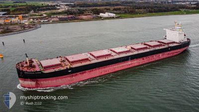
LEMESSOS NAPA
Cargo
Current Trip
| Time Travelled | 12 days |
|---|---|
| Remaining Time | 4 days |
| Distance Travelled | 3087.77 nm |
| Remaining Distance | 1504.89 nm |
| AVG Speed | 10.5 Noeuds |
| MAX Speed | 13.9 Noeuds |
| AVG Wind | 12.9 knots |
| MAX Wind | 30 knots |
| MIN Temp | 2.7°C / 36.86°F |
| MAX Temp | 28.4°C / 83.12°F |
| Tirant d eau | 12 m |
| Position reçue | 23 h, 57 m depuis |
Current Position
| Longitude | --- |
|---|---|
| Latitude | --- |
| Etat | Under way using engine |
| Vitesse | 10 Noeuds |
| Parcours | 122° |
| Zone | North Pacific Ocean |
| Station | T-AIS |
| Position reçue | 23 h, 57 m depuis |
Info
Information
The current position of LEMESSOS NAPA is in North Pacific Ocean with coordinates 16.70170° / -101.60200° as reported on 2026-01-05 01:57 by AIS to our vessel tracker app. The vessel's current speed is 10 Noeuds and is heading at the port of BALBOA. The estimated time of arrival as calculated by MyShipTracking vessel tracking app is 2026-01-10 17:17 LT
The vessel LEMESSOS NAPA (IMO: 9741293, MMSI: 212589000) is a Cargo It's sailing under the flag of [CY] Cyprus.
In this page you can find informations about the vessels current position, last detected port calls, and current voyage information. If the vessels is not in coverage by AIS you will find the latest position.
The current position of LEMESSOS NAPA is detected by our AIS receivers and we are not responsible for the reliability of the data. The last position was recorded while the vessel was in Coverage by the Ais receivers of our vessel tracking app.
The current draught of LEMESSOS NAPA as reported by AIS is 12 meters
Weather
| Temperature | 27.4°C / 81.32°F |
|---|---|
| Wind Speed | 2 knots |
| Direction | 321° NW |
| Pressure | 1012.4 hPa |
| Humidity | 66 % |
| Cloud Coverage | --- |
Featured Company
Most Visited Ports (Last year)
| Port | Arrivals | |
|---|---|---|
| 2 | ||
| 1 | ||
| 1 | ||
| 1 | ||
| 1 | ||
| 1 |
Last Trips
| Origin | Departure | Destination | Arrival | Distance | |
|---|---|---|---|---|---|
| 2025-10-07 00:11 | 2025-12-22 11:36 | 10808.04 nm |
Events
| Heure | Evenement | Détails | Position/ Destination | Info |
|---|---|---|---|---|
| 2026-01-05 02:18 | Etat Changé | Default Under way using engine |
16.66167 / -101.53833
PA BLB
|
Vitesse: 10 kn Parcours: 122° |
| 2026-01-05 01:57 | Etat Changé | Under way using engine Default |
16.70170 / -101.60200
PA BLB
|
Vitesse: 10 kn Parcours: 122° |
| 2026-01-05 01:57 | Hors de la zone couverte |
16.70170 / -101.60200
North Pacific Ocean
PA BLB
|
Vitesse: 10 kn Parcours: 122° |
|
| 2026-01-05 01:48 | Dans la zone couverte |
16.70170 / -101.60200
North Pacific Ocean
PA BLB
|
Vitesse: 10 kn Parcours: 122° |
|
| 2026-01-05 00:59 | Etat Changé | Default Under way using engine |
16.79237 / -101.74451
PA BLB
|
Vitesse: 10 kn Parcours: 121° |
| 2026-01-05 00:42 | Hors de la zone couverte |
16.84000 / -101.82000
North Pacific Ocean
PA BLB
|
Vitesse: 10 kn Parcours: 121° |
|
| 2026-01-05 00:28 | Etat Changé | Under way using engine Default |
16.84830 / -101.83700
PA BLB
|
Vitesse: 10 kn Parcours: 123° |
| 2026-01-05 00:24 | Etat Changé | Default Under way using engine |
16.84833 / -101.83667
PA BLB
|
Vitesse: 10 kn Parcours: 123° |
| 2026-01-05 00:10 | Etat Changé | Under way using engine Default |
16.87670 / -101.88300
PA BLB
|
Vitesse: 10.7 kn Parcours: 122° |
| 2026-01-05 00:04 | Etat Changé | Default Under way using engine |
16.88214 / -101.89096
PA BLB
|
Vitesse: 10 kn Parcours: 121° |