
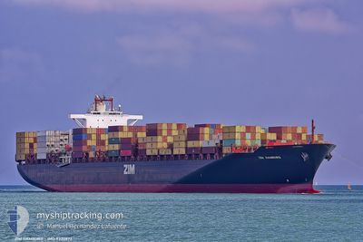
LE HAVRE EXPRESS
Container Ship
Current Trip
| Time Travelled | 5 days |
|---|---|
| Remaining Time | 2 days |
| Distance Travelled | 2030.92 nm |
| Remaining Distance | 1017.37 nm |
| AVG Speed | 15.8 Noeuds |
| MAX Speed | 19.2 Noeuds |
| AVG Wind | 19.3 knots |
| MAX Wind | 31.3 knots |
| MIN Temp | 24.5°C / 76.1°F |
| MAX Temp | 32.5°C / 90.5°F |
| Tirant d eau | 11.6 m |
| Position reçue | 3 d depuis |
Current Position
| Longitude | --- |
|---|---|
| Latitude | --- |
| Etat | Under way using engine |
| Vitesse | 15.4 Noeuds |
| Parcours | 102° |
| Zone | Caribbean Sea |
| Station | T-AIS |
| Position reçue | 3 d depuis |
Info
Information
The current position of LE HAVRE EXPRESS is in Caribbean Sea with coordinates 11.71345° / -61.89046° as reported on 2025-02-13 22:57 by AIS to our vessel tracker app. The vessel's current speed is 15.4 Noeuds and is heading at the port of SUAPE. The estimated time of arrival as calculated by MyShipTracking vessel tracking app is 2025-02-19 16:15 LT
The vessel LE HAVRE EXPRESS (IMO: 9332872, MMSI: 636093082) is a Container Ship that was built in 2009 ( 16 Age ). It's sailing under the flag of [LR] Liberia.
In this page you can find informations about the vessels current position, last detected port calls, and current voyage information. If the vessels is not in coverage by AIS you will find the latest position.
The current position of LE HAVRE EXPRESS is detected by our AIS receivers and we are not responsible for the reliability of the data. The last position was recorded while the vessel was in Coverage by the Ais receivers of our vessel tracking app.
The current draught of LE HAVRE EXPRESS as reported by AIS is 11.6 meters
Weather
| Temperature | 25.3°C / 77.54°F |
|---|---|
| Wind Speed | 17 knots |
| Direction | 55° NE |
| Pressure | 1013.1 hPa |
| Humidity | 88.2 % |
| Cloud Coverage | 100 % |
Featured Company
Last Port Calls
| Port | Arrival | Departure | Time In Port |
|---|---|---|---|
| 2025-02-10 06:30 | 2025-02-11 15:59 | 1 d | |
| 2025-02-01 23:51 | 2025-02-03 00:58 | 1 d | |
| 2025-01-29 16:33 | 2025-01-31 18:46 | 2 d | |
| 2025-01-17 18:30 | 2025-01-18 15:29 | 20 h | |
| 2024-12-23 04:33 | 2024-12-24 14:12 | 1 d | |
| 2024-12-13 18:03 | 2024-12-15 02:39 | 1 d | |
| 2024-12-07 16:17 | 2024-12-08 07:25 | 15 h | |
| 2024-12-06 04:48 | 2024-12-07 04:19 | 23 h | |
| 2024-12-01 22:15 | 2024-12-02 21:35 | 23 h |
Last Trips
| Origin | Departure | Destination | Arrival | Distance | |
|---|---|---|---|---|---|
| 2025-02-02 18:58 | 2025-02-10 01:30 | 1593.90 nm | |||
| 2025-01-31 12:46 | 2025-02-01 17:51 | 442.47 nm | |||
| 2025-01-18 10:29 | 2025-01-29 10:33 | 2455.80 nm | |||
| 2024-12-24 11:12 | 2025-01-17 13:30 | 5026.10 nm | |||
| 2024-12-14 23:39 | 2024-12-23 01:33 | 234.23 nm | |||
| 2024-12-08 04:25 | 2024-12-13 15:03 | 758.35 nm | |||
| 2024-12-07 01:19 | 2024-12-07 13:17 | 143.87 nm | |||
| 2024-12-02 18:35 | 2024-12-06 01:48 | 1032.60 nm | |||
| 2024-11-28 15:19 | 2024-12-01 19:15 | 1278.64 nm |
Events
| Heure | Evenement | Détails | Position/ Destination | Info |
|---|---|---|---|---|
| 2025-02-13 23:03 | Etat Changé | Default Under way using engine |
11.70850 / -61.86747
COCTG>BRSUA
|
Vitesse: 15.4 kn Parcours: 102° |
| 2025-02-13 22:57 | Etat Changé | Under way using engine Default |
11.71345 / -61.89046
COCTG>BRSUA
|
Vitesse: 15.6 kn Parcours: 101° |
| 2025-02-13 22:57 | Hors de la zone couverte |
11.71345 / -61.89046
Caribbean Sea
COCTG>BRSUA
|
Vitesse: 15.4 kn Parcours: 102° |
|
| 2025-02-13 22:47 | Etat Changé | Default Under way using engine |
11.72215 / -61.93347
COCTG>BRSUA
|
Vitesse: 15.5 kn Parcours: 101° |
| 2025-02-13 22:22 | Detecté en mer | Grenadian part of the Caribbean Sea |
11.74072 / -62.04252
Caribbean Sea
COCTG>BRSUA
|
Vitesse: 15.1 kn Parcours: 96° |
| 2025-02-13 22:20 | Etat Changé | Under way using engine Default |
11.74149 / -62.04926
COCTG>BRSUA
|
Vitesse: 15.1 kn Parcours: 97° |
| 2025-02-13 22:20 | Dans la zone couverte |
11.74072 / -62.04252
Caribbean Sea
COCTG>BRSUA
|
Vitesse: 15.1 kn Parcours: 96° |
|
| 2025-02-11 21:26 | Etat Changé | Default Under way using engine |
11.29685 / -74.95187
COCTG>BRSUA
|
Vitesse: 16.3 kn Parcours: 52° |
| 2025-02-11 21:19 | Hors de la zone couverte |
11.27860 / -74.97531
Caribbean Sea
COCTG>BRSUA
|
Vitesse: 16.3 kn Parcours: 52° |
|
| 2025-02-11 17:12 | Changement d'ETA | 2025/02/19 18:00 2025/02/18 14:00 |
10.44467 / -75.63230
COCTG>BRSUA
|
Vitesse: 19.1 kn Parcours: 8° |