

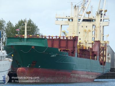
LARS D
Container Ship

Current Trip
| Time Travelled | 3 days |
|---|---|
| Remaining Time | --- |
| Distance Travelled | 1006.95 nm |
| Remaining Distance | --- |
| AVG Speed | 11.9 Noeuds |
| MAX Speed | 17.7 Noeuds |
| AVG Wind | 17.6 knots |
| MAX Wind | 26.5 knots |
| MIN Temp | 24.4°C / 75.92°F |
| MAX Temp | 32.8°C / 91.04°F |
| Tirant d eau | 6.8 m |
| Position reçue | 1 h, 21 m depuis |
Current Position
| Longitude | --- |
|---|---|
| Latitude | --- |
| Etat | At anchor |
| Vitesse | |
| Parcours | 1° |
| Zone | Caribbean Sea |
| Station | T-AIS |
| Position reçue | 1 h, 21 m depuis |
Information
The current position of LARS D is in Caribbean Sea with coordinates 10.31261° / -75.51930° as reported on 2025-02-20 23:23 by AIS to our vessel tracker app. The vessel's current speed is 0 Noeuds
The vessel LARS D (IMO: 9252797, MMSI: 255806107) is a Container Ship that was built in 2003 ( 22 Age ). It's sailing under the flag of [PT] Portugal.
In this page you can find informations about the vessels current position, last detected port calls, and current voyage information. If the vessels is not in coverage by AIS you will find the latest position.
The current position of LARS D is detected by our AIS receivers and we are not responsible for the reliability of the data. The last position was recorded while the vessel was in Coverage by the Ais receivers of our vessel tracking app.
The current draught of LARS D as reported by AIS is 6.8 meters
Weather
| Temperature | 26.4°C / 79.52°F |
|---|---|
| Wind Speed | 7 knots |
| Direction | 8° N |
| Pressure | 1009.4 hPa |
| Humidity | 72.7 % |
| Cloud Coverage | 65 % |


Featured Company
Last Port Calls
| Port | Arrival | Departure | Time In Port |
|---|---|---|---|
| 2025-02-16 13:23 | 2025-02-17 03:27 | 14 h | |
| 2025-02-12 23:29 | 2025-02-14 09:51 | 1 d | |
| 2025-02-12 09:51 | 2025-02-12 10:27 | 36 m | |
| 2025-02-10 12:28 | 2025-02-10 20:31 | 8 h | |
| 2025-02-06 07:43 | 2025-02-07 06:07 | 22 h | |
| 2025-02-03 07:30 | 2025-02-04 04:15 | 20 h | |
| 2025-01-29 16:18 | 2025-01-30 23:23 | 1 d | |
| 2025-01-25 20:31 | 2025-01-26 07:15 | 10 h | |
| 2025-01-23 04:15 | 2025-01-24 17:47 | 1 d | |
| 2025-01-20 04:19 | 2025-01-21 00:15 | 19 h |
Most Visited Ports (Last year)
| Port | Arrivals | |
|---|---|---|
| 20 | ||
| 15 | ||
| 12 | ||
| 8 | ||
| 7 | ||
| 7 |
Last Trips
| Origin | Departure | Destination | Arrival | Distance | |
|---|---|---|---|---|---|
| 2025-02-14 05:51 | 2025-02-16 09:23 | 395.58 nm | |||
| 2025-02-12 06:27 | 2025-02-12 19:29 | 27.53 nm | |||
| 2025-02-10 16:31 | 2025-02-12 05:51 | 394.06 nm | |||
| 2025-02-07 01:07 | 2025-02-10 08:28 | 1040.40 nm | |||
| 2025-02-04 00:15 | 2025-02-06 02:43 | 449.86 nm | |||
| 2025-01-30 19:23 | 2025-02-03 03:30 | 691.78 nm | |||
| 2025-01-26 03:15 | 2025-01-29 12:18 | 222.71 nm | |||
| 2025-01-24 13:47 | 2025-01-25 16:31 | 383.41 nm | |||
| 2025-01-20 20:15 | 2025-01-23 00:15 | 409.71 nm | |||
| 2025-01-15 15:42 | 2025-01-20 00:19 | 388.84 nm |
Events
| Heure | Evenement | Détails | Position/ Destination | Info |
|---|---|---|---|---|
| 2025-02-20 23:29 | Etat Changé | Default At anchor |
10.31266 / -75.51950
CO CTG
|
Vitesse: Parcours: 1° |
| 2025-02-20 23:23 | Hors de la zone couverte |
10.31261 / -75.51930
Caribbean Sea
|
Vitesse: Parcours: 5.6° |
|
| 2025-02-20 23:08 | Etat Changé | At anchor Default |
10.31272 / -75.51965
CO CTG
|
Vitesse: 0.1 kn Parcours: 8° |
| 2025-02-20 22:53 | Dans la zone couverte |
10.31272 / -75.51965
Caribbean Sea
|
Vitesse: 0.1 kn Parcours: 123.1° |
|
| 2025-02-20 20:50 | Etat Changé | Default At anchor |
10.31271 / -75.51872
CO CTG
|
Vitesse: 0.2 kn Parcours: 329° |
| 2025-02-20 20:47 | Hors de la zone couverte |
10.31279 / -75.51854
Caribbean Sea
|
Vitesse: 0.2 kn Parcours: 238.5° |
|
| 2025-02-20 19:53 | Etat Changé | At anchor Default |
10.31382 / -75.51770
CO CTG
|
Vitesse: Parcours: 270° |
| 2025-02-20 19:50 | Etat Changé | Default At anchor |
10.31388 / -75.51765
CO CTG
|
Vitesse: Parcours: 271° |
| 2025-02-20 18:38 | Etat Changé | At anchor Default |
10.31400 / -75.51764
CO CTG
|
Vitesse: Parcours: 270° |
| 2025-02-20 18:23 | Etat Changé | Default At anchor |
10.31400 / -75.51762
CO CTG
|
Vitesse: Parcours: 275° |