
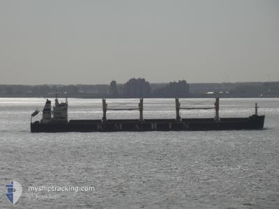
KMARIN OSLO
Cargo
Current Trip
| Time Travelled | --- |
|---|---|
| Remaining Time | 5 days |
| Distance Travelled | 8736.50 nm |
| Remaining Distance | 1392.58 nm |
| AVG Speed | 10.1 Noeuds |
| MAX Speed | 14.9 Noeuds |
| AVG Wind | 8.9 knots |
| MAX Wind | 21 knots |
| MIN Temp | 20.2°C / 68.36°F |
| MAX Temp | 29.6°C / 85.28°F |
| Tirant d eau | 13.9 m |
| Position reçue | 4 d depuis |
Current Position
| Longitude | --- |
|---|---|
| Latitude | --- |
| Etat | Under way using engine |
| Vitesse | 8.1 Noeuds |
| Parcours | 86.2° |
| Zone | Singapore Strait |
| Station | T-AIS |
| Position reçue | 4 d depuis |
Information
The current position of KMARIN OSLO is in Singapore Strait with coordinates 1.27212° / 104.23492° as reported on 2025-03-24 12:30 by AIS to our vessel tracker app. The vessel's current speed is 8.1 Noeuds and is heading at the port of QINGDAO. The estimated time of arrival as calculated by MyShipTracking vessel tracking app is 2025-04-03 08:15 LT
The vessel KMARIN OSLO (IMO: 9726516, MMSI: 356752000) is a Cargo It's sailing under the flag of [PA] Panama.
In this page you can find informations about the vessels current position, last detected port calls, and current voyage information. If the vessels is not in coverage by AIS you will find the latest position.
The current position of KMARIN OSLO is detected by our AIS receivers and we are not responsible for the reliability of the data. The last position was recorded while the vessel was in Coverage by the Ais receivers of our vessel tracking app.
The current draught of KMARIN OSLO as reported by AIS is 13.9 meters
Weather
| Temperature | 25.4°C / 77.72°F |
|---|---|
| Wind Speed | 18 knots |
| Direction | 57° ENE |
| Pressure | 1010.6 hPa |
| Humidity | 89.2 % |
| Cloud Coverage | 41 % |
Featured Company
Last Port Calls
| Port | Arrival | Departure | Time In Port |
|---|---|---|---|
| 2025-01-21 22:17 | 2025-01-27 02:21 | 5 d | |
| 2025-01-09 12:29 | 2025-01-11 14:02 | 2 d |
Last Trips
| Origin | Departure | Destination | Arrival | Distance | |
|---|---|---|---|---|---|
| 2025-01-11 22:02 | 2025-01-22 05:17 | 2385.74 nm | |||
| 2024-12-19 18:09 | 2025-01-09 20:29 | 3319.32 nm |
Events
| Heure | Evenement | Détails | Position/ Destination | Info |
|---|---|---|---|---|
| 2025-03-24 12:38 | Etat Changé | Default Under way using engine |
1.27318 / 104.25294
CN QDG
|
Vitesse: 8.1 kn Parcours: 86.2° |
| 2025-03-24 12:30 | Etat Changé | Under way using engine Default |
1.27212 / 104.23492
CN QDG
|
Vitesse: 8.2 kn Parcours: 89° |
| 2025-03-24 12:30 | Hors de la zone couverte |
1.27212 / 104.23492
Singapore Strait
CN QDG
|
Vitesse: 8.1 kn Parcours: 86.2° |
|
| 2025-03-24 12:22 | Etat Changé | Default Under way using engine |
1.27106 / 104.21667
CN QDG
|
Vitesse: 8.4 kn Parcours: 80.6° |
| 2025-03-24 12:11 | Etat Changé | Under way using engine Default |
1.26819 / 104.19087
CN QDG
|
Vitesse: 8.5 kn Parcours: 79° |
| 2025-03-24 12:10 | Etat Changé | Default Under way using engine |
1.26779 / 104.18855
CN QDG
|
Vitesse: 8.6 kn Parcours: 80.9° |
| 2025-03-24 12:00 | Etat Changé | Under way using engine Default |
1.26370 / 104.16494
CN QDG
|
Vitesse: 8.5 kn Parcours: 85° |
| 2025-03-24 11:58 | Etat Changé | Default Under way using engine |
1.26307 / 104.16021
CN QDG
|
Vitesse: 8.4 kn Parcours: 83.2° |
| 2025-03-24 11:52 | Changement de zone | Malaysian part of the Singapore Strait Indonesian part of the Singapore Strait |
1.26171 / 104.14698
Singapore Strait
CN QDG
|
Vitesse: 8.4 kn Parcours: 83.2° |
| 2025-03-24 11:26 | Changement d'ETA | 2025/04/03 18:00 2025/04/03 09:00 |
1.25518 / 104.08845
CN QDG
|
Vitesse: 7.7 kn Parcours: 87.1° |