
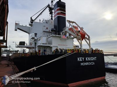
KEY KNIGHT
Bulk Carrier
Current Trip
JPWAK>AUABP
| Time Travelled | 23 days |
|---|---|
| Remaining Time | --- |
| Distance Travelled | 5125.82 nm |
| Remaining Distance | --- |
| AVG Speed | 10.4 Noeuds |
| MAX Speed | 14.5 Noeuds |
| AVG Wind | 13.8 knots |
| MAX Wind | 25 knots |
| MIN Temp | 9.2°C / 48.56°F |
| MAX Temp | 30°C / 86°F |
| Tirant d eau | 6.8 m |
| Position reçue | 1 d depuis |
Current Position
| Longitude | 147.10159° |
|---|---|
| Latitude | -18.84423° |
| Etat | Under way using engine |
| Vitesse | 10.3 Noeuds |
| Parcours | 308.6° |
| Zone | Coral Sea |
| Station | T-AIS |
| Position reçue | 1 d depuis |
Info
Information
The current position of KEY KNIGHT is in Coral Sea with coordinates -18.84423° / 147.10159° as reported on 2024-05-02 22:48 by AIS to our vessel tracker app. The vessel's current speed is 10.3 Noeuds
The vessel KEY KNIGHT (IMO: 9512317, MMSI: 636020651) is a Bulk Carrier that was built in 2012 ( 12 Age ). It's sailing under the flag of [LR] Liberia.
In this page you can find informations about the vessels current position, last detected port calls, and current voyage information. If the vessels is not in coverage by AIS you will find the latest position.
The current position of KEY KNIGHT is detected by our AIS receivers and we are not responsible for the reliability of the data. The last position was recorded while the vessel was in Coverage by the Ais receivers of our vessel tracking app.
The current draught of KEY KNIGHT as reported by AIS is 6.8 meters
Weather
| Temperature | 27.1°C / 80.78°F |
|---|---|
| Wind Speed | 15 knots |
| Direction | 131° SE |
| Pressure | 1007.8 hPa |
| Humidity | 73.9 % |
| Cloud Coverage | 96 % |
Featured Company
Last Port Calls
| Port | Arrival | Departure | Time In Port |
|---|---|---|---|
| 2024-04-09 07:01 | 2024-04-10 17:12 | 1 d | |
| 2024-04-04 03:56 | 2024-04-07 10:57 | 3 d | |
| 2024-03-07 10:58 |
Most Visited Ports (Last year)
| Port | Arrivals | |
|---|---|---|
| 2 | ||
| 1 | ||
| 1 | ||
| 1 | ||
| 1 | ||
| 1 |
Last Trips
| Origin | Departure | Destination | Arrival | Distance | |
|---|---|---|---|---|---|
| 2024-04-07 18:57 | 2024-04-09 15:01 | 555.70 nm | |||
| 2024-03-07 16:28 | 2024-04-04 11:56 | 5195.09 nm |
Events
| Heure | Evenement | Détails | Position/ Destination | Info |
|---|---|---|---|---|
| 2024-05-02 22:55 | Etat Changé | Default Under way using engine |
-18.83037 / 147.08333
JPWAK>AUABP
|
Vitesse: 10.3 kn Parcours: 308.6° |
| 2024-05-02 22:48 | Hors de la zone couverte |
-18.84423 / 147.10159
Coral Sea
|
Vitesse: 10.3 kn Parcours: 308.6° |
|
| 2024-05-02 21:16 | Etat Changé | Under way using engine Default |
-19.01801 / 147.31348
JPWAK>AUABP
|
Vitesse: 10.2 kn Parcours: 309° |
| 2024-05-02 21:03 | Dans la zone couverte |
-19.01801 / 147.31348
Coral Sea
|
Vitesse: 10.3 kn Parcours: 309.1° |
|
| 2024-05-02 08:24 | Démarrage | 13.75 nm, North West of BOWEN |
-19.85378 / 148.08812
JPWAK>AUABP
|
Vitesse: 4 kn Parcours: 42° |
| 2024-05-01 12:35 | Arret | 13.79 nm, North West of BOWEN |
-19.85649 / 148.08401
JPWAK>AUABP
|
Vitesse: 0.2 kn Parcours: 117° |
| 2024-05-01 10:27 | Démarrage | 18.53 nm, North West of BOWEN |
-19.74707 / 148.10454
JPWAK>AUABP
|
Vitesse: 3.1 kn Parcours: 198° |
| 2024-04-30 02:07 | Arret | 18.52 nm, North West of BOWEN |
-19.74857 / 148.10170
JPWAK>AUABP
|
Vitesse: 0.3 kn Parcours: 109° |
| 2024-04-29 20:55 | Etat Changé | Default Under way using engine |
-19.17112 / 147.49968
JPWAK>AUABP
|
Vitesse: 10.8 kn Parcours: 130.2° |
| 2024-04-29 20:49 | Hors de la zone couverte |
-19.15958 / 147.48547
Coral Sea
JPWAK>AUABP
|
Vitesse: 10.8 kn Parcours: 130.2° |