
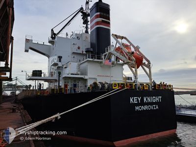
KEY KNIGHT
Bulk Carrier
Current Trip
JPWAK>AUABP
| Time Travelled | 14 days |
|---|---|
| Remaining Time | --- |
| Distance Travelled | 3355.09 морская миля |
| Remaining Distance | --- |
| AVG Speed | 10.6 Узлы |
| MAX Speed | 14.5 Узлы |
| AVG Wind | 11 knots |
| MAX Wind | 23.4 knots |
| MIN Temp | 9.2°C / 48.56°F |
| MAX Temp | 29.7°C / 85.46°F |
| Осадка | 6.8 м |
| Позиция Получена | 8 d тому назад |
Current Position
| Долгота | 134.97767° |
|---|---|
| Широта | 33.81345° |
| Статус | Under way using engine |
| Скорость | 9.4 Узлы |
| Курс | 186.3° |
| Район | Philippine Sea |
| Станция | T-AIS |
| Позиция Получена | 8 d тому назад |
Info
Information
The current position of KEY KNIGHT is in Philippine Sea with coordinates 33.81345° / 134.97767° as reported on 2024-04-16 03:59 by AIS to our vessel tracker app. The vessel's current speed is 9.4 Узлы
The vessel KEY KNIGHT (IMO: 9512317, MMSI: 636020651) is a Bulk Carrier that was built in 2012 ( 12 лет ). It's sailing under the flag of [LR] Liberia.
In this page you can find informations about the vessels current position, last detected port calls, and current voyage information. If the vessels is not in coverage by AIS you will find the latest position.
The current position of KEY KNIGHT is detected by our AIS receivers and we are not responsible for the reliability of the data. The last position was recorded while the vessel was in Coverage by the Ais receivers of our vessel tracking app.
The current draught of KEY KNIGHT as reported by AIS is 6.8 meters
Weather
| Temperature | 29.2°C / 84.56°F |
|---|---|
| Wind Speed | 5 knots |
| Direction | 90° E |
| Pressure | 1010.8 hPa |
| Humidity | 73.5 % |
| Cloud Coverage | 64 % |
Featured Company
Last Port Calls
| Port | Arrival | Departure | Time In Port |
|---|---|---|---|
| 2024-04-09 07:01 | 2024-04-10 17:12 | 1 d | |
| 2024-04-04 03:56 | 2024-04-07 10:57 | 3 d | |
| 2024-03-07 10:58 | |||
| 2024-02-09 18:04 | 2024-02-10 22:09 | 1 d |
Most Visited Ports (Last year)
| Port | Arrivals | |
|---|---|---|
| 2 | ||
| 1 | ||
| 1 | ||
| 1 | ||
| 1 | ||
| 1 |
Last Trips
| Origin | Departure | Destination | Arrival | Distance | |
|---|---|---|---|---|---|
| 2024-04-07 18:57 | 2024-04-09 15:01 | 555.70 морская миля | |||
| 2024-03-07 16:28 | 2024-04-04 11:56 | 5195.09 морская миля | |||
| 2024-01-14 08:30 | 2024-02-10 04:04 | 3969.27 морская миля |
Events
| Время | Событие | Детали | Позиция / Направление | Информация |
|---|---|---|---|---|
| 2024-04-16 04:03 | Статус изменился | Default Under way using engine |
33.80345 / 134.97621
JPWAK>AUABP
|
Скорость: 9.4 kn Курс: 186.3° |
| 2024-04-16 03:59 | Вне покрытия |
33.81345 / 134.97767
Philippine Sea
JPWAK>AUABP
|
Скорость: 9.4 kn Курс: 186.3° |
|
| 2024-04-16 03:52 | Статус изменился | Under way using engine Default |
33.83311 / 134.97960
JPWAK>AUABP
|
Скорость: 9.3 kn Курс: 185° |
| 2024-04-16 03:43 | Статус изменился | Default Under way using engine |
33.85559 / 134.98189
JPWAK>AUABP
|
Скорость: 9 kn Курс: 184.9° |
| 2024-04-16 03:37 | Статус изменился | Under way using engine Default |
33.87248 / 134.98351
JPWAK>AUABP
|
Скорость: 9.1 kn Курс: 188° |
| 2024-04-16 03:27 | Статус изменился | Default Under way using engine |
33.89782 / 134.98747
JPWAK>AUABP
|
Скорость: 8.9 kn Курс: 186.7° |
| 2024-04-16 02:32 | Статус изменился | Under way using engine Default |
33.99948 / 135.00191
JPWAK>AUABP
|
Скорость: 9.6 kn Курс: 190° |
| 2024-04-16 02:18 | Статус изменился | Default Under way using engine |
34.03744 / 135.00900
JPWAK>AUABP
|
Скорость: 9.9 kn Курс: 190.4° |
| 2024-04-16 00:45 | Начало движения | 1.18 nm, North West of WAKAYAMA |
34.23307 / 135.12655
JPWAK>AUABP
|
Скорость: 3.2 kn Курс: 296° |
| 2024-04-16 00:41 | Статус изменился | Under way using engine Moored |
34.23461 / 135.12770
JPWAK>AUABP
|
Скорость: 1.1 kn Курс: 147° |