
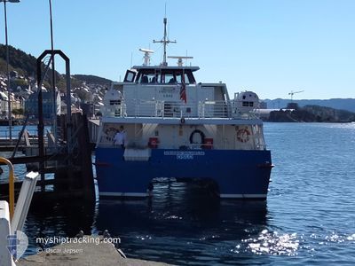
KEISER WILHELM
High speed craft
Current Trip
CRUISE
| Time Travelled | 17 h, 9 mins |
|---|---|
| Remaining Time | --- |
| Distance Travelled | 61.66 nm |
| Remaining Distance | --- |
| AVG Speed | 13.4 Noeuds |
| MAX Speed | 13.4 Noeuds |
| AVG Wind | 3.3 knots |
| MAX Wind | 6 knots |
| MIN Temp | 1.8°C / 35.24°F |
| MAX Temp | 12°C / 53.6°F |
| Tirant d eau | 2 m |
| Position reçue | 2 m depuis |
Current Position
| Longitude | 6.23875° |
|---|---|
| Latitude | 62.44362° |
| Etat | Moored |
| Vitesse | |
| Parcours | 45° |
| Zone | Norwegian Sea |
| Station | T-AIS |
| Position reçue | 2 m depuis |
Info
Information
The current position of KEISER WILHELM is in Norwegian Sea with coordinates 62.44362° / 6.23875° as reported on 2024-05-01 08:03 by AIS to our vessel tracker app. The vessel's current speed is 0 Noeuds
The vessel KEISER WILHELM (IMO: 9011557, MMSI: 257364700) is a High speed craft that was built in 1990 ( 34 Age ). It's sailing under the flag of [NO] Norway.
In this page you can find informations about the vessels current position, last detected port calls, and current voyage information. If the vessels is not in coverage by AIS you will find the latest position.
The current position of KEISER WILHELM is detected by our AIS receivers and we are not responsible for the reliability of the data. The last position was recorded while the vessel was in Coverage by the Ais receivers of our vessel tracking app.
The current draught of KEISER WILHELM as reported by AIS is 2 meters
Weather
| Temperature | 9.1°C / 48.38°F |
|---|---|
| Wind Speed | 6 knots |
| Direction | 159° SSE |
| Pressure | 1022.9 hPa |
| Humidity | 72.1 % |
| Cloud Coverage | 81 % |
Featured Company
Last Port Calls
| Port | Arrival | Departure | Time In Port |
|---|---|---|---|
| 2024-04-30 14:30 | 2024-04-30 14:56 | 26 m | |
| 2024-04-30 11:24 | 2024-04-30 11:53 | 29 m | |
| 2024-04-30 08:09 | 2024-04-30 08:42 | 33 m | |
| 2024-04-27 08:16 | 2024-04-27 08:47 | 30 m | |
| 2024-04-26 13:15 | 2024-04-26 13:33 | 17 m | |
| 2024-04-26 09:20 | 2024-04-26 10:29 | 1 h | |
| 2024-04-26 06:07 | 2024-04-26 06:36 | 29 m | |
| 2024-04-24 10:52 | 2024-04-24 11:11 | 18 m | |
| 2024-04-24 06:41 | 2024-04-24 07:27 | 45 m | |
| 2024-04-22 09:54 | 2024-04-22 10:12 | 18 m |
Last Trips
| Origin | Departure | Destination | Arrival | Distance | |
|---|---|---|---|---|---|
| 2024-04-30 13:53 | 2024-04-30 16:30 | 20.68 nm | |||
| 2024-04-30 10:42 | 2024-04-30 13:24 | 20.92 nm | |||
| 2024-04-27 10:47 | 2024-04-30 10:09 | 42.86 nm | |||
| 2024-04-26 15:33 | 2024-04-27 10:16 | 5.17 nm | |||
| 2024-04-26 12:29 | 2024-04-26 15:15 | 49.53 nm | |||
| 2024-04-26 08:36 | 2024-04-26 11:20 | 48.13 nm | |||
| 2024-04-24 13:11 | 2024-04-26 08:07 | 3.53 nm | |||
| 2024-04-24 09:27 | 2024-04-24 12:52 | 48.31 nm | |||
| 2024-04-22 12:12 | 2024-04-24 08:41 | 2.93 nm | |||
| 2024-04-22 09:07 | 2024-04-22 11:54 | 47.89 nm |
Events
| Heure | Evenement | Détails | Position/ Destination | Info |
|---|---|---|---|---|
| 2024-05-01 07:09 | Etat Changé | Moored Default |
62.44361 / 6.23872
CRUISE
|
Vitesse: Parcours: 45° |
| 2024-05-01 07:05 | Etat Changé | Default Moored |
62.44363 / 6.23874
CRUISE
|
Vitesse: Parcours: 45° |
| 2024-05-01 06:45 | Etat Changé | Moored Default |
62.44361 / 6.23874
CRUISE
|
Vitesse: Parcours: 45° |
| 2024-05-01 06:41 | Etat Changé | Default Moored |
62.44361 / 6.23878
CRUISE
|
Vitesse: Parcours: 45° |
| 2024-05-01 05:09 | Etat Changé | Moored Default |
62.44359 / 6.23876
CRUISE
|
Vitesse: Parcours: 44° |
| 2024-05-01 05:05 | Etat Changé | Default Moored |
62.44363 / 6.23873
CRUISE
|
Vitesse: Parcours: 44° |
| 2024-05-01 02:17 | Etat Changé | Moored Default |
62.44363 / 6.23875
CRUISE
|
Vitesse: Parcours: 44° |
| 2024-05-01 02:15 | Etat Changé | Default Moored |
62.44366 / 6.23874
CRUISE
|
Vitesse: Parcours: 44° |
| 2024-04-30 19:24 | Arret | 1.19 nm, West of FISKARSTRANDA |
62.44354 / 6.23877
CRUISE
|
Vitesse: 0.2 kn Parcours: 9° |
| 2024-04-30 16:33 | Démarrage | 2.98 nm, West of GEIRANGER |
62.09845 / 7.09672
CRUISE
|
Vitesse: 14.6 kn Parcours: 225.7° |