
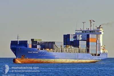
KATHERINE BORCHARD
Container Ship
Current Trip
| Time Travelled | 1 day |
|---|---|
| Remaining Time | 17 h, 33 mins |
| Distance Travelled | 654.95 nm |
| Remaining Distance | 242.90 nm |
| AVG Speed | 15.3 Noeuds |
| MAX Speed | 17.6 Noeuds |
| AVG Wind | 10.1 knots |
| MAX Wind | 23.1 knots |
| MIN Temp | 15.9°C / 60.62°F |
| MAX Temp | 20°C / 68°F |
| Tirant d eau | 8.7 m |
| Position reçue | 1 m depuis |
Current Position
| Longitude | -9.46228° |
|---|---|
| Latitude | 37.39189° |
| Etat | Under way using engine |
| Vitesse | 13.9 Noeuds |
| Parcours | 351.6° |
| Zone | North Atlantic Ocean |
| Station | T-AIS |
| Position reçue | 1 m depuis |
Info
Information
The current position of KATHERINE BORCHARD is in North Atlantic Ocean with coordinates 37.39189° / -9.46228° as reported on 2024-05-12 12:56 by AIS to our vessel tracker app. The vessel's current speed is 13.9 Noeuds and is heading at the port of LEIXOES. The estimated time of arrival as calculated by MyShipTracking vessel tracking app is 2024-05-13 06:30 LT
The vessel KATHERINE BORCHARD (IMO: 9246530, MMSI: 304623000) is a Container Ship that was built in 2004 ( 20 Age ). It's sailing under the flag of [AG] Antigua Barbuda.
In this page you can find informations about the vessels current position, last detected port calls, and current voyage information. If the vessels is not in coverage by AIS you will find the latest position.
The current position of KATHERINE BORCHARD is detected by our AIS receivers and we are not responsible for the reliability of the data. The last position was recorded while the vessel was in Coverage by the Ais receivers of our vessel tracking app.
The current draught of KATHERINE BORCHARD as reported by AIS is 8.7 meters
Weather
| Temperature | 16.7°C / 62.06°F |
|---|---|
| Wind Speed | 19 knots |
| Direction | 348° NNW |
| Pressure | 1019.4 hPa |
| Humidity | 85.6 % |
| Cloud Coverage | 53 % |
Featured Company
Last Port Calls
| Port | Arrival | Departure | Time In Port |
|---|---|---|---|
| 2024-05-10 10:23 | 2024-05-10 18:52 | 8 h | |
| 2024-05-07 22:54 | 2024-05-08 12:20 | 13 h | |
| 2024-05-04 06:47 | 2024-05-04 20:52 | 14 h | |
| 2024-05-02 08:09 | 2024-05-02 17:32 | 9 h | |
| 2024-04-30 23:23 | 2024-05-01 07:09 | 7 h | |
| 2024-04-30 22:54 | 2024-04-30 22:56 | 2 m | |
| 2024-04-30 19:48 | 2024-04-30 22:16 | 2 h | |
| 2024-04-29 01:25 | 2024-04-29 13:48 | 12 h | |
| 2024-04-25 04:10 | 2024-04-25 11:10 | 7 h | |
| 2024-04-22 16:32 | 2024-04-22 22:56 | 6 h |
Last Trips
| Origin | Departure | Destination | Arrival | Distance | |
|---|---|---|---|---|---|
| 2024-05-08 14:20 | 2024-05-10 12:23 | 691.56 nm | |||
| 2024-05-04 22:52 | 2024-05-08 00:54 | 987.43 nm | |||
| 2024-05-02 20:32 | 2024-05-04 08:47 | 470.42 nm | |||
| 2024-05-01 10:09 | 2024-05-02 11:09 | 354.93 nm | |||
| 2024-05-01 01:56 | 2024-05-01 02:23 | 20.22 nm | |||
| 2024-05-01 01:16 | 2024-05-01 01:54 | 18.48 nm | |||
| 2024-04-29 16:48 | 2024-04-30 22:48 | 362.96 nm | |||
| 2024-04-25 13:10 | 2024-04-29 04:25 | 1061.51 nm | |||
| 2024-04-23 00:56 | 2024-04-25 06:10 | 781.77 nm | |||
| 2024-04-19 23:24 | 2024-04-22 18:32 | 926.73 nm |
Events
| Heure | Evenement | Détails | Position/ Destination | Info |
|---|---|---|---|---|
| 2024-05-12 06:45 | Etat Changé | Under way using engine Default |
36.55613 / -8.41440
PTLEI
|
Vitesse: 15.2 kn Parcours: 290° |
| 2024-05-12 06:43 | Etat Changé | Default Under way using engine |
36.55286 / -8.40341
PTLEI
|
Vitesse: 16 kn Parcours: 289.9° |
| 2024-05-12 06:38 | Etat Changé | Under way using engine Default |
36.54504 / -8.37639
PTLEI
|
Vitesse: 16 kn Parcours: 290° |
| 2024-05-12 06:35 | Etat Changé | Default Under way using engine |
36.54079 / -8.36175
PTLEI
|
Vitesse: 15.8 kn Parcours: 289.2° |
| 2024-05-12 05:08 | Etat Changé | Under way using engine Default |
36.41572 / -7.91934
PTLEI
|
Vitesse: 16.2 kn Parcours: 290° |
| 2024-05-12 05:06 | Etat Changé | Default Under way using engine |
36.41364 / -7.91198
PTLEI
|
Vitesse: 16.2 kn Parcours: 289° |
| 2024-05-12 05:01 | Etat Changé | Under way using engine Default |
36.40614 / -7.88562
PTLEI
|
Vitesse: 16.3 kn Parcours: 289° |
| 2024-05-12 04:58 | Etat Changé | Default Under way using engine |
36.40160 / -7.86912
PTLEI
|
Vitesse: 16.3 kn Parcours: 288.2° |
| 2024-05-12 03:41 | Changement de zone | Portuguese part of the North Atlantic Ocean Spanish part of the North Atlantic Ocean |
36.28774 / -7.45507
North Atlantic Ocean
PTLEI
|
Vitesse: 16.2 kn Parcours: 287.8° |
| 2024-05-12 03:39 | Etat Changé | Under way using engine Default |
36.28509 / -7.44494
PTLEI
|
Vitesse: 16.1 kn Parcours: 288° |