
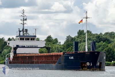
KAIE
General Cargo
Current Trip
| Trip Time | 1 day |
|---|---|
| Trip Distance | 234.80 nm |
| AVG Speed | 10.8 Noeuds |
| MAX Speed | 13.3 Noeuds |
| Tirant d eau | 4.8 m |
| AVG Wind | 12.3 knots |
| MAX Wind | 17.9 knots |
| MIN Temp | 2.2°C / 35.96°F |
| MAX Temp | 10.2°C / 50.36°F |
| Position reçue | 2 d depuis |
Current Position
| Longitude | -10.13995° |
|---|---|
| Latitude | 51.44531° |
| Etat | Under way using engine |
| Vitesse | 11.8 Noeuds |
| Parcours | 297.4° |
| Zone | North Atlantic Ocean |
| Station | T-AIS |
| Position reçue | 2 d depuis |
Info
Information
The current position of KAIE is in North Atlantic Ocean with coordinates 51.44531° / -10.13995° as reported on 2024-04-27 03:41 by AIS to our vessel tracker app. The vessel's current speed is 11.8 Noeuds and is currently inside the port of AUGHINISH.
The vessel KAIE (IMO: 9504102, MMSI: 305036000) is a General Cargo that was built in 2010 ( 14 Age ). It's sailing under the flag of [AG] Antigua Barbuda.
In this page you can find informations about the vessels current position, last detected port calls, and current voyage information. If the vessels is not in coverage by AIS you will find the latest position.
The current position of KAIE is detected by our AIS receivers and we are not responsible for the reliability of the data. The last position was recorded while the vessel was in Coverage by the Ais receivers of our vessel tracking app.
The current draught of KAIE as reported by AIS is 4.8 meters
Weather
| Temperature | 10°C / 50°F |
|---|---|
| Wind Speed | 14 knots |
| Direction | 255° WSW |
| Pressure | 998.6 hPa |
| Humidity | 91.3 % |
| Cloud Coverage | 92 % |
Featured Company
Last Port Calls
| Port | Arrival | Departure | Time In Port |
|---|---|---|---|
| 2024-04-28 03:15 | |||
| 2024-04-23 01:07 | 2024-04-26 16:06 | 3 d | |
| 2024-04-16 15:35 | 2024-04-16 17:07 | 1 h | |
| 2024-04-06 05:33 | 2024-04-13 17:38 | 7 d | |
| 2024-03-16 19:24 | 2024-03-20 17:45 | 3 d | |
| 2024-02-16 14:48 | 2024-02-22 18:59 | 6 d | |
| 2024-02-09 13:46 | 2024-02-11 16:06 | 2 d |
Most Visited Ports (Last year)
| Port | Arrivals | |
|---|---|---|
| 8 | ||
| 3 | ||
| 3 | ||
| 2 | ||
| 2 | ||
| 2 |
Last Trips
| Origin | Departure | Destination | Arrival | Distance | |
|---|---|---|---|---|---|
| 2024-04-26 17:06 | 2024-04-28 04:15 | 234.80 nm | |||
| 2024-04-16 19:07 | 2024-04-23 02:07 | 902.01 nm | |||
| 2024-04-13 20:38 | 2024-04-16 17:35 | 788.28 nm | |||
| 2024-03-20 18:45 | 2024-04-06 08:33 | 3066.08 nm | |||
| 2024-02-22 21:59 | 2024-03-16 20:24 | 2851.26 nm | |||
| 2024-02-11 17:06 | 2024-02-16 17:48 | 839.39 nm | |||
| 2024-01-30 21:15 | 2024-02-09 14:46 | 1705.84 nm |
Events
| Heure | Evenement | Détails | Position/ Destination | Info |
|---|---|---|---|---|
| 2024-04-28 03:15 | Arret |
52.64492 / -9.05559
[IE] AUGHINISH
|
Vitesse: 0.3 kn Parcours: 267° |
|
| 2024-04-28 03:15 | Port d'arrivée |
|
52.64492 / -9.05559
[IE] AUGHINISH
|
Vitesse: 3.5 kn Parcours: 93° |
| 2024-04-27 13:31 | Arret | 2.64 nm, South West of CAPPA UPPER |
52.59775 / -9.55192
IEAUG
|
Vitesse: 0.2 kn Parcours: 79° |
| 2024-04-27 03:41 | Hors de la zone couverte |
51.44531 / -10.13995
North Atlantic Ocean
IEAUG
|
Vitesse: 11.8 kn Parcours: 297.4° |
|
| 2024-04-27 03:16 | Changement de zone | Irish part of the North Atlantic Ocean Irish part of the Celtic Sea |
51.40774 / -10.02459
North Atlantic Ocean
IEAUG
|
Vitesse: 11.9 kn Parcours: 297.4° |
| 2024-04-26 16:16 | Changement d'ETA | 2024/04/27 12:00 2024/04/27 16:00 |
52.27535 / -6.99136
IEAUG
|
Vitesse: 8.6 kn Parcours: 108.5° |
| 2024-04-26 16:09 | Etat Changé | Under way using engine Moored |
52.27261 / -7.01358
IEAUG
|
Vitesse: 8.6 kn Parcours: 70.3° |
| 2024-04-26 16:08 | Changement d'ETA | 2024/04/27 16:00 2024/04/26 16:00 |
52.27171 / -7.01781
IEAUG
|
Vitesse: 8 kn Parcours: 76.5° |
| 2024-04-26 16:06 | PORT DE DEPART |
|
52.27014 / -7.02469
IEAUG
|
Vitesse: 6.3 kn Parcours: 51° |
| 2024-04-26 16:04 | Changement d'ETA | 2024/04/26 16:00 2024/04/27 16:00 |
52.26775 / -7.02794
[IE] WATERFORD
|
Vitesse: 5 kn Parcours: 35° |