

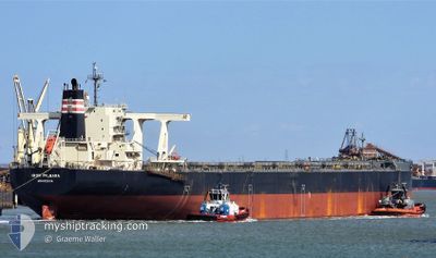
IRON PILBARA
Cargo

Current Trip
| Time Travelled | 4 days |
|---|---|
| Remaining Time | --- |
| Distance Travelled | 1056.12 nm |
| Remaining Distance | --- |
| AVG Speed | 9.4 Noeuds |
| MAX Speed | 11.9 Noeuds |
| AVG Wind | 7.6 knots |
| MAX Wind | 13.8 knots |
| MIN Temp | 27.3°C / 81.14°F |
| MAX Temp | 31.6°C / 88.88°F |
| Tirant d eau | 17.9 m |
| Position reçue | 3 d depuis |
Current Position
| Longitude | --- |
|---|---|
| Latitude | --- |
| Etat | Under way using engine |
| Vitesse | 9.2 Noeuds |
| Parcours | 345.5° |
| Zone | Indian Ocean |
| Station | T-AIS |
| Position reçue | 3 d depuis |
Information
The current position of IRON PILBARA is in Indian Ocean with coordinates -16.17286° / 117.51892° as reported on 2025-03-03 18:19 by AIS to our vessel tracker app. The vessel's current speed is 9.2 Noeuds and is heading at the port of QINGDAO. The estimated time of arrival as calculated by MyShipTracking vessel tracking app is 2025-03-18 12:00 LT
The vessel IRON PILBARA (IMO: 9621364, MMSI: 636016343) is a Cargo It's sailing under the flag of [LR] Liberia.
In this page you can find informations about the vessels current position, last detected port calls, and current voyage information. If the vessels is not in coverage by AIS you will find the latest position.
The current position of IRON PILBARA is detected by our AIS receivers and we are not responsible for the reliability of the data. The last position was recorded while the vessel was in Coverage by the Ais receivers of our vessel tracking app.
The current draught of IRON PILBARA as reported by AIS is 17.9 meters
Weather
| Temperature | 28°C / 82.4°F |
|---|---|
| Wind Speed | 14 knots |
| Direction | 330° NNW |
| Pressure | 1007.6 hPa |
| Humidity | 79.8 % |
| Cloud Coverage | 100 % |


Featured Company
Last Port Calls
| Port | Arrival | Departure | Time In Port |
|---|---|---|---|
| 2025-03-01 00:38 | 2025-03-02 15:34 | 1 d | |
| 2025-02-08 07:49 | 2025-02-10 12:29 | 2 d | |
| 2025-01-19 14:45 | 2025-01-21 04:11 | 1 d |
Most Visited Ports (Last year)
| Port | Arrivals | |
|---|---|---|
| 8 | ||
| 6 | ||
| 2 | ||
| 2 | ||
| 1 | ||
| 1 |
Last Trips
| Origin | Departure | Destination | Arrival | Distance | |
|---|---|---|---|---|---|
| 2025-02-10 20:29 | 2025-03-01 08:38 | 3613.77 nm | |||
| 2025-01-21 12:11 | 2025-02-08 15:49 | 3557.69 nm | |||
| 2024-12-25 16:03 | 2025-01-19 22:45 | 3930.88 nm |
Events
| Heure | Evenement | Détails | Position/ Destination | Info |
|---|---|---|---|---|
| 2025-03-03 18:24 | Etat Changé | Default Under way using engine |
-16.16036 / 117.51569
CN QDG
|
Vitesse: 9.2 kn Parcours: 345.5° |
| 2025-03-03 18:19 | Hors de la zone couverte |
-16.17286 / 117.51892
Indian Ocean
CN QDG
|
Vitesse: 9.2 kn Parcours: 345.5° |
|
| 2025-03-03 17:57 | Etat Changé | Under way using engine Default |
-16.22649 / 117.53251
CN QDG
|
Vitesse: 9.4 kn Parcours: 347° |
| 2025-03-03 17:52 | Dans la zone couverte |
-16.22649 / 117.53251
Indian Ocean
CN QDG
|
Vitesse: 9.3 kn Parcours: 347.6° |
|
| 2025-03-03 16:21 | Etat Changé | Default Under way using engine |
-16.47230 / 117.59010
CN QDG
|
Vitesse: 9.3 kn Parcours: 344.9° |
| 2025-03-03 16:16 | Hors de la zone couverte |
-16.48532 / 117.59351
Indian Ocean
CN QDG
|
Vitesse: 9.3 kn Parcours: 344.9° |
|
| 2025-03-03 15:02 | Etat Changé | Under way using engine Default |
-16.66465 / 117.63915
CN QDG
|
Vitesse: 9 kn Parcours: 347° |
| 2025-03-03 14:57 | Etat Changé | Default Under way using engine |
-16.67872 / 117.64291
CN QDG
|
Vitesse: 9.1 kn Parcours: 346° |
| 2025-03-03 14:42 | Etat Changé | Under way using engine Default |
-16.71471 / 117.65243
CN QDG
|
Vitesse: 9.1 kn Parcours: 346° |
| 2025-03-03 14:05 | Etat Changé | Default Under way using engine |
-16.80695 / 117.67585
CN QDG
|
Vitesse: 9.2 kn Parcours: 346° |