

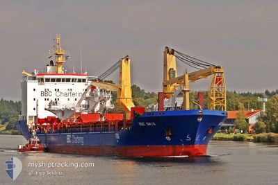
INDUSTRIAL KATHARINA
General Cargo

Current Trip
| Time Travelled | 1 day |
|---|---|
| Remaining Time | --- |
| Distance Travelled | 462.52 nm |
| Remaining Distance | --- |
| AVG Speed | 13.4 Noeuds |
| MAX Speed | 14.8 Noeuds |
| AVG Wind | 8.8 knots |
| MAX Wind | 14.9 knots |
| MIN Temp | 23.9°C / 75.02°F |
| MAX Temp | 28.5°C / 83.3°F |
| Tirant d eau | 5.9 m |
| Position reçue | 2 h, 53 m depuis |
Current Position
| Longitude | --- |
|---|---|
| Latitude | --- |
| Etat | Under way using engine |
| Vitesse | 13.5 Noeuds |
| Parcours | 211.8° |
| Zone | South Atlantic Ocean |
| Station | T-AIS |
| Position reçue | 2 h, 53 m depuis |
Information
The current position of INDUSTRIAL KATHARINA is in South Atlantic Ocean with coordinates -28.74856° / -48.64633° as reported on 2025-02-13 17:09 by AIS to our vessel tracker app. The vessel's current speed is 13.5 Noeuds
The vessel INDUSTRIAL KATHARINA (IMO: 9435129, MMSI: 305246000) is a General Cargo that was built in 2009 ( 16 Age ). It's sailing under the flag of [AG] Antigua Barbuda.
In this page you can find informations about the vessels current position, last detected port calls, and current voyage information. If the vessels is not in coverage by AIS you will find the latest position.
The current position of INDUSTRIAL KATHARINA is detected by our AIS receivers and we are not responsible for the reliability of the data. The last position was recorded while the vessel was in Coverage by the Ais receivers of our vessel tracking app.
The current draught of INDUSTRIAL KATHARINA as reported by AIS is 5.9 meters
Weather
| Temperature | 26.4°C / 79.52°F |
|---|---|
| Wind Speed | 12 knots |
| Direction | 152° SSE |
| Pressure | 1012.3 hPa |
| Humidity | 84.3 % |
| Cloud Coverage | 84 % |


Featured Company
Last Port Calls
| Port | Arrival | Departure | Time In Port |
|---|---|---|---|
| 2025-02-11 13:51 | 2025-02-12 07:38 | 17 h | |
| 2025-01-27 09:46 | 2025-01-28 19:35 | 1 d | |
| 2025-01-25 00:19 | 2025-01-25 15:31 | 15 h | |
| 2025-01-24 14:06 | 2025-01-24 21:30 | 7 h | |
| 2025-01-17 04:07 | 2025-01-17 20:35 | 16 h | |
| 2025-01-12 08:10 | 2025-01-15 05:34 | 2 d | |
| 2025-01-05 12:01 | 2025-01-07 21:19 | 2 d | |
| 2025-01-03 18:50 | 2025-01-04 11:36 | 16 h | |
| 2024-12-11 14:50 | 2024-12-27 22:16 | 16 d | |
| 2024-12-01 14:44 | 2024-12-03 04:25 | 1 d |
Most Visited Ports (Last year)
| Port | Arrivals | |
|---|---|---|
| 6 | ||
| 3 | ||
| 2 | ||
| 2 | ||
| 2 | ||
| 2 |
Last Trips
| Origin | Departure | Destination | Arrival | Distance | |
|---|---|---|---|---|---|
| 2025-01-28 15:35 | 2025-02-11 10:51 | 2943.57 nm | |||
| 2025-01-25 11:31 | 2025-01-27 05:46 | 413.48 nm | |||
| 2025-01-24 17:30 | 2025-01-24 20:19 | 25.62 nm | |||
| 2025-01-17 14:35 | 2025-01-24 10:06 | 2077.65 nm | |||
| 2025-01-14 23:34 | 2025-01-16 22:07 | 497.33 nm | |||
| 2025-01-07 15:19 | 2025-01-12 02:10 | 654.61 nm | |||
| 2025-01-04 06:36 | 2025-01-05 06:01 | 256.93 nm | |||
| 2024-12-27 17:16 | 2025-01-03 13:50 | 1306.88 nm | |||
| 2024-12-02 23:25 | 2024-12-11 09:50 | 2166.41 nm | |||
| 2024-11-30 00:44 | 2024-12-01 09:44 | 377.19 nm |
Events
| Heure | Evenement | Détails | Position/ Destination | Info |
|---|---|---|---|---|
| 2025-02-13 17:09 | Hors de la zone couverte |
-28.74856 / -48.64633
South Atlantic Ocean
BR RIG
|
Vitesse: 13.5 kn Parcours: 211.8° |
|
| 2025-02-13 10:09 | Changement d'ETA | 2025/02/14 14:30 2025/02/14 16:00 |
-27.27763 / -47.95349
BR RIG
|
Vitesse: 13.7 kn Parcours: 222° |
| 2025-02-13 09:04 | Tirant d'eau modifié | 5.9 6.7 |
-27.07942 / -47.78249
BR RIG
|
Vitesse: 14 kn Parcours: 215.2° |
| 2025-02-13 09:04 | Changement de destination | BR RIG TTCHA |
-27.07942 / -47.78249
BR RIG
|
Vitesse: 14 kn Parcours: 215.2° |
| 2025-02-13 09:04 | Changement d'ETA | 2025/02/14 16:00 2025/01/25 00:30 |
-27.07942 / -47.78249
BR RIG
|
Vitesse: 14 kn Parcours: 215.2° |
| 2025-02-13 08:49 | Etat Changé | Under way using engine Default |
-27.03101 / -47.74497
TTCHA
|
Vitesse: 13.5 kn Parcours: 214° |
| 2025-02-13 08:31 | Etat Changé | Default Under way using engine |
-26.97644 / -47.70345
TTCHA
|
Vitesse: 13.6 kn Parcours: 213.4° |
| 2025-02-13 08:27 | Etat Changé | Under way using engine Default |
-26.96285 / -47.69317
TTCHA
|
Vitesse: 13.6 kn Parcours: 214° |
| 2025-02-13 08:15 | Etat Changé | Default Under way using engine |
-26.92496 / -47.66483
TTCHA
|
Vitesse: 13.7 kn Parcours: 213.6° |
| 2025-02-13 07:50 | Detecté en mer | Brazilian part of the South Atlantic Ocean |
-26.84816 / -47.60770
South Atlantic Ocean
|
Vitesse: 13.8 kn Parcours: 213.4° |