
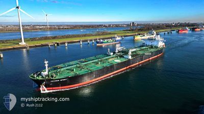
HOVDEN SPIRIT
Crude Oil Tanker
Current Trip
FOR ORDERS
| Time Travelled | 10 days |
|---|---|
| Remaining Time | --- |
| Distance Travelled | 2934.18 nm |
| Remaining Distance | --- |
| AVG Speed | 12.5 Noeuds |
| MAX Speed | 15.5 Noeuds |
| AVG Wind | 13.6 knots |
| MAX Wind | 24 knots |
| MIN Temp | 11.4°C / 52.52°F |
| MAX Temp | 22.4°C / 72.32°F |
| Tirant d eau | 11.1 m |
| Position reçue | 2 d depuis |
Current Position
| Longitude | -15.25145° |
|---|---|
| Latitude | 27.53468° |
| Etat | Under way using engine |
| Vitesse | 13.3 Noeuds |
| Parcours | 201.9° |
| Zone | North Atlantic Ocean |
| Station | T-AIS |
| Position reçue | 2 d depuis |
Info
Information
The current position of HOVDEN SPIRIT is in North Atlantic Ocean with coordinates 27.53468° / -15.25145° as reported on 2024-05-14 09:52 by AIS to our vessel tracker app. The vessel's current speed is 13.3 Noeuds
The vessel HOVDEN SPIRIT (IMO: 9596997, MMSI: 311001179) is a Crude Oil Tanker that was built in 2012 ( 12 Age ). It's sailing under the flag of [BS] Bahamas.
In this page you can find informations about the vessels current position, last detected port calls, and current voyage information. If the vessels is not in coverage by AIS you will find the latest position.
The current position of HOVDEN SPIRIT is detected by our AIS receivers and we are not responsible for the reliability of the data. The last position was recorded while the vessel was in Coverage by the Ais receivers of our vessel tracking app.
The current draught of HOVDEN SPIRIT as reported by AIS is 11.1 meters
Weather
| Temperature | 22.4°C / 72.32°F |
|---|---|
| Wind Speed | 13 knots |
| Direction | 5° N |
| Pressure | 1014.1 hPa |
| Humidity | 77.7 % |
| Cloud Coverage | 3 % |
Featured Company
Most Visited Ports (Last year)
| Port | Arrivals | |
|---|---|---|
| 1 | ||
| 1 | ||
| 1 | ||
| 1 | ||
| 1 |
Events
| Heure | Evenement | Détails | Position/ Destination | Info |
|---|---|---|---|---|
| 2024-05-14 09:58 | Etat Changé | Default Under way using engine |
27.51346 / -15.26272
FOR ORDERS
|
Vitesse: 13.3 kn Parcours: 201.9° |
| 2024-05-14 09:52 | Hors de la zone couverte |
27.53468 / -15.25145
North Atlantic Ocean
FOR ORDERS
|
Vitesse: 13.3 kn Parcours: 201.9° |
|
| 2024-05-14 02:40 | Etat Changé | Under way using engine Default |
28.89665 / -14.45668
FOR ORDERS
|
Vitesse: 13 kn Parcours: 219° |
| 2024-05-14 02:38 | Etat Changé | Default Under way using engine |
28.90093 / -14.45281
FOR ORDERS
|
Vitesse: 12.9 kn Parcours: 219.7° |
| 2024-05-14 00:56 | Etat Changé | Under way using engine Default |
29.18935 / -14.20498
FOR ORDERS
|
Vitesse: 12.9 kn Parcours: 218° |
| 2024-05-14 00:54 | Etat Changé | Default Under way using engine |
29.19649 / -14.19882
FOR ORDERS
|
Vitesse: 12.9 kn Parcours: 217° |
| 2024-05-13 22:35 | Etat Changé | Under way using engine Default |
29.58230 / -13.84652
FOR ORDERS
|
Vitesse: 13 kn Parcours: 219° |
| 2024-05-13 22:27 | Etat Changé | Default Under way using engine |
29.60467 / -13.82577
FOR ORDERS
|
Vitesse: 13 kn Parcours: 217.8° |
| 2024-05-13 22:17 | Etat Changé | Under way using engine Default |
29.63301 / -13.80000
FOR ORDERS
|
Vitesse: 12 kn Parcours: 217° |
| 2024-05-13 22:14 | Etat Changé | Default Under way using engine |
29.64167 / -13.79167
FOR ORDERS
|
Vitesse: 12.8 kn Parcours: 218.6° |